Tooley’s Dictionary Of Mapmakers Revised Edition E-J.
Edited by Josephine French, consulting editors Valerie Scott and Mary Alice Lowenthal.
Riverside (Connecticut): Early World Press. 2001. ISBN 0-906430-19-4. Pp. vi, 462, illustrations.
GB £76.00;US $113
(Available in Britain from Map Collector Publications; Americas and world-wide from
Early World Press, 1111 East Putnam Avenue, Riverside, CT 06878, U.S.A.; www.mapsage.com).
Reviewed by The Editor
After what has seemed an almost interminable wait, the second volume of the “new Tooley”, for letters ‘E’ to ‘J’ has finally arrived, with an almighty thump! At 462 pages, this volume dwarfs the original edition, in which A-J covered 345 pages.
One of the pleasures is scanning through the pages looking for names of familiar (or unfamiliar) figures, gleaning new information about map and mapping from the entries. Sadly, one of my favourite names “Gotobed East” (what were his parents thinking about?) a little known bookseller working in Ely, Cambridgeshire circa 1725 is not to be found.
However, my immediate excitement turned into some measure of disappointment. There are a good number of silly and unnecessary editorial mistakes, even as early as the list of contributors, where the majority are listed by surname but Dorothy Sloan and Maura O’Connor by Christian name (not a good sign for a dictionary), while the double-page portrait of Jodocus Hondius and Gerard Mercator on page 365 is so obviously the wrong way round. There are also problems in cross-referencing: in volume I, the British Admiralty is marked See Hydrographic Office. Volume II unfortunately doesn’t have any entry for “Hydrographical Office”.
An impressive feature of this new edition is the suite of portraits of figures, some familiar some unfamiliar. It might have been useful, however, to have pointed out that the portrait of William Faden is now in the British Library, on display on the Third Floor. I was also disappointed that a high proportion are not actually facing the biographical entry they accompany, and without some cross-reference they could be easily overlooked.
In my review of the first volume, I made a number of points that concerned me about the editorial approach of proceeding through the alphabet letter by letter, and then publishing in sections. Discrepancies arise relating to earlier volumes cannot easily be rectified, so as research into ‘E to J’ progresses none of the new information can be cross-referenced back to ‘A to D’. With what is effectively almost a three year gap between publication of volume 1 and 2, and assuming that a similar interval occurs between publication of volumes 3 and 4, there could be as much as a six or nine year interval between first volume and last, with each volume becoming progressively out-of-date, and out of step, as the volume following it is edited.
Some discrepancies were avoidable: Jacob Aeszler is found twice, under “Aeschler” (sic) and “Eszler”. Both names are cross-referenced to the other. Under the first entry he was co-editor, in the second co-publisher, of the 1513 Strasbourg Ptolemy. In the same way the Campanius family has to be entered under Holm [Holmiensis – of Stockholm] because A-D was already in print when the problem with ‘H’ emerged.
However, then there are the revised entries that require back cross-referencing: S.S. Edkins (Samuel) is given as the son-in-law of Thomas Marriott Bardin. There is no mention of Edkins in the entry on the Bardin family. The Swedish surveyor Daniel Hjort apparently assisted Buraeus in his landmark map of Scandinavia. If the researcher starts with Buraeus, there is no cross-reference to Hjort. I could go on.
I believe that the main problem – as with the original dictionary – is that the principal impetus is clearly to revise and correct the letter to hand, not to create new entries across the whole alphabet. For example, the entry on Stephen Eggenstein (page 11) is new, and refers to the apparently unique world map that was published in 1664, and illustrated in “The Map Collector”. Here was a great opportunity to add three names: the sheet was drawn by J. Christoph Storer, and engraved by Bartholome Kilian – two names not found in the original dictionary. As they are not referred to in the entry on Eggenstein, it is reasonable to assume that (but for this reference) they would not appear in the new edition.
Another principal criticism, which I also noted for the first volume, is that too much emphasis in the research seems to be done in secondary sources, some of doubtful reliability, rather than with the maps themselves. This is a facet of the way the Dictionary is being edited, as there is not a “Tooley” at the editorial helm, but is to overlook part of the network of connections that would bring the Dictionary together, interlink individuals, and provide evidence of professional relationships.
An example: John Eastgate is credited with engraving E.J. Johnson’s Chart of the coasts of Northumberland and Durham, 1819, and Eastgate is referred to in the entry for Johnson. Fine so far. Reference to the map would have shown that Alexander Findlay also worked on the map, and that it was published by James Whittle and Richard Holmes Laurie. The British Library also has the accompanying sailing directions, which would help resolve the difficulties of attribution – Johnson appears three times, with two of the three entries cross-referenced to Johnson, Edward John. The London publisher and bookseller Joseph Johnson also has three entries. A simple check of the publications noted would have shown that all three ‘men’ were working from the same address.
One duplication avoided is that of Thomas Edgar. Yet, while the two entries are now one, the information about his charting of Charlotte Sound has disappeared. In contrast, G. Ellis has become George Ellis (and I would be interested to know the authority for his Christian name), while the engraver George Ellis has disappeared.
My fear is that the new entries, and the revised and enlarged entries, concentrate on the obvious people, at the expense of the obscure. The column and a half devoted to Nicolas de Fer, or almost two columns on William Faden list any number of their publications but actually reveal very little about the careers or businesses of these two men or, in the case of the latter, almost completely miss the point.
These are people who are reasonably well known. How much more useful to have entries on Storer and Kilian, or any number of other engravers – George Ellis who engraved Thomas Ellis’s four-sheet map of Huntingdonshire in 1824, Jeremiah Evans who re-engraved Eyes and Fearson’s chart of the Lancashire coast in 1755, and l’Empereur, who engraved for John Rocque, as three engravers working in England omitted from the ‘E’s.
This volume appears under the imprint of a new publisher. Perhaps it would be advisable – for the benefit of the reader and the overall usefulness of the “Dictionary” – for the publishers to take a deep breath and publish the “Dictionary” in one go, so that the book can be properly revised and cross-referenced. That however, would make the existing volumes redundant.
The publisher’s write: “With its biographical information, examples of work, publication details, and now its extensive further references, this revised edition will replace its predecessor as the reference work which every dealer, collector and academic in the field will want to have at their fingertips.”
That is very much the case. This volume, and its companion, are already the most consulted volumes in my reference library, and they are an enormous improvement on the previous edition, but if this was a half-term report, one might summarise and say: made a promising start, but has slipped back, has the potential to be a great success, but needs to focus more on the basics.
New England in Early Printed Maps 1513 to 1800 An Illustrated Carto-Bibliography.
By Barbara Backus McCorkle
Providence, Rhode Island: John Carter Brown Library, 2001. ISBN 0-916617-53-X. Pp. xx, 354, 455 illustrations.
Available on Amazon.
US $185.00 (cloth).
Reviewed by The Editor
“New England in Early Printed Maps is the first comprehensive, full descriptive list of the printed maps of New England before 1800. Year by year and map by map, the work documents every effort to depict New England cartographically … New England in Early Printed Maps offers descriptions of over 800 maps depicting New England cartographically.”
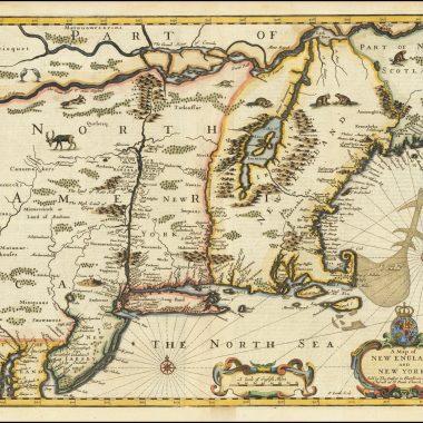
Thus reads the publisher’s blurb on the dustjacket. This is indeed a weighty volume, the fruit of many years research by Barbara McCorkle, formerly Curator of Maps at Yale University Library. The basic format is to discuss and, in something over half the entries, illustrate maps relevant to the history of the mapping of New England, not just maps of New England as an entity, but also maps and charts of maritime Canada, Canada, the eastern seaboard, eastern North America, and even maps of North America, and the Americas.
This all-inclusive approach has honourable predecessors, inter-alia William Cumming’s The Southeast In Early Maps, Kenneth Kershaw’s Printed Maps Of Canada, and Philip Burden’s Mapping of North America. It is, however, an approach of which I am not overly fond. I tend to feel that the mix of different map-types serves to inhibit the main narrative, and disguise the sense of cartographic development, while also causing the author fundamental problems about constitutes a “relevant map”. Just as a group of individuals might have a very different selection of their hundred favourite films, I think that different maps might have selected, or emphasised, and numbers of maps, several illustrated, omitted.
For example, the account starts with Martin Waldseemuller’s “Tabula Terre Nove” and proceeds from there. An interesting approach is that each map is allotted a number based on the final three digits of the year of publication, using the last three digits, and then a number for its sequence of publication within that year. Thus, Munster’s map of the Americas, published in 1540 is numbered ‘540.1’ As a numbering system is it is clearly far more convenient for the author – imagine having to renumber so many entries if an omission was discovered – and yet is simple for the reader to follow.

Each entry contains this reference number, mapmaker’s name, map-title, dimensions, medium, source, references, a brief footnote, and select list of locations. The illustrations throughout are generally of a high standard, and the designer has served the readers well by grouping together maps from very similar plates to illustrate their similarities, and differences. Examples are the Hennepin maps on page 66, the Moll maps on page 89, and so on.
The reader is also well served by two indexes at the end, the first listing the maps by title, and the second indexing all the personal names, making searching the book that much easier. There is also a listing at the end of maps of the individual states, and a good listing of secondary bibliographies.
New England in Early Maps is a substantial book, on a large format (page size is 11 ½ x 12 inches), housed in a sturdy binding – Smyth-sewn, with reinforced binding, for the technically minded – which seems strong enough to allow the frequent use I am sure copies will receive. Overall, it is very nicely produced, and an impressive looking volume.
The listing seems very thorough for maps specifically of the New England region. The only omission I particularly noticed was Scherer’s map of New England, from about 1700. One might quibble about inclusions and omissions, but overall the more general maps seem well chosen.
This is an extremely useful book, and it deserves to reach a wide audience. Librarians, collectors and dealers will find it a valuable first point of reference for all manner of maps of North America, not just for maps of New England, and to my mind the suite of illustrations alone justify the $185. It is a joy to see any number of rare maps properly illustrated, in a form that will enable users to compare illustration with actual map. I would heartily commend the book for that alone.
That is, however, to recommend the book for the wrong reasons. There is a price to pay for the wide ranging coverage in map and illustration, and that is the brevity of the footnotes. As a glaring example of this, if one goes to the entry for John Smith’s map of New England, a landmark in the mapping of the region, there is no list of the nine states of the map, only the note “Over the course of its long life there were many changes to the plate, geographical, iconographical, and in imprint …” If one wants to research the Smith map, this is not the book to use and, sadly, this is far from an isolated example.
Clearly the author is aware of the various states of the Smith map, and the many others not described. Whether it was the author’s decision, or the publishers, to throw the net so wide, I cannot but think that was a mistake.
The publishers may well write: “New England is Early Printed Maps is the definitive work in the field and will serve the need of researchers for generations to come …”, but although a very useful – and much recommended – addition to the literature on the mapping of the Americas, it is not the last word on the mapping of New England.
Lie Of The Land The Secret Life Of Maps.
Edited by April Carlucci and Peter Barber. London: The British Library, 2001.
ISBN 0 7123 4751 8. Pp 62, illustrations, many colour.
GBP £9.95 (paper).
Reviewed by The Editor
In July 2001, the British Library launched its new exhibition “Lie of the Land: the Secret Life Of Maps”, which is open until April 2002. The exhibition was organised by Tony Campbell, recently retired as Map Librarian, and Peter Barber, the Deputy Map librarian, with the assistance of the staff of the Map Library.
The aim of the exhibition is to show how the content of the map can says as much about the mapmaker as the area depicted. It can represent his own foibles, prejudices, wishful-thinking, imagination, or darker motives – power, manipulation, hate, revenge, political and religious fanaticism, and the exhibition sets out to show the way that maps – in all their seeming innocence on paper – can be bent to these purposes.
A fuller review of the exhibition can be found in MapForum.Com 13. Indeed, I am pleased to say that the exhibition, deservedly in view of the tremendous hard work that went into it, has been a huge success. By September 11th, the day I received the information, over 35,000 visitors had been to see the exhibition, up 30% on the next most popular British Library exhibition.
At the time I said that one of my only wishes was that there was an accompanying booklet for the exhibition. Unfortunately, time pressures meant that the booklet has only just become available, but although only slim it is a worthy accompaniment to the exhibition.
The booklet illustrates more than thirty of the maps from the exhibition – if only it could have covered all 133 items – specially selected to illustrate the themes, revealing the secrets hidden in maps, and the human stories behind their creation. Each map is illustrated, many in colour, with a brief text setting out the particular point of interest.
One of the ‘fun’ items was a British military survey map of an inaccessible part of Ghana. The young army officers, left with one hill to survey, decided on a shortcut, and drew it in the shape of an elephant, complete with trunk, ears and legs. Another fascinating item is a British military reconnaissance photographic mosaic of part of Ayrshire, near Prestwick, ‘before’ and ‘after’, as it were. “After” shows a neat pattern of fields. “Before”, however, clearly shows the Royal Air Force airfield, with runways, hangars, dispersal and accommodation huts. In the mosaic, these sensitive features were simply painted out. Really however, among the thirty-odd maps there is something that will be of interest to all
The book is nicely produced, with a lively text, and the reproductions of a high standard. At £9.95, it seems very good value, and I would encourage readers to make haste to the exhibition – and allow plenty of time, for there is a wealth of items to see – and on the way out to detour via the bookshop to pick up this little booklet as a fascinating souvenir of a great exhibition.
Septentrionalium Regionum: The Mapping of the Northern Regions 1482-1601. An
Exhibit of Important Early Maps of Scandinavia.
Edited by William B. Ginsberg. Oslo, October 6-21,2001.
82pp., illus.
GBP 15.00 (paper).
Norvegia Regnum: A Collection of Maps and Sea Charts of Norway 1602-1827. An
Exhibit Showing the Development of the Mapping of Norway.
Edited by William B. Ginsberg. Oslo, October 6-21,2001. 34pp., illus.
GBP 6.00 (paper).
Reviewed by The Editor
Published as companion guides to the recent exhibit organised by William Ginsberg at Grev Wedels Plass Auksjoner in Oslo, these catalogues offer an interesting and informative overview of printed cartography in Scandinavia in general, and Norway specifically, over the centuries.
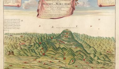
The first part of the exhibit, “The Mapping of the Northern Regions 1482-1601”, concentrates on the most important early maps in Scandinavia. The catalogue includes forty-five maps, all illustrated, many in colour. Each map is briefly discussed and included in these descriptions are the title of the map, dimensions, date of publication, the book in which the map was published, and other interesting facts and editorial remarks. The accompanying illustrations are all of a very high quality, and many are full-page. Included in the forty-five maps is an appendix containing four maps of Scandinavia and three maps of the Arctic dating from between 1613-1727. These have been included to demonstrate the appeal of some subsequent decorative maps of the region. There is also a short bibliography for the reader who is interested in learning more about cartography and the mapping of Norway and the rest of Scandinavia. This catalogue is not meant to be either comprehensive or complete, but it does give a very nice carto-bibliographic overview of the region.
The second catalogue, “A Collection of Maps and Sea Charts of Norway 1602-1827”, is devoted entirely to the cartography of Norway. Unlike the previous catalogue, which was carto-bibliographic in nature, this one has a stronger emphasis on the representation of Norway and the cartographers involved. Included is also a short overview of sea charts of Norway by major cartographers of the sixteenth and seventeenth centuries. Though a much shorter publication, each entry is briefly discussed, including the title of the map, dimensions, publication date, and often a brief biography of the cartographer. The maps are illustrated, some in colour, but the images are much smaller than in the other catalogue and, though clear, it is sometimes a bit difficult to see details.
Both catalogues, though published to coincide with an exhibition, are capable of standing on their own merits. Attractively produced, lavishly illustrated, and with each map and chart being individually summarised, these are items that anyone with an interest in the cartography of the Scandinavian countries will enjoy.