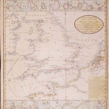
The name ‘Lafreri-School’ is a widely used, but rather inaccurate, term used to describe a loose grouping of cartographers, mapmakers, engravers and publishers working in the twin centres of Rome and Venice, from about 1544 to circa 1585.
Earlier this century, George Beans, a prominent American collector of Italian maps and atlases, proposed the alternative name ‘I.A.T.O.’ to describe the composite collections assembled and sold by this school – ‘Italian, Assembled-To-Order’. While more apposite, it has failed to catch on with modern cataloguers and collectors.
For the purposes of this article, I intend to refer to the cartographers, engravers and publishers involved as “the school”, although even this term implies a greater structure and organisation than can currently be established.
The principal reference source on the work of the school is R.V. Tooley‘s Maps in Italian Atlases of the Sixteenth Century (1). In his study, published in 1939, Tooley listed some 614 maps and plates (with variant states counted separately). Some were described from personal examination, others noted from secondary sources and listings. While now much out-dated, as more recent regional carto-bibliographies have effectively superceded particular sections, and new collections have come to light, it remains the only overview of the output of the school.
Originally these Italian publishers of “contemporary” maps issued them as separate sheets: they were not illustrating a text like the Ptolemaic maps so there was no need for standardization. For this reason, there is a very wide range of sizes associated with such maps, from half-sheet up to eight or more sheets. It was only latterly that publishers started to sell the maps in bound collections, a development between 1565 & 1569 (the date of the collection at Yale), but certainly by about 1572, when an engraved title starts to appear in some collections.
However, the lack of uniformity of sizes caused considerable problems when it came to binding the maps. Some had to be folded to fit the format while others, which were too small, had to be enlarged. The method adopted, which in hindsight seems very unsatisfactory, was to trim individual maps to the engraved border, and then paste on additional margins to give the paper size required.
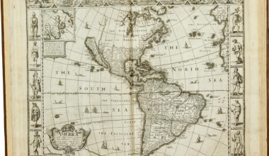
A second feature of the output of the school is that no one publisher seems to have tried to achieve complete geographical coverage of the world, but rather “cherry-picked” regions or subjects that, presumably, were felt to be saleable. This meant that no single publisher could produce a world atlas from his own stock. Instead, bound collections tend to be composed around the stock of one dealer, supplemented from materials published by several others, to achieve some measure of completeness. Such collections were assembled for a purchaser – assembled to-order, as Beans put it – so such collections reflect the business or hereditary interests of the purchaser, as well as his own personal preferences among individual maps of a region, hence no two collections are the same.
While frequently termed ‘atlases’, such collections do not fall within a strictly applied definition of ‘atlas’. Without too much digression, I would describe the basic requirements for an atlas to be: that it is a bound volume in which the principal constituent is the cartographic element, and the other contents (if present), such as text or plates, are subsidiary; that the volume has a formal printed title-page; that the maps are prepared to a uniform format; and that individual examples of the volume are assembled with a standardized content. While these collections pass the first criteria, they lack the uniformity and standardisation that I consider a minimum requisite, and the absence of a title-page in the vast majority of examples underlines this lack of vision.
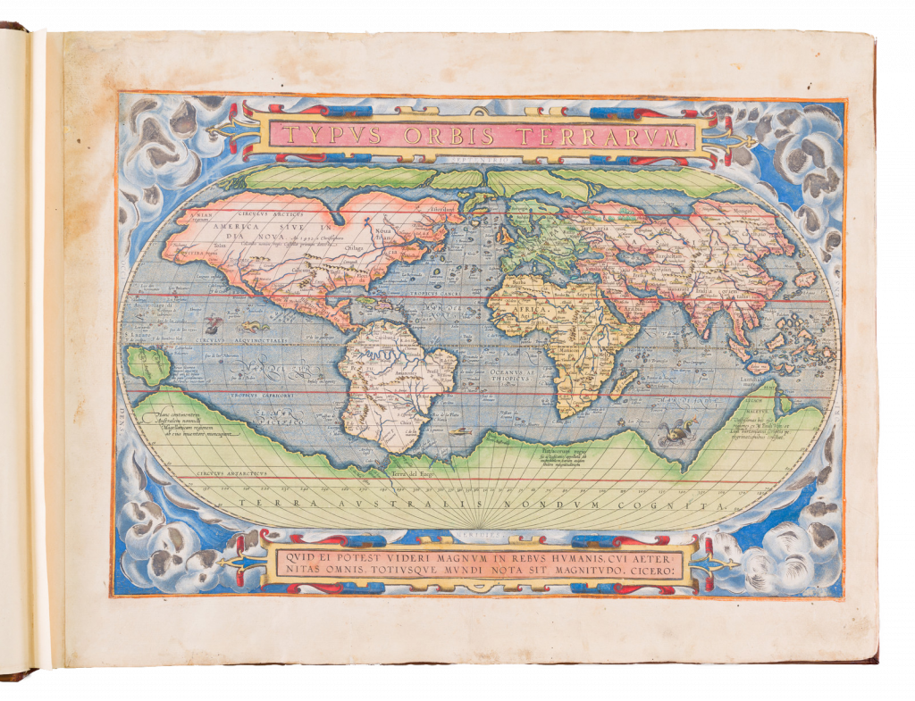
Nevertheless, these collections are important for preserving a very large number of maps that might otherwise be lost, and served as an inspiration, and example, to Abraham Ortelius for his Theatrum Orbis Terrarum, the first modern printed atlas of the World, published in 1570.
The Mapmakers
The principal cartographer of the school was Giacomo Gastaldi (fl. 1542-1565), a Piedmontese who worked in Venice, becoming Cosmographer to the Venetian Republic. Karrow described him as “one of the most important cartographers of the sixteenth century. He was certainly the greatest Italian mapmaker of his age…” (2). While his achievement is obvious, it is hard to quantify. A large number of maps were published throughout this period with the geography credited to Gastaldi, but it is often difficult to know what role Gastaldi played in their creation. As a practice, he did not sign himself as publisher, although his name may be found in the title, dedication, or text to the reader. Frequently where there is no imprint one may assume that Gastaldi was the publisher. A further clue may be that many of the maps attributable to Gastaldi as publisher seem to have been engraved by Fabius Licinius.
In other cases, where publication is credited to another, it is not always certain whether Gastaldi was commissioned by the publisher to compile the map, whether another less-enterprising publisher merely copied his work and attribution, or simply added Gastaldi’s name in the title to add authority to the delineation. His name clearly commanded the same sort of respect that the Sanson name had in the last years of the seventeenth century, and as Guillaume de l’Isle’s had in the first half of the eighteenth century.
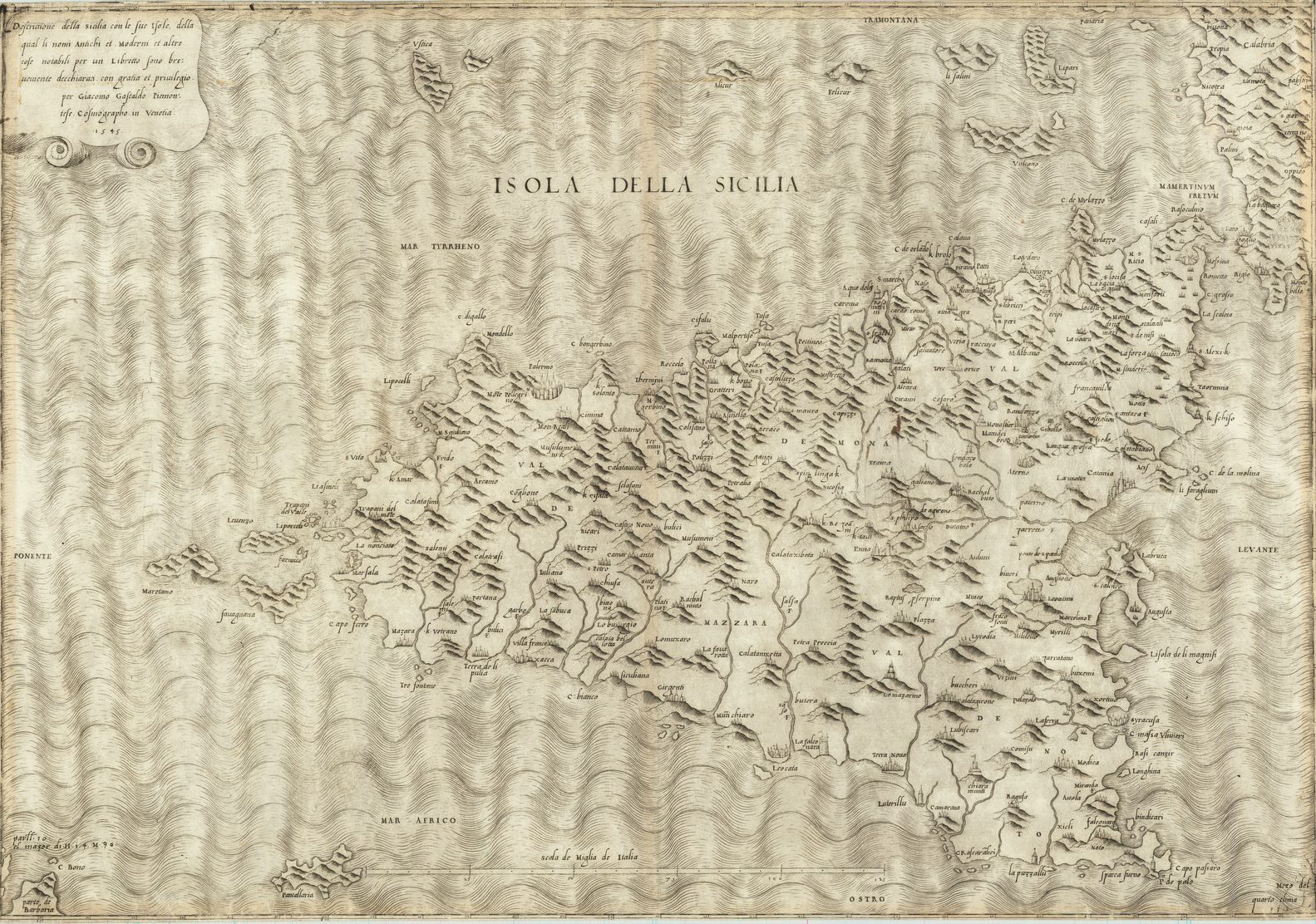
Gastaldi’s first published map was of Spain, engraved on four sheets, and issued in 1544. The following year he published a map of Sicily, among the most widely copied of all his maps. In the course of a prolific career, Gastaldi subsequently produced a number of maps of Italy, and individual parts of the peninsula, with his general map of Italy, and the map of Piedmont also being very influential.
Among the most important of his maps, however, were of areas outside Italy. Principal among these was his map of the World, published in 1546, a four sheet map of the countries of south-eastern Europe, published in 1559, and his series of three maps of the Middle East, Southern Asia, and South-East Asia with the Far East, issued between 1559 and 1561. In 1562, Gastaldi issued a two-sheet map of the Kingdom of Poland, and in 1564, a magnificent eight-sheet map of Africa.
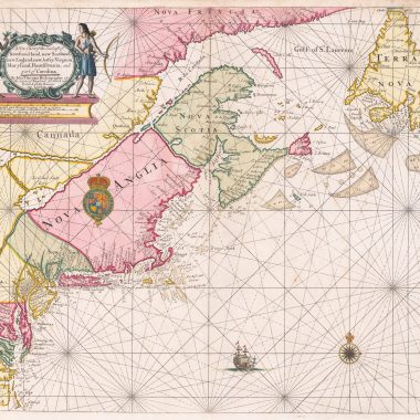
In addition to this prolific output, Gastaldi also prepared the maps for the 1548, Venice, edition of Ptolemy’s ‘Geografia’. The modern map of Germany, which is dated 1542 in the title, is his earliest dated work, although it was not published until some six years later. Gastaldi had a close relationship with Giovanni Battista Ramusio, and it would seem likely that Gastaldi compiled the maps used in the latter’s Delle Navigationi Et Viaggi (1550-1556) including maps of Africa, the Middle East and Southern Asia, South-East Asia and the Far East, the Americas, New England and New France, West Africa and Sumatra. While Karrow also attributes the map of Hispaniola to Gastaldi, this map was printed from a block prepared for an edition of Peter the Martyr’s Historia De L’Indie Occidentale (Venice, 1534), which is believed to have been edited by Ramusio.
Antonio Lafreri, by contrast, was purely a map & print-seller and publisher, who had a prolific output of material, particularly relating to Rome. Much of his other cartographic work, however, was derivative. Born Antoine Lafrère, in Besançon in Burgundy, Lafreri settled in Rome circa 1540. From 1553 to 1562, he worked in partnership with Antonio Salamanca, and for a brief time after the latter’s death, his son Francesco Salamanca. In 1563, the partnership was brought to an end, and Lafreri was left in control of the firm, which he built up to being the largest of the Rome map-and print-sellers and publishers. After his death, in 1577 he was succeeded by his nephew, Claudio Duchetti.
The reason that Lafreri’s name is now used as an umbrella term for the school is because he issued a catalogue of his stock in 1572, entitled ‘Indice Delle Tavole Moderne Di Geografia Della Maggior Parte Del Mondo …’. This catalogue is very similar, both in title and contents. to bound collections of maps with an engraved title Tavole Moderne Di Geografia De La Maggior Parte Del Mondo Di Diversi Autori. Accordingly bound collections with the engraved title were attributed to Lafreri, and thence his name became associated with the group as a whole. Some writers have attributed the title to Duchetti, but there seems no good reason to challenge Lafreri’s role.
Having said that much of his cartographic output was derivative, it should be said that Lafreri was very active as a publisher and seller of broadsheet ‘news-maps’, maps illustrating important contemporary events. Of these, by far the most popular was the siege of Malta by the Turks in 1565, and Lafreri produced maps of the island, the fortifications of Valetta, and depicting various stages in the siege, including the Turkish retreat. Another popular subject was the battle of Lepanto, on October 7th 1571, in which the Turkish fleet was routed by a combined Venetian, Spanish and allied fleet. Just over a month after the battle, on November 14th, Lafreri published a detailed plan of the battle – a remarkably short space of time considering the intricacies of engraving such an image.
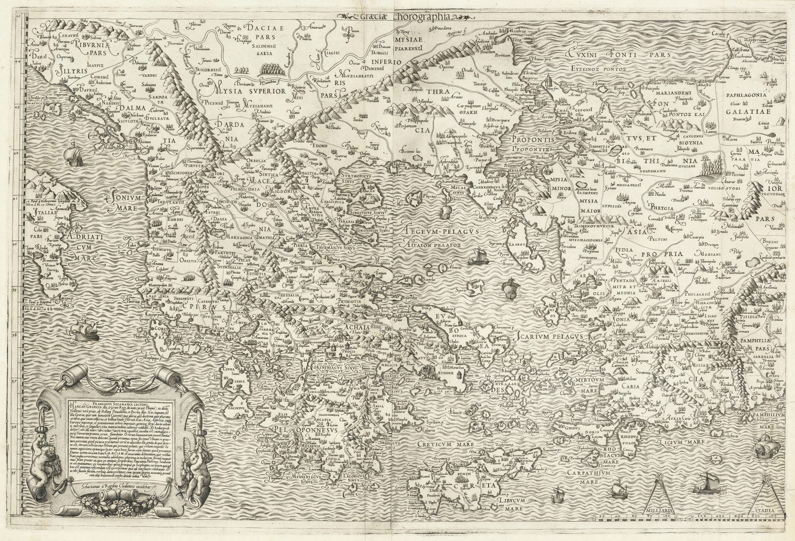
Antonio Salamanca also published a number of maps, the earliest being maps of Eastern Europe and the Holy Land, published in 1548, and a map of the World, published circa 1550, which was later re-issued by Lafreri, with his imprint substituted. Francesco Salamanca seems only to have published a map of Greece, circa 1562/3.
Duchetti (or Claude Duchet), flourished from about 1570 to about 1585. Among his earliest maps were a series of maps of the Mediterranean islands, including Minorca, Majorca and Cyprus. His stock (including plates published by Lafreri) passed to Giovanni Orlandi, who reprinted many of them, dated 1602.
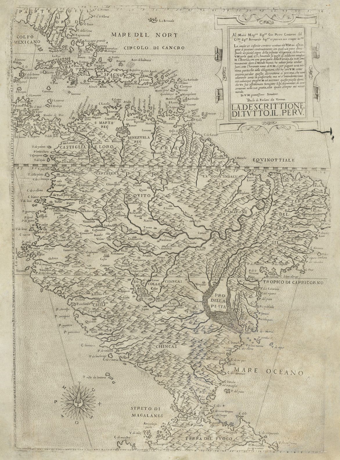
Paolo Forlani was a cartographer and engraver who worked in Venice between 1560 and circa 1571. The majority of his output was published under the imprint of other publishers, such as Giovanni Francesco Camocio, Ferrando Bertelli and Bolognini Zaltieri. In a pioneering study, David Woodward (4), by identifying Forlani’s engraving style through various stages of development, has attributed a large number of previously unidentified maps to his hand, and provided a clearer picture of some of the publishing arrangements of the period.
Another cartographer was the Englishman George Lily, who signed his work ‘GLA’ (Georgius Lilius Anglus). Lily, an English Catholic, went into exile to Rome as part of the entourage of Cardinal Pole. According to Lynam, Lily may have worked as an “editor of maps issued under the auspices of the Church” (5), associated with the Rome publisher Michele Tramezini.
Lily’s most famous map was his ‘Britanniae Insulae Quae Nunc Angliae Et Scotiae Regna Continet Cum Hibernia Adiacente Nova Descriptio‘, dated 1546. Although unsigned, it may have been engraved by Nicolas Beatrizet, and was probably published by Tramezini. Lily’s original is of great rarity, but subsequent mapmakers of the school copied its delineation, without attribution.
Two other maps that bear Lily’s his monogram are Pirro Ligorio’s ‘Vrbis Romae Sitvs…‘, published by Tramezini in 1552, and his own ‘Nova Germaniae Descriptio…‘, engraved by Beatrizet and published by Tramezini in 1553.
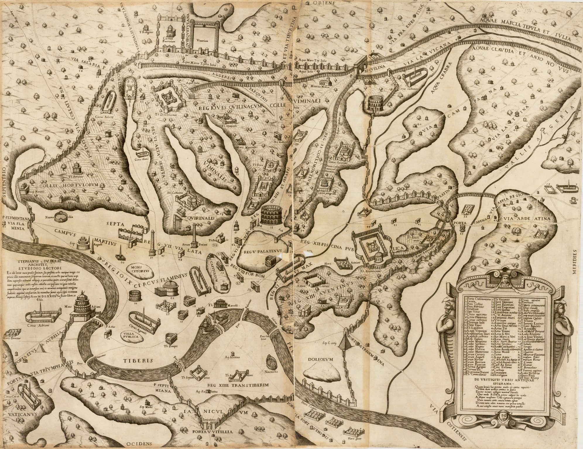
Pirro Ligorio (fl. 1552-1563) was an architect, artist and cartographer, born in Naples, but based in Rome, and associated with Tramezini, who published many of his maps, plans and views. With his architect’s background, he seems to have been particularly interested in Roman remains and antiquities. The majority of his work relates to Rome, but he also drew maps of France, Belgium, Germany, Greece and the Kingdom of Naples.
Among the publishers, Michele Tramezini (fl. ca. 1546-1562), based in Rome, is perhaps the most interesting. A large proportion of the material that he published was from original sources, or was re-issues of material published outside Italy. Perhaps the most important part of his work, in the long-term, was the copying of the wall-maps of Jan van Deventer, depicting the provinces of the Low Countries. Unfortunately, because of the vulnerability of wall-maps, it is often only through Tramezini’s copies, albeit on a much reduced scale, that evidence of van Deventer’s original work is preserved. Indeed, when Gerard de Jode, the Antwerp publisher active from the 1550’s to the 1590’s, wanted to publish maps of the constituent provinces of the Low Countries, he turned to Tramezini’s versions for a source, in the absence of van Deventer’s originals (6).
Tramezini also published a reduction of Cornelis Anthoniszoon’s ‘Caert van Oostland ...’, first issued in Antwerp in 1543, then re-issued in 1551, and circa 1560. Of the first and second states, no example is known, while only one example of the third state survives. He also published Fernando Alvares Seco’s map of Portugal, circa 1561, which was the first separate printed map of the country.
| Among the engravers employed by Tramezini, Beatrizet has already been mentioned. Another was Jacobus Bos (who signed himself ‘Belga’). Bos (fl. ca. 1555-1561) engraved many of Tramezini’s copies of Deventer’s work, and may help explain Tramezini’s interest in that area. A third was Sebastian de Re (fl. ca.1557 – 1562), who also published a few maps and plans under his own name. |
A lesser publisher in Rome was Vicenzo Luchini (fl. ca. 1556 – 1564), who specialised primarily in Italian subjects, including maps of Lombardy, Sicily and the March of Ancona. Another figure was Mario Cartaro (fl. ca.1562-1612), an engraver, mapmaker and publisher. One of his most important publications was de Angelis’ plan of Jerusalem, in 1578, although I would not actually categorise the piece as a “Lafreri-school map.”
Bolognini Zaltieri (fl. 1560’s) was one of three men who dominated the map-publishing trade in Venice. He had a prolific output, much of which emanated, either in compilation, or in engraving, with Forlani, with the focus on regions outside Italy. His most famous publication is a map of North America, published in 1566, which was the first separate printed map of the region. Other maps published by him are a detailed plan of Venice, with an extensive key below, a map of Ireland, of the Holy Land, and two plans of Tunis. He also issued a series of maps of the individual provinces of the Low Countries, copied from Tramezini.
The largest grouping was the Bertelli family. The most active was Ferrando Bertelli, who flourished in the 1560’s and 1570’s, but maps from the last quarter of the seventeenth century are known with the imprints of Andrea, Donato, Lucca, Nicolo and Pietro. Again, a number of maps published by Ferrando were drawn or engraved by Forlani.
In the early 1560s Giovanni Francesco Camocio published a number of maps that were drawn by Forlani, including maps of the World, North Atlantic, Africa, France, Switzerland, and provinces of the Low Countries, to note but a few. Circa 1570, Camocio published an Isolario, or collection of maps of islands, principally from the Mediterranean, but including the British Isles and Iceland. Camocio’s earliest issues lacked a title-page, and tended to be a relatively random selection from the available stock. Later he added a title Isole Famose Porti, Fortezze E Terre Maritime. After his death, which is assumed to have been in 1573, the plates were reprinted, with a title-page bearing the Bertelli family address ‘alla Libraria del Segno di S. Marco’, possibly by Donato Bertelli, whose imprint is found on a later state of Camocio’s world map of 1560.
Lesser figures include Niccolo Nelli (fl. ca.1565-1570), who drew three maps of parts of Africa and Asia, published by Ferrando Bertelli, copied from Gastaldi’s maps in Ramusio, and who may have been involved in the publication of Camocio’s world map of 1567, if the monogram ‘NNF 1567’ can be read as ‘Nicolo Nelli Formis.’
Domenico Zenoi (fl. ca. 1557-1562) was an engraver-cum-publisher, with a side line in pornographic pictures which brought him into conflict with the Venetian authorities.
Petrus de Nobilibus (fl. 1590’s) re-printed maps originally in the stock of most of the leading publishers. For example, his name is found on the second state of Lafreri’s title-page, on Tramezini’s map of Denmark, and Forlani’s maps of Cuba and the Gulf of Venice.
Giovanni Orlandi (fl. Rome, ca.1600-1604) re-issued a large number of maps acquired from the stock of Duchetti, dated 1602, which is presumably when, or very shortly after, he acquired the plates. It is possible that he was connected in some way to Henricus (or Hendrick) van Schoel, who was also working at Rome. Several of the plates he issued are also dated 1602.
Bibliography
1. R.V. Tooley: Maps in Italian Atlases of the Sixteenth Century, being a comparative list of the Italian maps issued by Lafreri, Forlani, Duchetti, Bertelli and others, found in atlases, Imago Mundi III (1939) (reprint edition, Amsterdam: N. Israel, 1964).
2. Robert W. Karrow Jr: Mapmakers of the Sixteenth Century and Their Maps (Chicago: Speculum Orbis Press, 1993), p.216. His chapter on Gastaldi is the best account of Gastaldi’s life and career.
3. Karrow, op. cit., p.229, 30/81.
4. David Woodward: The Maps and Prints of Paolo Forlani A Descriptive Bibliography (Chicago, Newbery Library, 1990.
5. Edward Lynam: The Map Of The British Isles Of 1546 (Jenkintown, NJ, Tall Tree Press, 1934), p.3.
6. Günter Schilder: The Cartographic Relationships between Italy and The Low Countries in the sixteenth century (The Map Collector, 17, pp.2-8).