Compiled by Paula Dryburgh
INTRODUCTION
The ‘Map Collectors Circle’ was founded by the late R.V. Tooley in 1963. In the course of the next thirteen years, under his editorship, the ‘Map Collectors Circle’ published 110 monographs on aspects of historical cartography. Unfortunately, however, publication was discontinued in 1975. Today the complete set is highly prized for the wide-ranging and valuable series of articles it contains. However, its usefulness is limited by the lack of a cumulative index to the articles, authors and subjects it contained.

This series of three indices is an attempt to address that problem, listing the articles by author, in numerical sequence, and by subject.
A number of the articles were subsequently re-printed as books, or collections, often updated, with revisions and corrections, and these publications are listed below, as well as being identified in the list of authors.
For the purpose of brevity, articles appearing in Tooley’s two main collections The Mapping of America, and Mapping of Australia are referred to as ‘Reprinted in Tooley: America or Tooley: Australia’.
Hodson, Donald. The Printed Maps of Hertfordshire 1577-1900. (London: Dawson, 1974)
Kapp, Kit S. Central America in Early Maps up to 1860. (North Bend, Ohio, Kapp, 1974)
Kapp, Kit S. The Early Maps of Panama up to 1865. (North Bend, Ohio: Kapp, 1971)
Palmer, Margaret. Printed Maps of Bermuda … Third Revised Edition. (London: Holland Press Cartographica, 1983)
Shirley, Rodney W. Early Printed Maps of the British Isles 1477-1650. (Revised Edition: East Grinstead, Surrey, Antique Atlas Publications, 1991)
Skelton, R.A. County Atlases of the British-Isles. (London: Carta Press, 1970)
Tooley, R.V. A Collectors’ Guide to the Maps of the African Continent and Southern Africa. (London: Carta Press, 1969)
Tooley, R.V. The Mapping of America. (London: Holland Press Cartographica, 1980)
Tooley, R.V. Mapping Of Australia. (London: Holland Press Cartographica, 1979)
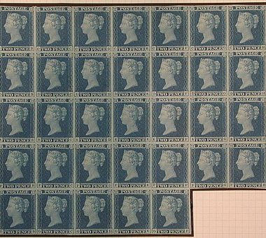
Tooley, R.V. Dictionary of Mapmakers. (Tring, Herts: Map Collector Publications, 1979)
Tooley, R.V. Printed Maps of Tasmania, 1642-1900. (London: Francis Edwards, 1975)
Zacharakis, Christos G. A Catalogue of Printed Maps of Greece 1477-1800 (Second Edition, Athens: Samourkas Foundation, 1992).
ALPHABETICAL BY AUTHOR
The maps of south-west France with special reference to Cognac being the catalogue of a Collection
[Collection belonging to Richelieu et Cie of Cognac]
Map Collectors’ Series No.26, 1966 in Map Collectors’ Circle Vol.3
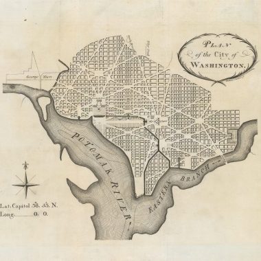
North American city plans being a selection of plans of the cities of Albany, Baltimore, Boston, Charlestown, Cincinnati, Detroit, Ebenezer, Montreal, Newport, New Orleans, New York, Philadelphia, Quebec, Savannah, St.Augustine and Washington
Map Collectors’ Series No.20, 1965 in Map Collectors’ Circle Vol.2
One hundred foreign maps of Australia 1773 – 1887
Map Collectors’ Series No.12, 1964 in Map Collectors’ Circle Vol.2
Some early printed maps of Trinidad and Tobago with a facsimile of Faden’s descriptive account of the island of Trinidad, 1802
Map Collectors’ Series No.10, 1964 in Map Collectors’ Circle Vol.1
BELLAIRE, Alfred
Decorative initial letters used in atlases
Map Collectors’ Series No.52, 1969 in Map Collectors’ Circle Vol.6
BROEKEMA, C.
Maps of the Canary Islands Published before 1850 A checklist
Map Collectors’ Series No.74, 1971 in Map Collectors’ Circle Vol.8
CAMPBELL, Tony
Claes. Jansz. Visscher A hundred maps described
Map Collectors’ Series No.46, 1968 in Map Collectors’ Circle Vol.5
CAMPBELL, Tony
Japan: European printed maps to 1800
Map Collectors’ Series No.36, 1967 in Map Collectors’ Circle Vol.4
CAMPBELL, Tony
New light on the Jansson-Visscher maps of New England
Map Collectors’ Series No.24, 1965 in Map Collectors’ Circle Vol.3
[re-printed in Tooley: America]
CAMPBELL, Tony
The Printed Maps of Barbados from the earliest times to 1873
Map Collectors’ Series No.21, 1965 in Map Collectors’ Circle Vol.3
EVANS, Olwen Caradoc
Maps of Wales and Welsh cartographers
Map Collectors’ Series No.13, 1963 in Map Collectors’ Circle Vol.2
EVANS, Olwen Caradoc
Marine plans and charts of Wales
Map Collectors’ Series No.54, 1969 in Map Collectors’ Circle Vol.6
FORDHAM, Angela
Falkland Islands A bibliography of 50 examples of printed maps bearing specific reference to the Falkland Islands.
Map Collectors’ Series No.11, 1964 in Map Collectors’ Circle Vol.2
FORDHAM, Angela
Town Plans of the British Isles series appearing in atlases from 1580-1850
Map Collectors’ Series No.22, 1965 in Map Collectors’ Circle Vol.3
FORDHAM, H. George
Christopher Saxton of Dunningley His life and Work
Offprint
Map Collectors’ Series No.51, 1969 in Map Collectors’ Circle Vol.6
HARGREAVES, R.P.
French explorers maps of New Zealand
Map Collectors’ Series No.32, 1966 in Map Collectors’ Circle Vol.4
HENSHALL, J.M.
Sir H. George Fordham Carto-bibliographer
Map Collectors’ Series No.51, 1969 in Map Collectors’ Circle Vol.6
HODSON, D.
The printed maps of Hertfordshire 1577-1900
reprinted as Hodson, Donald The Printed Maps of Hertfordshire 1577-1900. (London: Dawson, 1974)
Part 1 (1577-1784)
Map Collectors’ Series No.53, 1969 in Map Collectors’ Circle Vol.6
Part 2 (1785-1820)
Map Collectors’ Series No.59, 1969 in Map Collectors’ Circle Vol.6
Part 3 (1821-1860)
Map Collectors’ Series No.65, 1970 in Map Collectors’ Circle Vol.7
Part 4 (1861-1885)
Map Collectors’ Series No.75, 1971 in Map Collectors’ Circle Vol.8
Part 5 (1886-1900 and supplement)
Map Collectors’ Series No.83, 1972 in Map Collectors’ Circle Vol.9
HOPPEN, Stephanie
Fifty small and miniature maps of Africa
Map Collectors’ Series No.108, 1975 in Map Collectors’ Circle Vol.11
HYDE, Ralph
Ward maps of the city of London
Map Collectors’ Series No.38, 1967 in Map Collectors’ Circle Vol.4
KAPP, Kit S.
The early maps of Colombia up to 1850
Map Collectors’ Series No.77, 1971 in Map Collectors’ Circle Vol.8
reprinted as Kapp, Kit S. Central America in Early Maps up to 1860. (North Bend, Ohio, Kapp, 1974)
KAPP, Kit S.
The early maps of Panama up to 1865
Map Collectors’ Series No.73, 1971 in Map Collectors’ Circle Vol.8
reprinted as Kapp, Kit S. The Early Maps of Panama up to 1865. (North Bend, Ohio: Kapp, 1971)
KAPP, Kit S.
The printed maps of Central America up to 1860
Part 1
Map Collectors’ Series No.103, 1974 in Map Collectors’ Circle Vol.11
Part 2 1762-1860
Map Collectors’ Series No.106, 1975 in Map Collectors’ Circle Vol.11
KAPP, Kit S.
The printed maps of Jamaica up to 1835
Map Collectors’ Series No.42, 1968 in Map Collectors’ Circle Vol.5
KINGSLEY: see under MANN, Sylvia
McGECHAEN, Alexander & VERNER, Coolie
Maps in the parliamentary papers by the Arrowsmiths A finding list
Part 1 1-263
Map Collectors’ Series No.88, 1973 in Map Collectors’ Circle Vol.9
Part 2 264-462
Map Collectors’ Series No.89, 1973 in Map Collectors’ Circle Vol.9
MALINOWSKI, H.
The Malinowski collection of maps of Poland
Part 1
Map Collectors’ Series No.25, 1966 in Map Collectors’ Circle Vol.3
Part 2
Map Collectors’ Series No.31, 1966 in Map Collectors’ Circle Vol.4
Part 3
Map Collectors’ Series No.43, 1968 in Map Collectors’ Circle Vol.5
Part 4
Map Collectors’ Series No.56, 1969 in Map Collectors’ Circle Vol.6
Part 5
Map Collectors’ Series No.57, 1969 in Map Collectors’ Circle Vol.6
Part 6
Map Collectors’ Series No.84, 1972 in Map Collectors’ Circle Vol.9
MANN, Sylvia & KINGSLEY, David
Playing Cards Depicting maps of the British Isles, and of English and Welsh Counties
Map Collectors’ Series No.87, 1972 in Map Collectors’ Circle Vol.9
PALMER, Margaret
The Isles of Scilly
Map Collectors’ Series No.3, 1963 in Map Collectors’ Circle Vol.1
PALMER, Margaret
The printed maps of Bermuda
Map Collectors’ Series No.19, 1965 in Map Collectors’ Circle Vol.2
Reprinted as Palmer, Margaret. Printed Maps of Bermuda … Third Revised Edition. (London: Holland Press Cartographica, 1983)
RUBENS, R.
South East Asia A selection of maps on Borneo, Burma, Cambodia, Malay, Thailand & Vietnam
Map Collectors’ Series No.109, 1975 in Map Collectors’ Circle Vol.11
SCHRIRE, D.
Adams’ & Pine’s maps of the Spanish Armada
Map Collectors’ Series No.4, 1963 in Map Collectors’ Circle Vol.1
SCHRIRE, D.
Bickhams’ birds eye county views and the British Monarchy including the North American Supplement reproduced in full
Map Collectors’ Series No.27, 1966 in Map Collectors’ Circle Vol.3
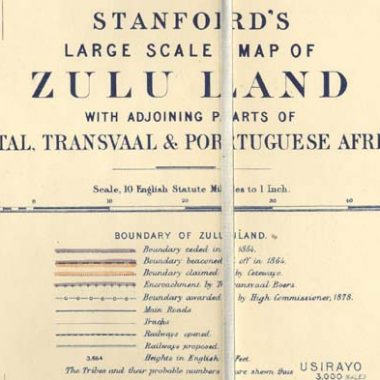
SCHRIRE, D.
The Cape of Good Hope 1782-1842 from De la Rochette to Arrowsmith being some notes on the development of the early mapping of European-occupied South Africa by English cartographers
Map Collectors’ Series No.17, 1965 in Map Collectors’ Circle Vol.2
SHIRLEY, R.W.
Early printed maps of the British Isles 1477-1650 A bibliography
Reprinted as Shirley, Rodney W. Early Printed Maps of the British Isles 1477-1650. (Revised Edition: East Grinstead, Surrey, Antique Atlas Publications, 1991)
Part 1 1477-1555
Map Collectors’ Series No.90, 1973 in Map Collectors’ Circle Vol.9
Part 2 1556-1592
Map Collectors’ Series No.94, 1973 in Map Collectors’ Circle Vol.10
Part 3 1593-1610
Map Collectors’ Series No.95, 1974 in Map Collectors’ Circle Vol.10
Part 4 1611-1636
Map Collectors’ Series No.97, 1973 in Map Collectors’ Circle Vol.10
Part 5 1637-1650 Appendices and index
Map Collectors’ Series No.101, 1974 in Map Collectors’ Circle Vol.11
SKELTON, R.A.
County atlases of the British Isles 1579-1850 A bibliography
Reprinted as Skelton, R.A. County Atlases of the British-Isles. (London: Carta Press, 1970)
Part One 1579-1611
Map Collectors’ Series No.9, 1964 in Map Collectors’ Circle Vol.1
Part Two 1612-1646
Map Collectors’ Series No.14, 1964 in Map Collectors’ Circle Vol.2
Part 3 (1646-1670)
Map Collectors’ Series No.41, 1968 in Map Collectors’ Circle Vol.5
Part 4 (1671-1703)
Map Collectors’ Series No.49, 1968 in Map Collectors’ Circle Vol.5
Part 5 (1579-1703: appendices)
Map Collectors’ Series No.63, 1970 in Map Collectors’ Circle Vol.7
SKELTON, R.A. & TOOLEY, R.V.
The marine surveys of James Cook in North America 1758-1768 particularly the survey of Newfoundland A bibliography of printed charts and sailing-directions
Map Collectors’ Series No.37, 1967 in Map Collectors’ Circle Vol.4
Reprinted in Tooley: America.
STERN, M.F.
Ancient maps and explorers’ routes on stamps
Map Collectors’ Series No.15, 1964 in Map Collectors’ Circle Vol.2
STEVENS, Henry & TREE, Roland
Comparative cartography exemplified in an analytical & bibliographical desription of nearly one hundred maps and charts of the American continent published in Great Britain during the years 1600 to 1850
Offprint from ‘Essays honoring Lawrence C.Wroth 1951’ with addenda.
Map Collectors’ Series No.39, 1967 in Map Collectors’ Circle Vol.4
Reprinted in Tooley America
STOPP, K.
Maps of Germany with marginal town views
Map Collectors’ Series No.35, 1967 in Map Collectors’ Circle Vol.4
TOOLEY, R.V.: see also under SKELTON, R.A.
TOOLEY, R.V.
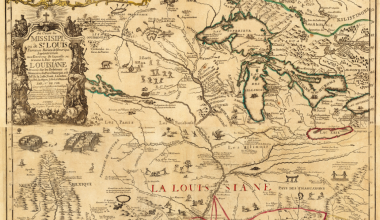
California as an Island A Geographical misconception illustrated by 100 examples from 1625 to 1770
Map Collectors’ Series No.8, 1963 in Map Collectors’ Circle Vol.1
Reprinted in Tooley: America
TOOLEY, R.V.
A Dictionary of mapmakers including cartographers, geographers, publishers, engravers, etc., from earliest times to 1900.
Reprinted as Tooley, R.V. Dictionary of Mapmakers. (Tring, Herts: Map Collector Publications, 1979)
Part 1 (A to Callan)
Map Collectors’ Series No.16, 1965 in Map Collectors’ Circle Vol.2
Part 2 (Callan, J. to Czoering)
Map Collectors’ Series No.28, 1966 in Map Collectors’ Circle Vol.3
Part 3 (D to Fatio)
Map Collectors’ Series No.40, 1967 in Map Collectors’ Circle Vol.4
Part 4 (Fatout to Gutierrez)
Map Collectors’ Series No.50, 1968 in Map Collectors’ Circle Vol.5
Part 5 (Gutierrez to Hutchinson)
Map Collectors’ Series No.67, 1970 in Map Collectors’ Circle Vol.7
Part 6 (Hutchinson to Kruse)
Map Collectors’ Series No.78, 1971 in Map Collectors’ Circle Vol.8
Part 7 (Krusenstern to Lutsch von Luchsenstein)
Map Collectors’ Series No.91, 1973 in Map Collectors’ Circle Vol.10
Part 8 (Luttrell to Mills J.B.)
Map Collectors’ Series No.99, 1974 in Map Collectors’ Circle Vol.10
Part 9 (Mills J.E. to Oppolzer)
Map Collectors’ Series No.100, 1974 in Map Collectors’ Circle Vol.10
Part 10 (Orbigny to Powell, T.K.)
Map Collectors’ Series No.110, 1975 in Map Collectors’ Circle Vol.11
TOOLEY, R.V.
Early Antarctica A glance at the beginnings of cartographic representation of the South Polar regions.
Map Collectors’ Series No.2., 1963 in Map Collectors’ Circle Vol.1
TOOLEY, R.V.
Early maps and views of the Cape of Good Hope
Map Collectors’ Series No.6, 1963 in Map Collectors’ Circle Vol.1
TOOLEY, R.V.
Early maps of Australia The Dutch Period being examples from the collection of R.V.Tooley with bibliographical notes
Map Collectors’ Series No.23, 1965 in Map Collectors’ Circle Vol.3
Reprinted in Tooley: Australia
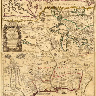
TOOLEY, R.V.
French mapping of the Americas The De l’Isle, Buache, Dezauche Succession (1700-1830)
Map Collectors’ Series No.33, 1966 in Map Collectors’ Circle Vol.4
Reprinted in Tooley: America
TOOLEY, R.V.
Geographical Oddities, or, curious, ingenious, and imaginary maps and miscellaneous plates published in atlases.
Map Collectors’ Series No.1, 1963 in Map Collectors’ Circle Vol.1
TOOLEY, R.V.
Leo Belgicus An illustrated list of variants
Map Collectors’ Series No.7, 1963 in Map Collectors’ Circle Vol.1
TOOLEY, R.V.
Maps of Africa A selection of printed maps from the Sixteenth to the Nineteenth Centuries
Reprinted as Tooley, R.V. A Collectors’ Guide to the Maps of the African Continent and Southern Africa. (London: Carta Press, 1969)
Part 1
Map Collectors’ Series No.47, 1968 in Map Collectors’ Circle Vol.5
Part 2
Map Collectors’ Series No.48, 1968 in Map Collectors’ Circle Vol.5
TOOLEY, R.V.
Printed maps of America
Part 1
Map Collectors’ Series No.68, 1971 in Map Collectors’ Circle Vol.7
Part 2
Map Collectors’ Series No.69, 1971 in Map Collectors’ Circle Vol.7
Part 3
Map Collectors’ Series No.80, 1972 in Map Collectors’ Circle Vol.8
Part 4
Map Collectors’ Series No.96, 1974 in Map Collectors’ Circle Vol.10
TOOLEY, R.V.
The printed maps of Antigua 1689-1899
Map Collectors’ Series No.55, 1969 in Map Collectors’ Circle Vol.6
TOOLEY, R.V.
Printed maps of Australia being a catalogue of a collection.
Reprinted in Tooley, R.V. Mapping Of Australia. (London: Holland Press Cartographica, 1979)
Part 1
Map Collectors’ Series No.60, 1970 in Map Collectors’ Circle Vol.6
Part 2
Map Collectors’ Series No.64, 1970 in Map Collectors’ Circle Vol.7
Part 3 (F-H)
Map Collectors’ Series No.66, 1970 in Map Collectors’ Circle Vol.7
Part 4 (J-L)
Map Collectors’ Series No.72, 1971 in Map Collectors’ Circle Vol.8
Part 5 (M-St)
Map Collectors’ Series No.79, 1972 in Map Collectors’ Circle Vol.8
Part 6 (S-Z)
Map Collectors’ Series No.85, 1972 in Map Collectors’ Circle Vol.9
Part 7 (with index)
Map Collectors’ Series No.86, 1972 in Map Collectors’ Circle Vol.9
Addenda
Map Collectors’ Series No.93, 1973 in Map Collectors’ Circle Vol.10
TOOLEY, R.V.
The printed maps of the continent of Africa and regional maps south of the Tropic of Cancer (1500-1900)
Part I 1500-1600
Map Collectors’ Series No.29, 1966 in Map Collectors’ Circle Vol.3
Part II Printed maps of East and Central Africa 1500-1600
Map Collectors’ Series No.30, 1966 in Map Collectors’ Circle Vol.3
TOOLEY, R.V.
The printed maps of Dominica and Grenada
Map Collectors’ Series No.62, 1970 in Map Collectors’ Circle Vol.7
TOOLEY, R.V.
The printed maps of New South Wales 1773-1873
Map Collectors’ Series No.44, 1968 in Map Collectors’ Circle Vol.5
Reprinted in Tooley: Australia.
TOOLEY, R.V.
Printed maps of St. Kitts, St. Lucia and St. Vincent
Map Collectors’ Series No.81, 1972 in Map Collectors’ Circle Vol.9
TOOLEY, R.V.
Printed maps of Southern Africa and its parts Catalogue of a Collection
Map Collectors’ Series No.61, 1970 in Map Collectors’ Circle Vol.7
TOOLEY, R.V.
The printed maps of Tasmania: A chronological list from 1777-1900 With an alphabetical index.
Map Collectors’ Series No.5, 1963 in Map Collectors’ Circle Vol.1
Reprinted as Tooley, R.V. Printed Maps of Tasmania, 1642-1900. (London: Francis Edwards, 1975)
TOOLEY, R.V.
Printed sea charts of Scandinavia A preliminary list
Part 1
Map Collectors’ Series No.70, 1971 in Map Collectors’ Circle Vol.7
Part 2
Map Collectors’ Series No.71, 1971 in Map Collectors’ Circle Vol.8
bA Sequence of maps of Africa
Map Collectors’ Series No.82, 1972 in Map Collectors’ Circle Vol.9
TOOLEY, R.V.
A Sequence of maps of America
Map Collectors’ Series No.92, 1973 in Map Collectors’ Circle Vol.10
Reprinted in Tooley: America
TOOLEY, R.V.
Some portraits of geographers and other persons associated with maps
Map Collectors’ Series No.104, 1974 in Map Collectors’ Circle Vol.11
Map Collectors’ Series No.105, 1974 in Map Collectors’ Circle Vol.11
TOOLEY, R.V.
Title pages from 16th to 19th century
Map Collectors’ Series No.107, 1975 in Map Collectors’ Circle Vol.11
VERNER, Coolie: see also under McGECHAEN, Alexander
VERNER, Coolie
Captain Collins’ coasting pilot a carto-bibliographical analysis
Map Collectors’ Series No.58, 1969 in Map Collectors’ Circle Vol.6
VERNER, Coolie
Maps by John Arrowsmith in the publications of the Royal Geographical Society
Map Collectors’ Series No.76, 1971 in Map Collectors’ Circle Vol.8
VERNER, Coolie
Maps of the Yorktown campaign 1780-1781 A preliminary checklist of printed and manuscript maps prior to 1800
Map Collectors’ Series No.18, 1965 in Map Collectors’ Circle Vol.2
Reprinted in Tooley: America.
VERNER, Coolie
Smith’s Virginia and its derivatives A carto-bibliographical study of the diffusion of Geographical knowledge.
Map Collectors’ Series No.45, 1968 in Map Collectors’ Circle Vol.5
Reprinted in Tooley: America.
ZACHARAKIS, C.G.
A catalogue of printed maps of Greece and Greek regions 1477-1800
Reprinted as Zacharakis, Christos G. A Catalogue of Printed Maps of Greece 1477-1800 (Second Edition, Athens: Samourkas Foundation, 1992).
Part 1
Map Collectors’ Series No.98, 1974 in Map Collectors’ Circle Vol.10
Part 2
Map Collectors’ Series No.102, 1974 in Map Collectors’ Circle Vol.11
NUMERICAL ORDER
Vol 1
1 Geographical Oddities: by R. V. Tooley.
2 Maps Of Antarctica: by R. V. Tooley.
3 Maps Of The Isles Of Scilly: by Margaret Palmer.
4 Adams And Pine’s Maps Of The Armada: by D. Schrire.
5 The Printed Maps Of Tasmania: by R. V. Tooley.
6 Early Maps Of The Cape Of Good Hope: by R. V. Tooley.
7 Leo Belgicus: A List Of Variants: by R. V. Tooley.
8 California As An Island: by R. V. Tooley.
9 County Atlases, British Isles: by R. A. Skelton. Part I, 1579-1612.
10 Some Early Printed Maps Of Trinidad And Tobago
Vol II 1964-5
11 Falkland Islands: by A. Fordham.
12 Hundred Foreign Maps Of Australia, 1773-1887: by R. V. Tooley.
13 Maps Of Wales And Welsh Cartographers: by Olwen Caradoc Evans.
14 County Atlases Of The British Isles: Part II, 1612-1646: by R. A. Skelton
15 Maps And Explorers’ Routes On Stamps: by Capt. M. F. Stern.
16 A Dictionary Of Mapmakers, Part I, A-Callan: by R. V. Tooley.
17 The Cape Of Good Hope 1782-1842: by D. Schrire.
18 Maps Of The Yorktown Campaign: by Prof. Coolie Verner.
19 The Printed Maps Of Bermuda: by Margaret Palmer.
20 North American City Plans.
Vol III 1965-6
21 The Printed Maps Of Barbados: by Tony Campbell.
22 Town Plans Of The British Isles: by Angela Fordham.
23 Early Maps Of Australia, The Dutch Period: by R. V. Tooley.
24 The Jansson-Visscher Maps Of New England: by Tony Campbell.
25 Malinowski Collection, Maps Of Poland, Part I: by H. Malinowski.
26 The Maps Of South-West France.
27 Bickham’s Birds Eye County Views And The British Monarchy: by D. Schrire.
28 A Dictionary Of Mapmakers, Part II (Callan-Czoering): by R. V. Tooley.
29 Printed Maps Of Africa. Part I, The Continent Of Africa, 1500-1600: by R. V. Tooley.
30 Printed Maps Of Africa. Part II, Regional Maps: by R. V. Tooley.
Vol IV 1966-7
31 Malinowski Collection, Maps Of Poland, Part II: by H. Malinowski.
32 French Explorers Maps Of New Zealand: by R. P. Hargreaves.
33 French Mapping Of The Americas, (De L’Isle): by R. V. Tooley.
34 Notes And Addenda.
35 Maps Of Germany With Marginal Views: by Prof. Dr. K. Stopp.
36 Japan: European Printed Maps To 1800: by Tony Campbell.
37 Surveys Of Cook In North America: by R. A. Skelton and R. V. Tooley.
38 Ward Maps Of The City Of London: by Ralph Hyde.
39 Comparative Cartography: by Henry Stevens and Roland Tree.
40 A Dictionary Of Mapmakers, Part III: (D to Fatio): by R. V. Tooley
Vol V 1967-8
41 County Atlases Of The British Isles, Part III: 1646-1670: by R. A. Skelton.
42 The Printed Maps Of Jamaica Up To 1825: by Capt. Kit S. Kapp.
43 Malinowski Collection, Maps Of Poland, Part III: by H. Malinowski.
44 The Printed Maps Of New South Wales, 1773-1873: by R. V. Tooley.
45 Smith’s Virginia And Its Derivative: by Prof. Coolie Verner.
46 C. J. Visscher: A Hundred Maps Described: by Tony Campbell.
47 Maps Of Africa, 16th-19th Century. Part 1: by R. V. Tooley.
48 Maps Of Africa, Part 2: by R. V. Tooley.
49 County Atlases Of The British Isles, Part IV: 1671-1703: by R. A. Skelton.
50 A Dictionary Of Mapmakers, Part IV: Fatout to Gutierrez: by R. V. Tooley
Vol VI 1970
51 Sir H. George Fordham, Cartobibliographer: by J. M. Henshall.
52 Decorative Initials In Maps And Atlases: by Alfred Bellaire.
53 Maps Of Hertfordshire, Part I, 1577-1784: by D. Hodson.
54 Marine Plans And Charts Of Wales: by Olwen Caradoc Evans.
55 The Printed Maps Of Antigua, 1689-1899: by R. V. Tooley.
56 Malinowski Collection, Maps Of Poland, Part IV: by H. Malinowski.
57 Malinowski Collection, Maps Of Poland, Part V: by H. Malinowski.
58 Captain Collins’ Coasting Pilot: by Prof Coolie Verner.
59 Printed Maps Of Hertfordshire, Part II: 1785-1820: by D. Hodson.
60 Maps Of Australia, Part I: by R. V. Tooley.
Vol VII 1970-1
61 Maps Of Southern Africa And Its Parts. Catalogue Of A Collection: by R. V. Tooley.
62 Printed Maps Of Dominica And Grenada: by R. V. Tooley.
63 County Atlases Of The British Isles, Part V, 1579-1703: appendices: by R. A. Skelton.
64 Printed Maps Of Australia, Part III: by R. V . Tooley.
65 Printed Maps Of Hertfordshire, Part III: by D. Hodson.
66 Printed Maps Of Maps Of Australia, Part III: by R. V. Tooley.
67 A Dictionary Of Mapmakers, Part V: by R. V. Tooley.
68 Printed Maps Of America, Part 1: by R. V. Tooley.
69 Printed Maps Of America, Part II: by R. V. Tooley.
70 Printed Charts Of Scandinavia, Part I: by R. V. Tooley.
Vol VIII 1971
71 Printed Charts Of Scandinavia, Part II: by R. V. Tooley.
72 Printed Maps Of Australia, Part IV: by R. V. Tooley.
73 The Early Maps Of Panama Up To 1865: by Capt. Kit S. Kapp.
74 Maps Of The Canary Islands Published Before 1850: by C. Broekema.
75 Printed Maps Of Hertfordshire, Part IV, 1861-1885: by D. Hodson.
76 Maps By John Arrowsmith: by Coolie Verner.
77 The Early Maps Of Colombia Up To 1850: by Capt. Kit S. Kapp.
78 A Dictionary Of Mapmakers, Part VI, Hutchinson to Kruse: by R. V. Tooley.
79 Printed Maps Of Australia, Part V: by R. V. Tooley.
80 Printed Maps Of America, Part III: by R. V. Tooley.
Vol IX 1972-1973
81 Maps Of St. Kitts, St. Lucia & St. Vincent: by R. V. Tooley.
82 A Sequence Of Maps Of Africa: by R. V. Tooley.
83 Printed Maps Of Hertfordshire, Part V, 1886-1900 and supplement: by R. V. Tooley
84 Malinowski Collection, Maps Of Poland, Part VI: by H. Malinowski.
85 Maps Of Australia, Part VI: by R. V. Tooley.
86 Malinowski Collection, Maps Of Poland, Part VII, with Index: by H. Malinowski.
87 Playing Cards: by Sylvia Mann and David Kingsley.
88 Maps In The Parliamentary Papers By The Arrowsmiths: by Alexander McGeghaen & Coolie Verner.
89 Maps In The Parliamentary Papers By The Arrowsmiths: by Alexander McGeghaen & Coolie Verner.
90 Printed Maps Of The British Isles, Part I, 1477-1555: by R. W. Shirley.
Vol. X 1973-1974
91 A Dictionary Of Mapmakers, Part VII, Krusenstern to Lutsch von Luchtenstein: by R.V. Tooley
92 A Sequence Of Maps Of America: by R. V. Tooley.
93 Printed Maps Of Australia, Addenda: by R. V. Tooley.
94 Printed Maps Of The British Isles, Part II, 1556-1592: by R.W. Shirley.
95 Printed Maps Of The British Isles, Part III, 1593-1610: by R.W. Shirley.
96 Printed Maps Of America, Part IV: by R. V. Tooley.
97 Maps Of The British Isles, Part IV, 1611-1636: by R. W. Shirley.
98 Maps Of Greece Part I: by Christos G. Zacharakis.
99 A Dictionary Of Mapmakers, Part VIII, Luttrell to Mills J.B.: by R. V. Tooley.
100 A Dictionary Of Mapmakers, Part IX, Mills J.E. to Oppolzer: by R. V. Tooley.
Vol. XI 1974-1975
101 Printed Maps Of The British Isles, Part V, 1637-1650 Appendices and index: by R. V. Tooley.
102 Maps Of Greece Part II: by Christos G. Zacharakis.
103 Central America (Excluding Mexico), Part I: by Capt. Kitt S. Kapp.
104 Some Portraits Of Geographers, Part I: by R. V. Tooley.
105 Some Portraits Of Geographers, Part II: by R. V. Tooley.
106 Central America (Excluding Mexico), Part I: by Capt. Kitt S. Kapp.
107 Title-Pages, 16th-19th Century: by R. V. Tooley.
108 Small and Miniature Maps Of Africa: by Stephanie Hoppen
109 South East Asia: by R. Rubens.
110 Dictionary Of Mapmakers, Part X, Orbigny to Powell, T.K.: by R. V. Tooley
INDEX BY SUBJECT
Subject Issue number/Volume number
Adams, Robert 4/1
Africa 6/1, 17/2, 29/3, 30/3, 47/5, 48/5, 61/7, 82/9, 108/11
Albany 20/2
Americas 33/4, 68/7, 69/7, 80/8, 92/10, 96/10
Antarctica 2/1
Antigua 55/6
Armada 4/1
Arrowsmith 17/2, 76/8, 88/9, 89/9
Atlas decoration 52/6
Australia 12/2, 23/3, 44/5, 60/6, 64/7, 66/7, 72/8, 79/8, 85/9, 86/9, 93/10
Baltimore 20/2
Barbados 21/3
Bermuda 19/2
Bickham, George 27/3
Birds eye views 27/3
Borneo 109/11
Boston 20/2
British Isles 9/1, 14/2, 22/3, 41/5, 49/5, 63/7, 87/9, 90/9, 94/10, 95/10, 97/10, 101/11
Burma 109/11
California 8/1
Cambodia 109/11
Canary Islands 74/8
Cape of Good Hope 6/1, 17/2
Cartographers 13/2, 16/2, 28/3, 40/4, 50/5, 67/7, 78/8, 91/10, 99/10, 100/10, 104/11, 105/11, 110/11
Cartographic Curiosities 1/1
Central America 103/11, 106/11
Charlestown 20/2
Charts 37/4, 54/6, 58/6, 70/7, 71/8
Cincinnati 20/2
City Plan 20/2, 22/3
Cognac 26/3
Collins, Captain 58/6
Colombia 77/8
Cook, James 37/4
County atlases 9/1, 14/2, 41/5, 49/5, 63/7
De la Rochette 17/2
Detroit 20/2
Dominica 62/7
Ebenezer 20/2
Exploration 15/2, 32/4,
Falkland Islands 11/2
Fordham, H.George 51/6
France 26/3
Germany 35/4
Greece 98/10, 102/11
Grenada 62/7
Hertfordshire 53/6, 59/6, 65/7, 75/8, 83/9
Initials 52/6
Jamaica 42/5
Jansson/Visscher 24/3
Japan 36/4
Leo Belgicus 1/1, 7/1
London 38/4
Malay 109/11
Malinowski Collection 25/3, 31/4, 43/5, 56/6, 57/6, 84/9
Miniature Maps 108/11
Montreal 20/2
New England 24/3
Newfoundland 37/4
Newport 20/2
New Orleans 20/2
New South Wales 44/5
New York 20/2
New Zealand 32/4
North America 20/2, 33/4, 37/4, 39/4, 68/7, 69/7, 80/8, 92/10, 96/10
Notes & Addenda 34/4
Oddities 1/1
Panama 73/8
Parliamentary Papers 88/9, 89/9
Philadelphia 20/2
Pine, John 4/1
Playing cards 87/9
Poland 25/3, 31/4, 43/5, 56/6, 57/6, 84/9, 86/9
Portraits 104/11, 105/11
Quebec 20/2
Richelieu Collection 26/3
Savannah 20/2
Saxton, Christopher 51/6
Scandinavia 70/7, 71/8
Scilly Isles 3/1
Smith, John 45/5
South Africa 17/2, 61/7
South America 33/4
South East Asia 109/11
Spanish Armada 4/1
Stamps 15/2
St.Augustine 20/2
St.Kitts 81/9
St.Lucia 81/9
St.Vincent 81/9
Tasmania 5/1
Thailand 109/11
Title pages 107/11
Tobago 10/1
Town plans 20/2, 22/3, 38/4
Trinidad 10/1
Vietnam 109/11
Virginia 45/5
Visscher, C.J. 24/3, 46/5
Wales 13/2, 54/6
Ward maps 38/4
Washington 20/2
West Indies Islands 10/1, 19/2, 21/3, 55/6, 62/7, 81/9
Yorktown 18/2