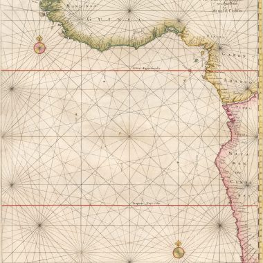
mapforumOctober 12, 2022 15th IssueCollation: Zee Atlas Ofte Water-Wereldt, ca.1654-1658 Library of Congress G1059. C64 1669 vault; Phillips 480 Collated by David Parry The example described is in…
mapforumOctober 12, 2022 15th IssueCollation: The New Fierie Sea-Colomne, 1639 [Koeman: J. Col 23]Library of Congress G1793 .C6 1640; Phillips 3331 by Jason Hubbard [Engraved Title page:] The |…
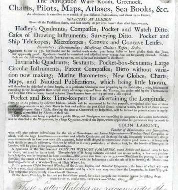
mapforumOctober 4, 2022 13th IssueEphemera: Colin Lamont Unusual broadside catalogue/advertisement for Colin Lamont, advertising himself as seller of sea-atlases and charts, related scientific and timekeeping…
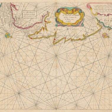
mapforumOctober 4, 2022 13th IssuePrinted Maps of New England: 1630-1660 1630 [1630]: GERRITSZ., HesselNOVA ANGLIA, / NOVVM BELGIVM / ET VIRGINIA. [1b][Inset] ‘Bermuda majori mole expressa’ 82 x…
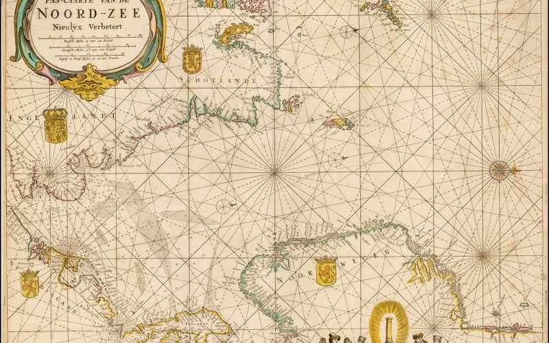
12th Issue MapForum Articles Maps in Colom’s Atlases: Atlas ou Colom Ardante, 1668 Atlas / ou / Colom Ardante / Demonstrant toutes les Costes de la Grand / Mer, de tout… mapforumSeptember 26, 2022
mapforumSeptember 23, 2022 MapForum ArticlesMaps in Colom’s Atlases: Atlas or Fyrie Colom, 1668 [Engraved Title page:] Atlas / or / Fyrie Colom. / Wherein are livelÿ Portraÿed all the knowne /…
mapforumSeptember 21, 2022 MapForum ArticlesMaps in Colom’s Atlases: The New Fierie Sea-Colomne, 1649 The best existing reference for the pilot guides and Sea Atlases of Jacob Aertsz. Colom is the fourth…
mapforumSeptember 19, 2022 MapForum ArticlesCollation: Thomas Salmon’s Modern History The following is a collation of the second edition in Italian (first edition, 1734) of Thomas Salmon’s work,…
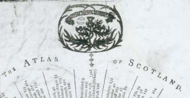
mapforumAugust 25, 2022 MapForum ArticlesThe Atlas of Scotland Edinburgh, May 18. 1797. -Designed by J.Halliday, Caledonian Mercury Office. -Entered in Stationers Hall.Broadsheet, 420 x 235mm. the…
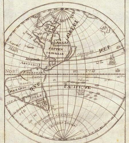
10th Issue MapForum Articles California on the East Coast Mallet: Novveav Continent. From the German edition, ‘Beschreibung Des Gantzen Welt-Kriesses’ (‘Description de l’Univers’), published by Johann David… mapforumAugust 22, 2022