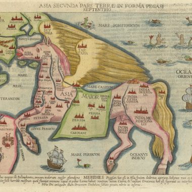
An interesting aspect of cartographic history is how and when names were given to far off places discovered and exploited during the aptly named Age of Reconnaissance and the period of Trade and Dominion.1 To discover a new land and name it was essentially a political action. No actual settlement or even ceremonial possession may have followed but by naming a discovery, and charting it, a prior claim to land or seaway could be made at a later time if it was expedient to do so. This was emphasised by Alexander Dalrymple, the first hydrographer of the British Navy, in a debate as to whether unknown European voyagers had discovered the east coast of Australia before James Cook, thereby excluding any English claim for the planned settlement of Botany Bay.2 Dalrymple’s evidence for the prior discovery of Australia’s east coast was the so-called “Harleian” or “Dauphin” map, of the sixteenth century, given to the British Museum by Sir Joseph Banks in 1790.3
Naming what were believed to be new discoveries was not always done with the sort of care an hydrographer like Alexander Dalrymple would have wanted. He bemoaned the poor quality of marine charts and he criticised those voyagers who failed to observe simple naming procedures because “Great confusion arises from the application of different names to the same islands, and of the same names to different islands.”4 He advocated native names should always be used but when this was not possible he recommended the use of descriptive terms. But be that as Dalrymple and other hydrographers may have wanted, the reality was that explorers continued to name their geographical discoveries as they, not an hydrographer sitting comfortably in a distant homeland, saw fit. In general, one can see how given names often reflected the type of voyage undertaken. Apart from monarchs, whom most explorers memorialised, discoveries made by naval vessels invariably honoured naval dignitaries and often members of the crew. 5 On the other hand, there were expeditions like those of the Dutch East India Company (the VOC). 6 Discoveries made on their voyages of exploration were often named after people associated with the company or the home ports from which they sailed.7 Christianity was a particularly influential source for names. Through the West Indies and across the Pacific, sixteenth and early seventeenth century Spanish voyagers charted a catalogue of saints. Ships too, of course, were often memorialised throughout maritime history.
That place names were sometimes duplicated was inevitable and an interesting instance of this concerns New Zealand. How the nation state got its name is still something of a puzzle but from 1605-06 to about 1792 there were in fact two “New Zealands,” both of them well charted and both discovered under the auspices of the VOC.
The decades from 1590 to 1620 were ones of rapid expansion for the Dutch seaborne trade in West Africa, the Mediterranean and the East Indies.8 In 1600, as far from Europe as one could almost get, the first Dutch ship reached Japan. The VOC was founded in 1602 and in 1605 the Dutch took Amboina and drove the Portuguese from almost a hundred year’s hold on the Moluccas. By 1620 consolidation of Dutch trade was entrenched and Batavia, the “Queen of the Eastern Seas,” had been founded on the ruins of Jakarta.
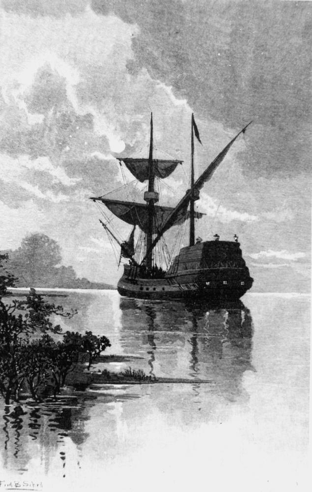
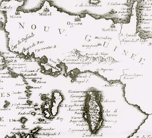
In the same year the Portuguese lost their foothold in the Moluccas, Jan Verschoor, the director in charge of the Bantam factory, authorised the small three-masted yacht Duyfken to sail on an exploratory voyage to search for gold and silver rumoured to be found in the uncharted lands southeast of the Spice Islands. Commanded by Willem Jansz, the Duyfken sailed from Banda east to the north of Kee and Aru Islands, and on to the south coast of New Guinea in the vicinity of False Cape. On the way Jansz discovered the “first” New Zealand (Nieú Zelandt) charting it to the north of Kee Island. A coloured manuscript chart of the voyage, bound into the folio-sized Atlas van der Hem,clearly shows the discovery as one of several small stretches of coast drawn like pieces of incompletely mapped islands.9 This appears to be the earliest use of the name New Zealand and although this is the focus of discussion here, it has to be said that the real fame of the Duyfken chart rests on the fact it bears the earliest surviving image of Australia, charted well to the southeast as Nova Guinea, which Jansz also discovered on the same voyage.
It is interesting to see that over the years New Zealand of the East Indies did not appear on all maps of the region and, when it did, its location varied slightly in different publications. Preliminary research suggests it was usually mapped to the north of Kee Island which is just to the west of Aru Island.10 When Kee Island was not shown New Zealand was sometimes charted along the southern coast of the land of the Papuas either to the northwest or northeast of Aru Island.
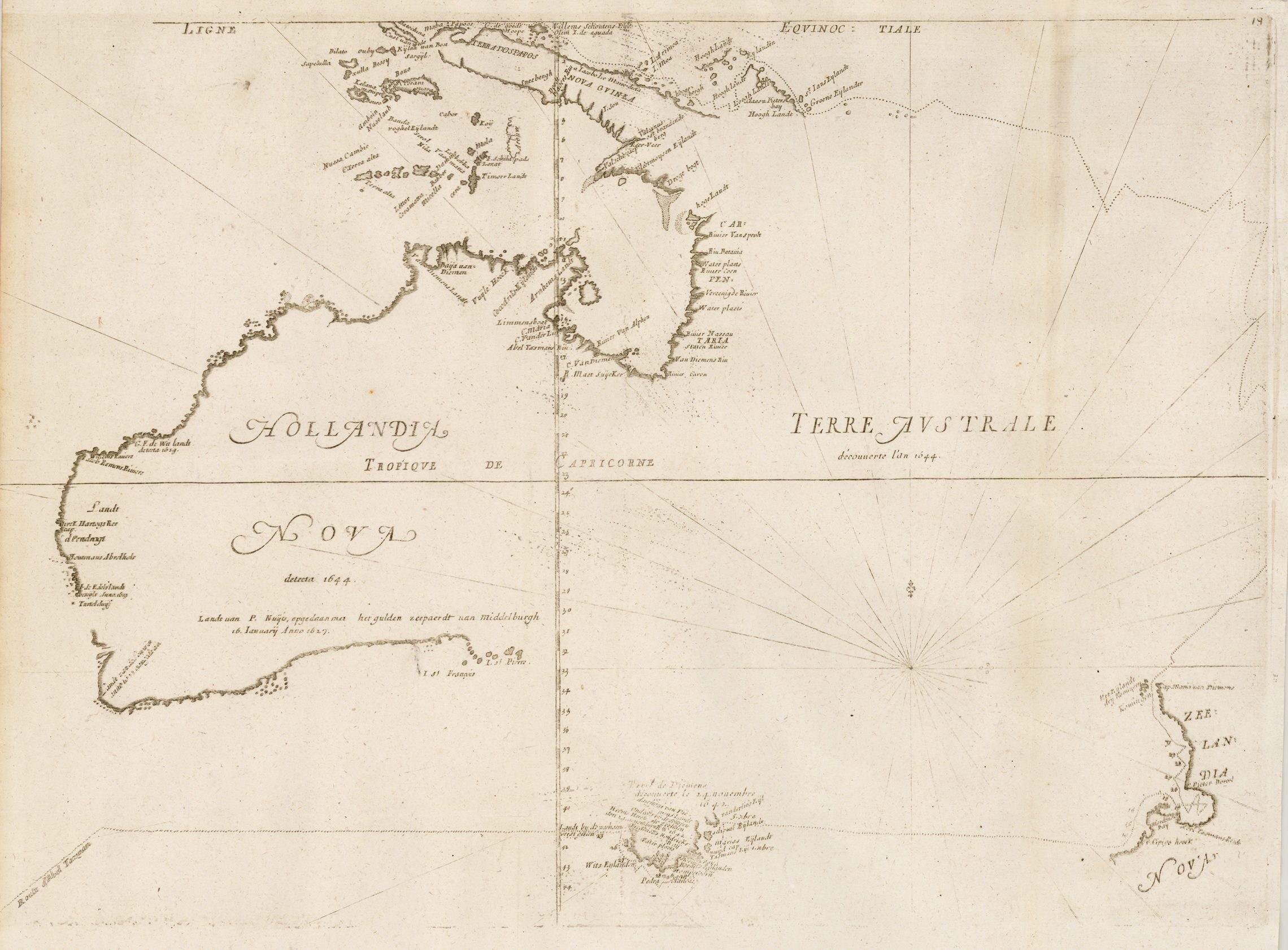
Nieú Zelandt was retained on the charts of the VOC and appeared in Hessel Gerritsz’ authoritative manuscript chart of the Pacific Ocean, Mar del Sur, Mar Pacifico in 1622.11 Gerritsz, a famous mapmaker in is day, had been appointed cartographer of the VOC in 1617. No further discoveries seem to have been made over the sixteen years since the Duyfken’s voyage and Gerritsz’ map still shows New Zealand as a very small island-like landmass with only a southern coastline and, isolated far to the southeast, the first charted coast of Australia was still called New Guinea.12
At the beginning of a lengthy legend beneath the east Indonesian archipelago, Gerritsz noted “New Zealand (ie New Guinea) east of Ceram, sailed by Jasper Janss. the younger; Duifjesland (the land of the little Dove), opposite Kei and Aru…”13
New Zealand, in its variously spelt forms, appeared on a number of published maps at least from 1633 onwards. The 1633 and 1640 editions of the Hondius-Janssonius Indiae Orientalis show New Zealand to the north of Kee Island.
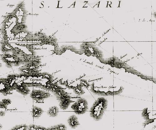
Likewise, it was retained in the 1652 and 1660 editions of Sanson d’Abbeville’s Les Iles Moluques but mapped to the northwest of Kee Island.
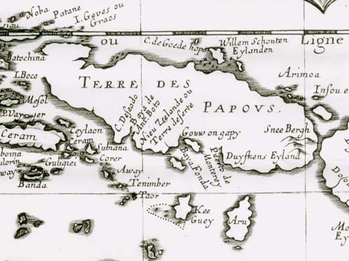
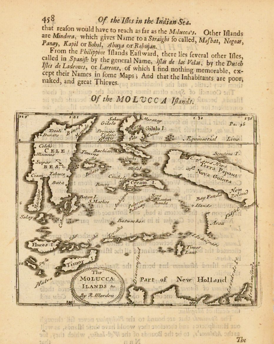
In Giacomo de Rossi’s Isole del India of 1683, New Zealand also appears northwest of Kee Island. On the other hand, in 1688 Robert Morden placed New Zeland near False Cape to the northeast of Aru Island on his map The Molucca Ilands.
It is not known for how long, and on what maps, the “first” New Zealand continued to appear. However, it was still shown on some maps as late as 1792 for it is well marked by Elwe in his Atlas de geheele Wereld of that year 187 years since Willem Jansz’s discovery.
The “second” New Zealand was the nation state discovered in the southwest Pacific by Abel Janzoon Tasman in 1642. The voyage which led to Tasman’s discovery is well documented and only needs a brief mention here. Tasman commanded another of the voyages of exploration sent out from Batavia, this time by the ambitious, undischarged bankrupt, Governor-General Anthony Van Diemen.14 Tasman left Batavia in August 1642 with instructions to sail as far south as 52 or 54 degrees of latitute, find and explore the southern continent for gold and silver, and take control of any trade to be had. In addition, he was to see if there was an alternative route back to the Netherlands by sailing round the southern continent and east across the Pacific into the south Atlantic via the Cape Horn route discovered in 1616 by Jacob Le Maire and Willem Cornelius Schouten.
In poorly rigged vessels, Tasman sailed deep into the south seas to about 49 degrees of latitude, running before a driving westerly carrying rain, hail and snow. He realised that to sail further south into the “furious fifties” with a heaving swell meant his ships would not survive. As he continued his easting he decreased latitude. On 25 November he fell in with the coast of Tasmania which he named Van Diemen’s Land, after his “illustrious master” Anthony Van Diemen. From Van Diemen’s Land he sailed further east and on 13 December 1642 sighted a “land uplifted high” bearing away to the southeast. Tasman had discovered the west coast of New Zealand’s South Island, sighting the shore somewhere between present day Hokitika and Okarito.
Contrary to popular belief, although the nation state of New Zealand was named after the province of Zeeland in the Netherlands, the name New Zealand was not given by Abel Tasman. Tasman named the country Staten Landt after surmising its shores might well be the western limits of the same Staten Landt which Le Maire and Schouten had discovered off the southeast coast of South America in 1616. At the time it was believed that Staten Landt was part of the southern continent which encircled the globe or extended northwest to southeast across the Pacific almost as far as present day New Zealand.15 Tasman wrote “this Land we have given the name of the Staten Landt in honour of the High and Mighty states because it could well be, that this land Would be joined to the state Landt, but unsure this Same Land appears to be a Very fine land and [we] trust that this is the main coast of the unknown Southland “16
Sometime between 1643 and 1645 the name Staten Landt was changed to Zelandia Nova and appeared as such, probably for the first time, in Blaeu’s world map of 1645-46. “Zelandia” and “Zeeland” are clear references to the Dutch province of Zeelandt from which the new name was derived. But how the change occurred has always been something of a puzzel. Andrew Sharp and B.J.Slot suggest the alteration was probably made in the chambers of the VOC in Amsterdam because of an important coincidence. At about the same time Tasman’s voyage was being planned by the Dutch East India Company in 1642, the Dutch West India Company was also planning an expedition to the southern hemisphere. The West India Company was anxious to see if it could get a foothold in the gold-rich lands of Chile and Peru at a time when the native indians were at loggerheads against the Spanish. The expedition was to sail around Cape Horn via the straits of Le Maire, following Le Maire’s track. Hendrik Brouwer was to command. Brouwer reached the Cape Horn region in time for the summer of 1642 at about the same time that Tasman was heading toward New Zealand. As he passed through the Straits of Le Maire, Brouwer hit bad weather a combination of the roaring forties and the furious fifties and was blown back, eastwards along the coast of Le Maire’s Staten Landt. Brouwer had no option but to hug the land, however it suddenly came to an end and he found his ships once more confronted by open sea. Brouwer, who was not on a voyage trying to make new discoveries had, by accident, discovered that Le Maire’s Staten Landt was in fact only a small island. It was not part of a southern continent. More important, Brouwer established there was no continent stretching from Staten Landt west across the Pacific toward New Zealand. Unbeknown to Tasman, his Staten Landt had nothing to do with Le Maire’s Staten Landt.
The decision to re-name Tasman’s Staten Landt as Zeelandia Nova was probably taken in the Amsterdam Chambers of the VOC because at the time, as Sharp and Slot suggest, the VOC’s company officers were likely to be the only ones aware of both Tasman’s and Brouwer’s discoveries, reports of which reached the Netherlands at about the same time.17 It would have been obvious straight away especially to the VOC cartographer Blaeu that because of Brouwer’s discovery Tasman could not use the name Staten Landt. Therefore another name would have to be given.
McCormick thought the naming of New Zealand was tied up with the early naming of Australia as Hollandia Nova possibly about the time when that name was applied to the whole continental mass. Just as the two Dutch provinces Holland and Zeelandt were neighbours separated by the sea, so too the lands of Hollandia Nova and Zelandia Nova were sea-bound neighbours, albeit on a much larger scale, which McCormick saw as a geographical parallel, “For the sake of symmetry and to honour the second great Maritime province of the Netherlands, is it not possible that Zeelandia Nova was selected to describe the other southern land….”18
Unfortunately, the decision to re-name Tasman’s Staten Landt as Zelandia Nova was not officially recorded in the VOC company documents or, if it was, those documents seem to be lost. However, it could well be the case that the re-naming exercise was not important enough in itself to warrant a formal decision by the Directorate. On the other hand, perhaps secrecy may have played a part for the Company feared foreign competition.19 If Tasman had not discovered the western limits of Le Maire’s Staten Landt, what had he discovered? This type of information was best kept amongst as few people as possible. Whatever new land Tasman had found the first step was surely to map it and name it unequivocally for the VOC thereby establishing Dutch priority of discovery. On the basis of what little we know today, the name change was probably decided between a few directors and the Company’s chartmaker. 20
Just as there appear to be no records for how New Zealand got its name, it seems there was no formal decision made about removing the name Nieú Zelandt, the first and “other” New Zealand, from the coast of New Guinea. The fact the name may have only appeared on a few maps could mean that as soon as Tasman’s discovery was made known to the world, mapmakers focused their attention on the “second” New Zealand leaving the other name to fall into disuse and eventual disappearance.
Notes.
1.J.H.Parry, The Age of Reconnaissance. Weidenfeld & Nicholson, London 1964.; J.H.Parry, Trade and Dominion. Weidenfeld & Nicholson, London 1971.
2. Howard T. Fry Alexander Dalrymple and the Expansion of British Trade. Frank Cass, London 1970 p.132-134.
3. The Harliean map is the subject of much debate. Compare W.A.R.Richardson’s, The Portuguese Discovery of Australia. Fact or Fiction? National Library of Australia, Canberra, 1989, with Helen Wallis’ Java la Grande: The Enigma of the Dieppe Maps, in Williams and Frost (eds), Terra Australis to Australia. Melbourne 1988. The Harleian map is in the Manuscript Department of the British Library. Catalogue number ADD.MS.5413.
4. Alexander Dalrymple, Memoir concerning the Chagos Archipelago and the Adjacent Islands. London, 1786. Footnote p.2.
5. Cook’s journals give good examples eg.”Mt Egmont” in New Zealand, was named after the First Lord of the Admiralty. “Young Nick’s Head”, the first piece of New Zealand seen by a European since Tasman in 1642 was named after Nicholas Young the surgeon’s boy on the Endeavour. J.C.Beaglehole, The Journals of Captain James Cook. Vol.I, Hakluyt Society, London 1955 pp. 173, 233.
6. More properly the Verenigde Öostindische Compagnie.
7. Andrew Sharp, The Voyages of Able Janszoon Tasman. Clarendon Press, Oxford, 1968.Tasman, for instance, honoured the Governor of Batavia and his wife in “Van Diemens Land” (present day Tasmania) and “Cape Maria Van Diemen”(the north west cape of New Zealand). See Sharp’s index p.355 listing numerous places named after these two people.
8. For a good summary of Dutch activities see C.R.Boxer, The Dutch Seaborne Empire 1600-1800. Hutchinson, 1965.
9. “Chart of the Duyfken‘s Route 1605-06″ in Atlas van der Hem. Österreichische Nationalbibliothek, Vienna.
10. The name “Aru” was spelled a number of ways eg. Aru, Arau, Arow, Aruu, Daru, Arauw.
11. J.Keuning, “Hessel Gerritsz” Imago Mundi, VI, 1949, p.58.
12. This large map is rather difficult to reproduce effectively in a book, however, see the double page plate 3.29 in John Goss, The Mapmaker’s Art. An Illustrated History of Cartography. Rand McNally, 1993 pp.80-81. The diagonally-printed name Nieú Zelandt is just discernable in red, north of Kee Island.
13. This translation taken from Keuning, “Hessel Gerritsz” p.58.
14. Boxer, Dutch Seaborne Empire. p.52.
15. See Coronelli’s Mare del Sud Mare del Pacifico of 1668 for a good example of the latter, in Moreland and Bannister Antique Maps, Phaidon Press, London, p.277.
16. Sharp, Voyages of Tasman pp.124-125.
17. Slot, op.cit. p.71.
18 E.H.McCormick, “Tasman and New Zealand, A Bibliographic Study”, Alexander Turnbull Library Bulletin, No.14, 1959 p.
19 Keuning, op.cit.p.56
20 B.J.Slot op.cit. p.72.