Leo Belgicus An illustrated and annotated Carto-bibliography.
By H.A.M. van der Heijden.
Alphen aan de Rijn: Canaletto, 1990. ISBN 8064 69 644 6.
Reviewed by The Editor
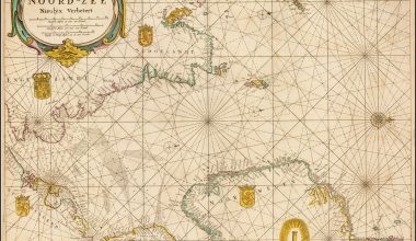
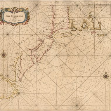
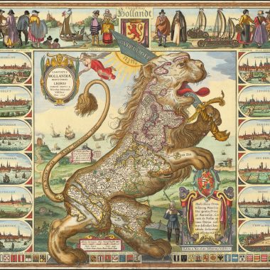
One of the most widely copied, and popular cartographic curiosities is the ‘Leo Belgicus’ – the Belgian Lion, first designed by Michael Eitzinger, and published in 1583. The first author to attempt to describe the many variant forms was R.V. Tooley in issue 7 of the Map Collectors Series’ in 1963/1964, in which he listed 51 examples, illustrating 24. While a very useful first listing, it proved difficult to establish which were printed from the same plate, and which form new plates. As is the way, the list served to highlight errors and omissions. Further additions and amendments were published in issue 34 of the same series. A further article was by Stephanie Hoppen, ‘Leo, King of the Map Jungle’ (Tring: The Map Collector, no. 14, p.48-50).
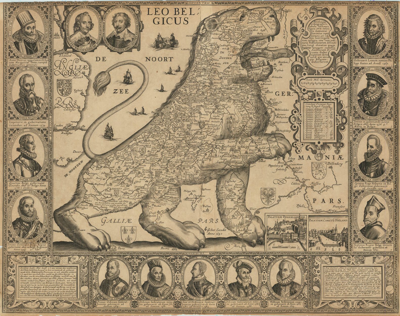
Van der Heijden’s carto-bibliography serves a welcome update on Tooley’s material. The author starts with an introduction to the political background in the Low Countries, during the revolt of the Low Countries against their Spanish overlords, and the symbolism of the ‘Leo’ for people of the period, with the rise of nationalist sentiment. The author then describes the birth of the genre, and the various forms used by various publishers. These he divides into four principal forms:
1. The Lion standing on its hind legs, facing east (to the right of the page), the earliest form.
2. The Lion standing, facing southward, first appearing circa 1611.
3. The Lion seated, in peaceful mood, produced at the time of the Twelve Years Truce (1609-1622).
4. The ‘Leo Hollandicus’, produced and published as it became increasingly clear that the Seven United Provinces would win its independence.
Confusingly however, having established these four groups, the actual listing is divided into seven groups, with each of the maps in the group described chronologically. Van der Heijden describes 32 separate printing platforms (copperplates and woodcuts), with separate states this increases to 65 examples. Of this later number some 25 were not in Tooley’s original listing, an impressive increase.
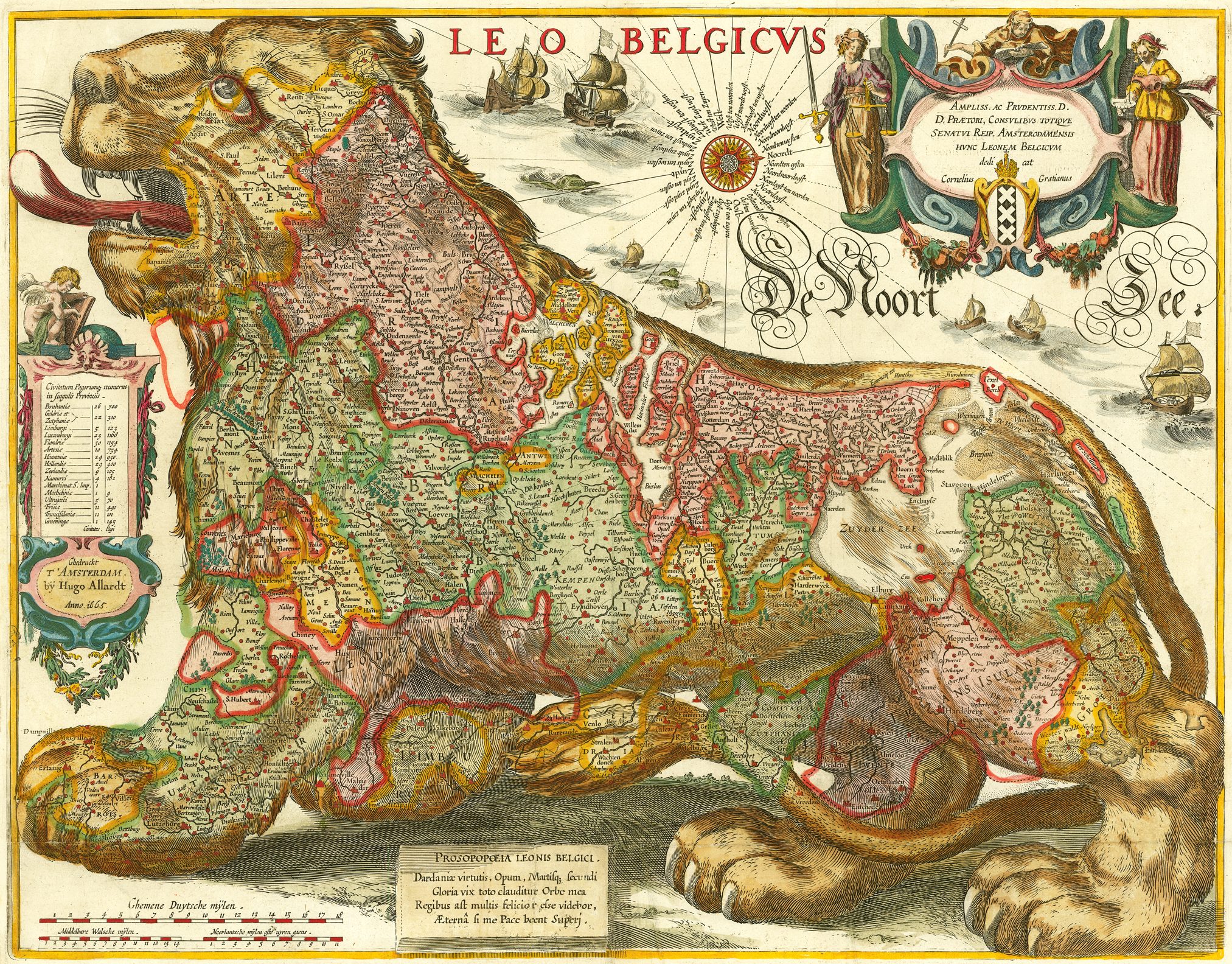
The author then proceeds to describe each of the maps, and individual states, listing the title, scales (both stated and calculated), the imprint, medium, size, relevant texts on the map (helpfully translated into English), locations, and then biographical and bibliographic notes. Wherever possible the text is illustrated with a picture of the state concerned. These are generally of very good quality, and very useful in amplifying the textual description. In some cases, relevant title-pages are also reproduced.
As is the way with all books, no sooner had this book appeared in print than a previously unrecorded set of maps by Jodocus Hondius Sr. was discovered, including a Leo Belgicus. The engravings date from Hondius’ London period, but the surviving examples were published in 1593, after his return to the Low Countries. The set is described by Gunter Schilder, ‘An unrecorded set of thematic maps by Hondius’ (The Map Collector, 59, Summer 1992, p.44ff).
De Ouste Gedrucke Kaarten Van Europa.
By H.A.M. van der Heijden. Alphen aan de Rijn: Canaletto, 1992. ISBN 90 6469 652 7. 146pp, illusts. Hfl 195 (wrappers).
Text in Dutch with a 7 page summary in English at the end.
Reviewed by The Editor
The author’s purpose in this publication is a systematic description of printed maps covering Europe as a whole (or intending to do so) published before the appearance of Ortelius’ map of Europe in the Theatrum (Antwerp, 1570), taking this cut-off point “because the Europe map in Ortelius’ Theatrum Orbis Terrarum of 1570 corresponds more or less with reality and therefore served as a model for all the later ones”.
Within this limited time-span the author has allowed himself some flexibility, listing in the carto-bibliography maps of Europe published after Ortelius that depend on maps pre-dating Ortelius, and discussing (and illustrating) other sixteenth century maps in the introduction, as well as Cornelis Claesz’ wall-map of Europe published in 1604, and Johannes Janssonius’s wall-map of 1617. In fact, the coverage in the introduction and carto-bibliography gives a reasonably comprehensive and thorough view of the subject up to the end of the sixteenth century.
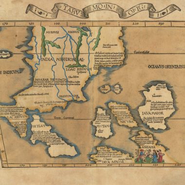
In the main body of the book, the carto-bibliography lists 40 maps and charts of Europe, ranging in date from Martin Waldseemuller’s wall-map of Europe, first published in 1511, of which no example is known of the first state, to Fausto Rughesi’s broadsheet map of 1597. While a number of the maps are well-known (those by Bordone, Munster and Ortelius for example) the majority of the maps described are multi-sheet wall maps of some rarity.
Each description gives the title of the map, its scale, place and date of publication, its publisher, and origin, size and then other comments. Each map is illustrated and, overall, the reproductions are of very high quality. There is some loss of definition in some of the larger maps, inevitable on account of their size but also, unfortunately, some loss of visibility in the gutter of the book when some illustrations are spread of the two pages.
An unexpected bonus is a second carto-bibliography appended at the end, listing 6 printed delineations of Europe in female form, ranging from Busius’ (or Putsch’s) woodcut of 1537 to the engraved version of Bunting’s map, published in 1638, and also illustrating Bohn’s version from the late eighteenth century. Inadvertently, one map, Eitzinger’s map of Europe from 1587, is omitted from this listing, although it is illustrated as fig.10 in the introductory text.
This is an extremely valuable book on a subject that it little covered in the existing literature, partly because of the rarity of the material, and the suite of illustrations in the carto-bibliography (the introduction is also extensively illustrated), make this a most valuable reference work, even for those not familiar with Dutch. This coupled with its modest price deserve to make this volume a feature of every map-lover’s reference library.
The Victorian Maps of Devon County Maps 1838-1901.
By Kit Batten and Francis Bennett
Tiverton: Devon Books, 2000. ISBN: 1 85522 756 8.
Reviewed by The Editor
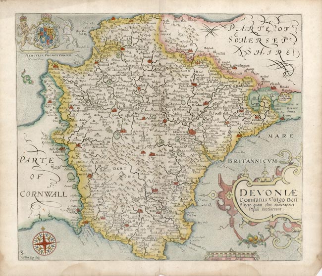
This is the second volume in the authors’ carto-bibliography of printed maps of Devon from Christopher Saxton’s map of 1575 to 1901. In this volume, the authors defined their parameters, thus: “a county map of Devon is a printed map published specifically to show the whole of Devonshire on one or two sheets, either individually or with only one other complete county”. The first volume, for the period from 1575 to 1837, was published in 1996, to favourable reviews. One of the principal features of the first volume was that an example of each map described (and the authors located 117 maps in their chosen period) was illustrated, either in whole, or in part, for the large-scale multi-sheet maps.
The thoroughness with which the authors approached their topic is shown by the number of maps listed. Batten and Bennett listed 117 individual maps for the period to 1837 (disregarding variant states), while David Kingsley’s Printed Maps of Sussex contains only 109 for the same period. With the completion of this second volume, Batten and Bennett record 183 maps (numbered to 182, and 82A) compared to Kingsley’s 154.
It should be noted that in the interval between the two volumes, only two new maps from the early period were brought to the attention of the authors, 82A, Arrowsmith’s map of the Diocese of Exeter, and a thumb-nail map of Devon used as the Index to the Ordnance Survey map of the County, illustrated as Fig: 1, but not accorded a separate number in the carto-bibliography. It should be noted, contra their note on page xxxi, that this map can also be found on the covers of sets of the map issued in the original wrappers (as the example in this author’s collection).
The book commences with a series of introductory chapters, first a general introduction, with sections on printing and topography, and then a longer section on the development of the railway network in Devon, with a valuable list of the railways built (with dates), and a map showing the spread of railways, as well as those projected but not completed, information of great importance in dating variant states of many of the maps they describe. The section on the railways is leavened with any number of fascinating details about the effect of the railways on travel.
Quoting from a guide book written by Cecil Torr, the authors note that in March 1841, Torr’s father travelled by horse-drawn coach from London to Exeter, the journey taking eighteen hours, with stops for supper and breakfast. Just over eighteen months later, he travelled from Paddington to Taunton by train, before completing his journey by coach. This time the journey was now nine hours and forty minutes. In 1845, the same journey took just seven and a half hours, and in 1846, the introduction of the express train direct to Exeter reduced the journey time to four and a half hours.
The second introductory section is devoted to “The Victorian Guide Book”, a particularly interesting development of the Victorian era, aimed at the growing numbers of “tourists” travelling to the coastal towns, or famous beauty spots, spa-towns and so on. The authors describe the guide produced by the major publishing houses such as John Murray and Adam and Charles Black, but also detail guide produced by local authors and publishers from the south-west. This is particularly useful as it sets the scene for this very popular genre, which is widely represented in the main carto-bibliography, which follows.
In the carto-bibliography, each map is given its own double-page spread (or more, as necessary), with the text on the left hand page and the illustration facing the description. The large page size (29 by 21 cm) gives plenty of room to allow great clarity in the layout. Each entry starts with a biographical note, and other relevant comments, a description of the first state of the map, and then its later states (where appropriate), with a listing of the atlases or books that the map appeared in. Footnotes appear at the foot of the page. The text is in large type, with the successive carto-bibliographical information laid out in bullet points, so all the relevant information comes easily to the reader (and to the eye).
Unfortunately, the illustrations are of rather variable quality. While they illustrate clearly the general appearance of the map, it is often difficult to make out particular features or names, even on relatively small maps, while some of the detail in larger maps is almost indistinguishable.
The authors are to be commended for this volume. Not content merely with writing and editing the text, they also undertook the layout, and financed publication of this volume. It is to be regretted that more and more authors of carto-bibliographies, the basic building block of cartographic history, are having to underwrite their own publications, in the face of hesitation from publishers to consider volumes with a perceived limited market. The authors have combined to produce a handsome book, which is excellent value for money, and which also sets a new standard for county carto-bibliographies which, it can be hoped, future authors will aspire to. With its general notes, and detail of county atlases of the Victorian age, this book will be sought after not only by the collector of Devon maps, but also by those of other counties wishing to access the latest scholarship on English county atlases, and serial publications, in the reign of Queen Victoria.