One of the most fascinating printed books from the fifteenth century is Hartman Schedel’s ‘Liber Cronicarum ..’ or, as it is widely known to an English-speaking audience today, the Nuremberg Chronicle. The Chronicle was published in two editions in the same year, first a Latin edition, published on July 12th 1493, and then a German edition, published on December 23rd 1493.
The Nuremberg Chronicle proved to be a very popular volume. In a study published in 1976 (1), some 800 examples of the Latin edition and 400 of the German edition were traced. Examples of the book can frequently be encountered in the stock of leading dealers, or at auction.
The Chronicle is the most ambitious and impressive example of book publishing from the fifteenth century. A folio volume, with (in the German edition), 286 pages of text, the Chronicle contains somewhere in the region of 1,800 woodcuts (many duplicates), designed to present a textual and pictorial history of the world, from the Creation to the fifteenth century, dawn from Biblic sources, supplemented from classical authors such as Pomponius Mela, Gaius Julius Solinus.
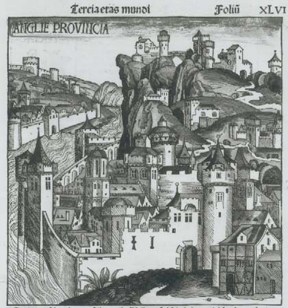
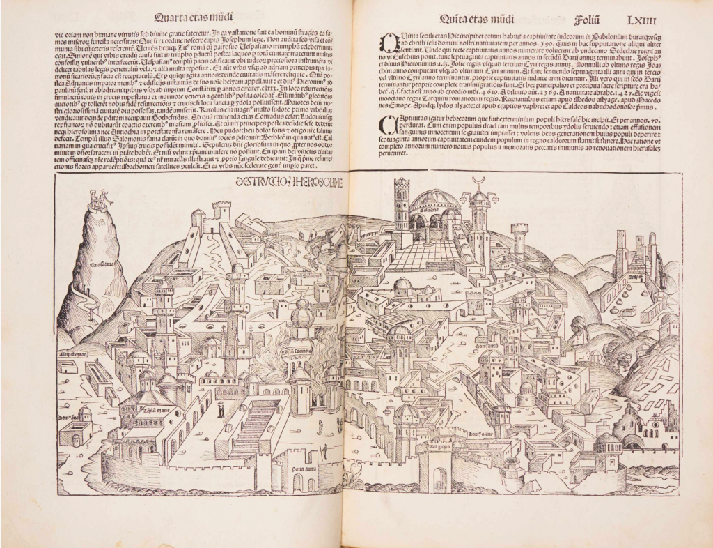
The principal illustrations are maps of the World and of Germany and central Europe, but there are also 99 views of towns and cities, several anonymous, principally of Europe, but including some from the Near East, such as Constantinople, Damascus, Babylon and Jerusalem. The majority of these views are imaginary. Thus, for example, the woodcut entitled ‘ANGLIE PROVINCE’, and variously said to be London or Dover, is more plausibly a view of Nuremberg. Indeed, 49 of the views are actually printed from a group of 14 woodcuts, used indiscriminately throughout. There are also thirty double-page view of cities, including Nuremberg, Venice, Rome, Strasbourg, Saltzburg, Ulm, Basle and others, where the publishers have attempted to portray a more realistic image of the city shown.
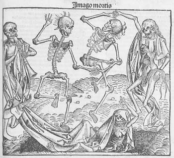
In addition to the topographical images, there is an enormous number of other subjects, including diagrams of the Creation, family trees, portraits & biblical scenes. It is a veritable pictorial encyclopedia both of history, but also of contemporary Europe.
The Liber Cronicarum is also interesting as being published in 1493. In tone and focus the Liber is very backward-looking, and appeared in print just before Christopher Columbus’ discoveries were to completely re-shape contemporary man’s view of the World.
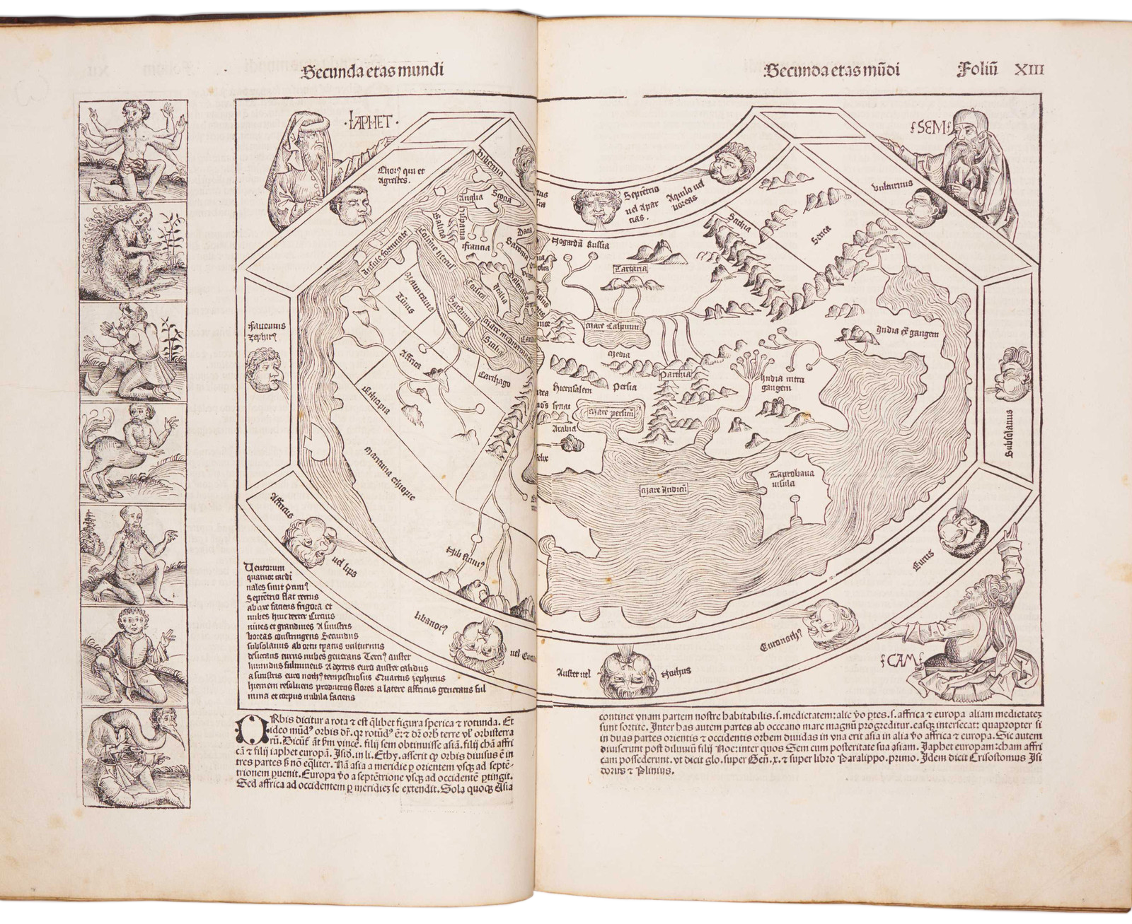
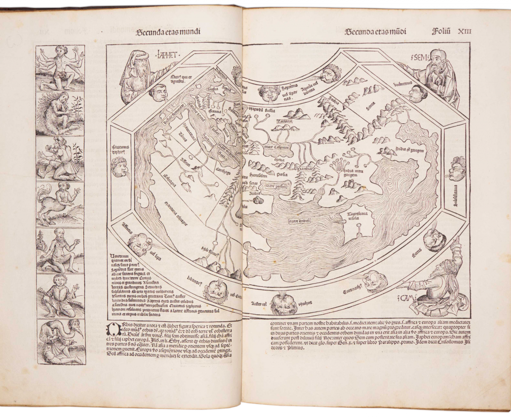
Schedel’s World map is thus of the traditional Ptolemaic type, omitting Scandinavia, southern Africa and the Far East, and depicting the Indian Ocean as landlocked. The woodcut is flanked by the figures of Shem, Japhet and Ham, the sons of Noah, who re-populated the Earth after the Flood (incidentally, one of the most striking of the woodcuts set in the text is of the construction of the Ark).
On the left hand side, and printed from a separate block, are pictures of outlandish creatures, culled from classical and early mediaeval travelers’ accounts. Rodney Shirley described the figures thus:
“Among the scenes are a six-armed man, possibly based on a file of Hindu dancers so aligned that the front figure appears to have multiple arms; a six-fingered man, a centaur, a four-eyed man from a coastal tribe in Ethiopia; a dog-headed man from the Simien Mountains, a cyclops, one of those men whose heads grow beneath their shoulders, one of the crook-legged men who live in the desert and slide along instead of walking; a strange hermaphrodite, a man with one giant foot only (stated by Solinus to be used a parasol but more likely an unfortunate sufferer from elephantisis), a man with a huge underlip (doubtless seen in Africa), a man with waist-length hanging ears, and other frightening and fanciful creatures of a world beyond” (2)
One unusual feature of the map is the presence of a large island off the west coast of Africa. One possibility is that its presence might relate to the account of Martin Behaim’s voyage to the region, which is incorporated by Schedel into his text.
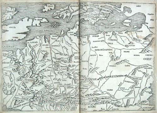
The second map was apparently compiled by Hieronymus Münzer, a Nuremberg physician, who had travelled extensively throughout Europe, and who also contributed the accompanying text. Münzer’s map clearly derives some information for Cardinal Nicolaus of Cusa’s (or Cusanus) map of Germany and central Europe, but the many uncertainties about the publication history of the latter map, as described by Campbell (3) and Karrow (4), do not allow a precise conclusion about the nature of the relationship. However, as Campbell pointed out, the geographical description in the text, and the delineation in the map do vary. For example, the map, copying Cusa, shows the Rivers Meuse and Rhine as following parallel courses to separate mouths in the North Sea, while in the text Munzer describes the two rivers flowing into a shared estuary (5).
While the text was compiled and edited by Schedel, much of the credit for this huge undertaking must go to the printer Anton Koberger, but more particularly to the two designers employed to work on the woodcuts – Michael Wohlgemuth and Willem Pleydenwurff, who cut the blocks, probably with the assistance of their pupil, Albrecht Durer.
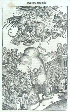
Some of the woodcuts, particularly those symbolising the struggle of good versus evil have allowed plenty of opportunity for artistic expression, are powerful images, testament to the skills brought together to see this magnificent book through the press.
Notes
(1) Wilson, Adrian & Joyce Lancaster Wilson, The Making Of The Nuremberg Chronicle (Amsterdam, 1976), p.238.
(2) Shirley, Rodney W. The Mapping Of The World Early Printed World Maps 1472-1700, London: Holland Press Cartographica, 1983.
(3) Cambell, Tony. The Earliest Printed Maps 1472-1500 (London: The British Library, 1987), map 220, and notes on page 153.
(4) Karrow, Robert W. Jr. Mapmakers Of The Sixteenth Century And Their Maps (Chicago, Speculum Orbis Press, 1993): ‘Nicolaus Cusanus’, and p.136, map 23/1.4;
(5) Campbell, p.153.
Photographs of the World, Europe, Death and Good & Evil courtesy of Altea Maps and Books