While Dr. John Speed inherited some of his father’s maps and books, the materials for the History and Theatre were the property of Sudbury and Humble. In about 1618, Sudbury retired from the firm, and the plates passed to the sole ownership of Humble. Subsequently, he added plates for the miniature county atlas, and the folio Prospect.
Stationers’ Company, Public domain, via Wikimedia Commons
On his death in 1640, Humble’s son William inherited the stock-in-trade. William continued to publish the atlases, and added the miniature edition of the Prospect, but under his control, the folio atlases were published in a rather haphazard fashion, and his editions are particularly rare. In 1659, William Humble sold his rights in Speed’s books and atlases to another bookseller, William Garrett, who entered them with the Stationers’ Company on March 24th 1659:
“William Garrett Entred … by vertue of a note under the hand of William Humble of London, Esqr. all his estate right & title in ye booke or copie called ‘A Prospect of ye most famous parts of the World … Pformed by John Speed … vi. d. [and] … all his estate, right & title in the book or copie called The Theatre of the Empire of Great Brittaine … divided and described by John Speed … vj. d. (9)
Also specified in the Register are the History, and the two miniature atlases.
However, Garrett seems only to have retained ownership of the rights for a short time, before selling them to Roger Rea the Elder and Younger, who planned new editions. Although the date 1662 appears on the title-pages for the miniature county atlas, and for the folio Prospect, it is probable that publication was not completed until 1665, only for the vast majority of the examples printed to be destroyed in the Great Fire of London. At about the same time, one of the Roger Reas, probably the senior, died, perhaps as a result of the Plague. The remaining partner endeavoured unsuccessfully to re-issue the folio county atlas, and did reprint the miniature atlases in 1666 and 1668, but the financial losses incurred during the Fire may have been insurmountable, and no more is heard of the plates until they reappear in the hands of Bassett and Chiswell, in 1674/5.
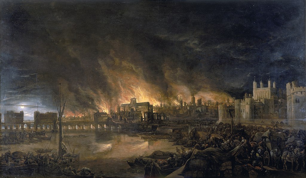
Museum of London, Public domain, via Wikimedia Commons
BASSETT AND CHISWELL’S EDITION OF SPEED’S ATLASES
Thomas Bassett and Richard Chiswell were both booksellers in London, active in the 1670’s and 1680’s. Bassett specialized in legal books, while Chiswell was publisher for the Royal Society. Publication of the Speed atlases is perhaps the only project carried out jointly by these two publishers, although they are sometimes found working together in co-operation with other booksellers. Nor, indeed, was either partner notable for dealing in maps. Presumably, their co-operation was a product of circumstance and opportunity, rather than intent, on either side, to enter the map-world.
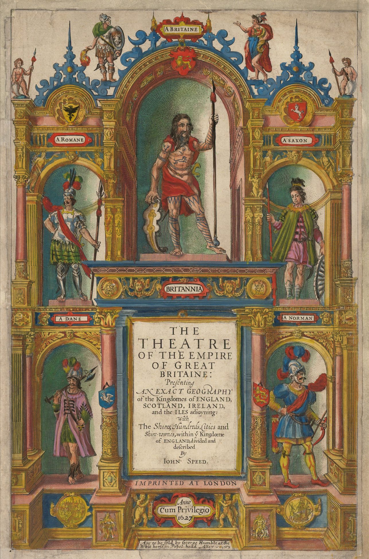
The partners announced their intention to reprint the four atlases, in an advertisement in the London Gazette for February 1674/5. Next to the First Edition, this was the most important folio edition of the Theatre (and probably the largest printing), and certainly the most important of any of the editions of the Prospect.
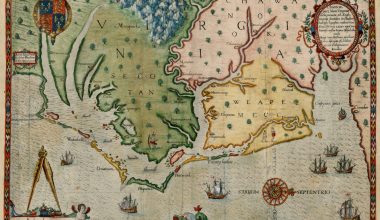
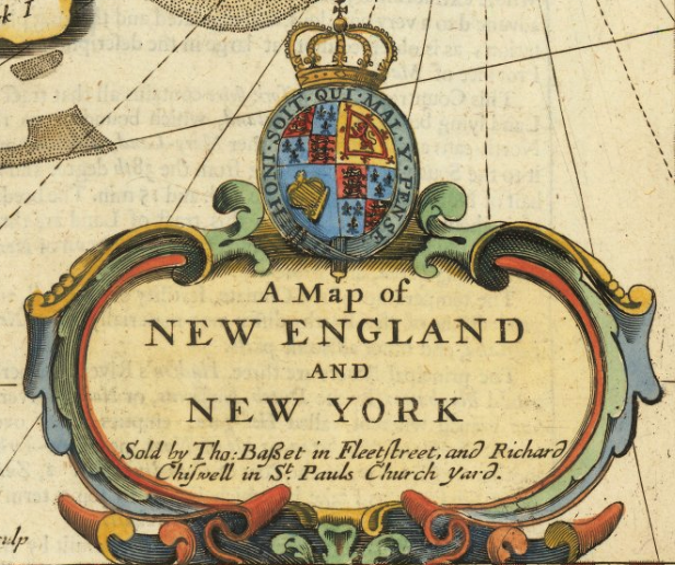
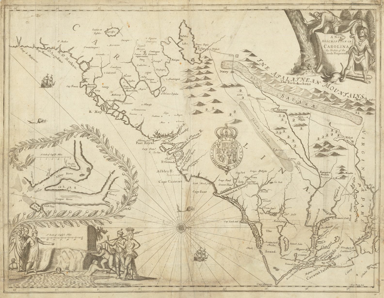
Not content with merely resetting the text of the Theatre, Bassett and Chiswell inserted their imprint on the maps, and made minor corrections to a number of the county maps – adding new coats of arms, revising some spellings, and adding a few names. While the Theatre was still the superior county atlas available, the Prospect was very much outdated, and this had been evident even as it was first issued. Little could be done, or indeed was done, to amend the existing maps (beyond changing the imprint), but the publishers added a new section of maps of ‘His Majesty’s Dominions Abroad”, as it was described on the title. This section was composed of maps engraved by Francis Lamb, of: Jamaica and Barbados, New England, Virginia, and the Carolinas.
The new maps are based on similar versions in Ogilby’s America, with the exception of the map of Virginia, which is derived from Augustine Herrman’s extremely important four-sheet map of the region, published in 1673. The map of New England and New York is from a Dutch model, and forms part of the sequence known as the “Jansson-Visscher” series of maps of New England. (10) The map of the Carolinas is an early derivative of the Ogilby-Moxon “Carolina”, the so-called “The First Lord Proprietors Map”, because of the invaluable role played by the Proprietors in providing information incorporated in the map (11).
Clearly, Bassett and Chiswell did not feel great confidence in the world atlas, either in folio or octavo forms. In both editions they inserted letter- press titles, which portray the Prospect in a secondary role to the Theatre. In this they were probably correct, as this was to be the final use of the printing plates for both versions of the Prospect. The plates may have passed to Philip Lea, but they are not heard of again, except those of Virginia and Canaan, in re-issues by Christopher Browne.
This was also to be the last formal edition of the Theatre with the accompanying text. The maps themselves were frequently re-printed thereafter, by a number of successive publishers in atlas collections without text and often without title, such as Christopher Browne. Henry Overton and Cluer Dicey.
Apart from the Theatre, Speed is also credited with other atlases, to which it is probable that he made little or no contribution.
ENGLAND WALES SCOTLAND AND IRELAND DESCRIBED
In 1627, George Humble published a miniature edition of the Theatre, containing sixty-three maps of the British Isles. The title reads:
‘England Wales Scotland and Ireland Described and Abridged With ye Historic Relation of things worthy memory from a farr larger Voulume. Done by John Speed.’
Notwithstanding the probably deliberate ambiguity in the title, this atlas is primarily composed of plates engraved by Pieter van den Keere between about 1599 and circa 1605, based on the corresponding maps from Saxton’s untitled atlas of England and Wales, published in 1579. Van den Keere never completed the atlas, and the plates passed to Willem Janszoon Blaeu, who used them in a miniature edition of Camden’s Britannia, published in 1617.
Subsequently, the plates were acquired by George Humble, in about 1619. He discarded five plates, which depicted groups of counties together, in favour of sixteen new plates, with each county shown separately. In addition, seven new maps were engraved, including general maps of England, Scotland, Ireland and Wales. The new plates are not so well executed as the Dutch originals, and were probably engraved in England.
On van den Keere’s maps, Humble had the existing Latin titles erased, and replaced with English forms, plate numbers added, but no geographical amendments were made to the plates. A proof set exists in the British Library’s Map Library, with variant plate numbers on the new plates. The atlas was frequently re-issued, often bound with miniature editions of the World atlas.
Apart from the Theatre, Speed is also credited with other atlases, to which it is probable that he made little or no contribution.
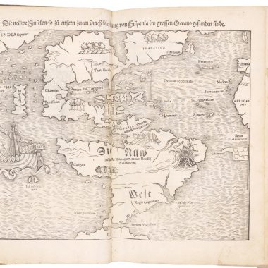
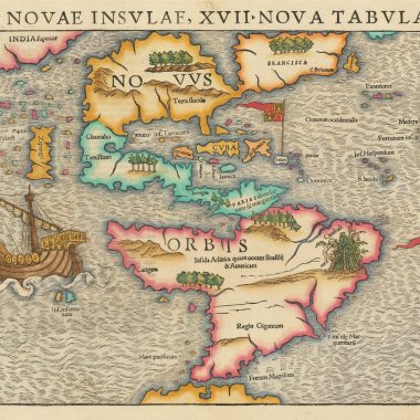
A PROSPECT OF THE MOST FAMOUS PARTS OF THE WORLD – Miniature Edition.
A fourth atlas associated with Speed’s name was a miniature edition of the Prospect, first published in 1646. Although Speed’s name does not appear on the title-page of the 1646 edition, or on any of the maps, this miniature atlas was most frequently issued bound with the miniature edition of the Theatre, and so is often attributed to him. Once again, the printing plates for the atlas were engraved in Amsterdam, by Pieter van den Keere, Jodocus Hondius’ brother-in-law. Van den Keere had a long and distinguished career as an engraver. Indeed, the World map, in the miniature edition may be his last dated engraving.
The maps are simple reductions of the folio maps, but with the side panels omitted, under constraint of size. The accompanying text is also taken from the folio editions. It was not until Bassett and Chiswell re-issued the miniature Prospect and Theatre in 1675-6, that a connection was made on the title-page to Speed: An Epitome of Mr. John Speed’s Theatre of the Empire of Great Britain. and of His Prospect of the Most Famous Parts of the World.
THE GENEALOGIES OF HOLY SCRIPTURE
Further evidence of Speed’s interest in genealogy is to be found in a number of different sets of woodblocks depicting Biblical Genealogies, prepared for inclusion in the front of Bibles. These sets differ, primarily in their format, depending on whether they were to he issued in folio, quarto or octavo editions. The first appearance of the folio version of the Genealogies is found bound into the King James Bible, printed by Robert Barker in 1611. These folio editions were often accompanied by an engraved map of Canaan, dated 1611, which is found printed from one of two very similar plates, which were apparently used interchangeably. In the quarto editions is found a smaller woodblock map, which is a careful reduction of the folio version.
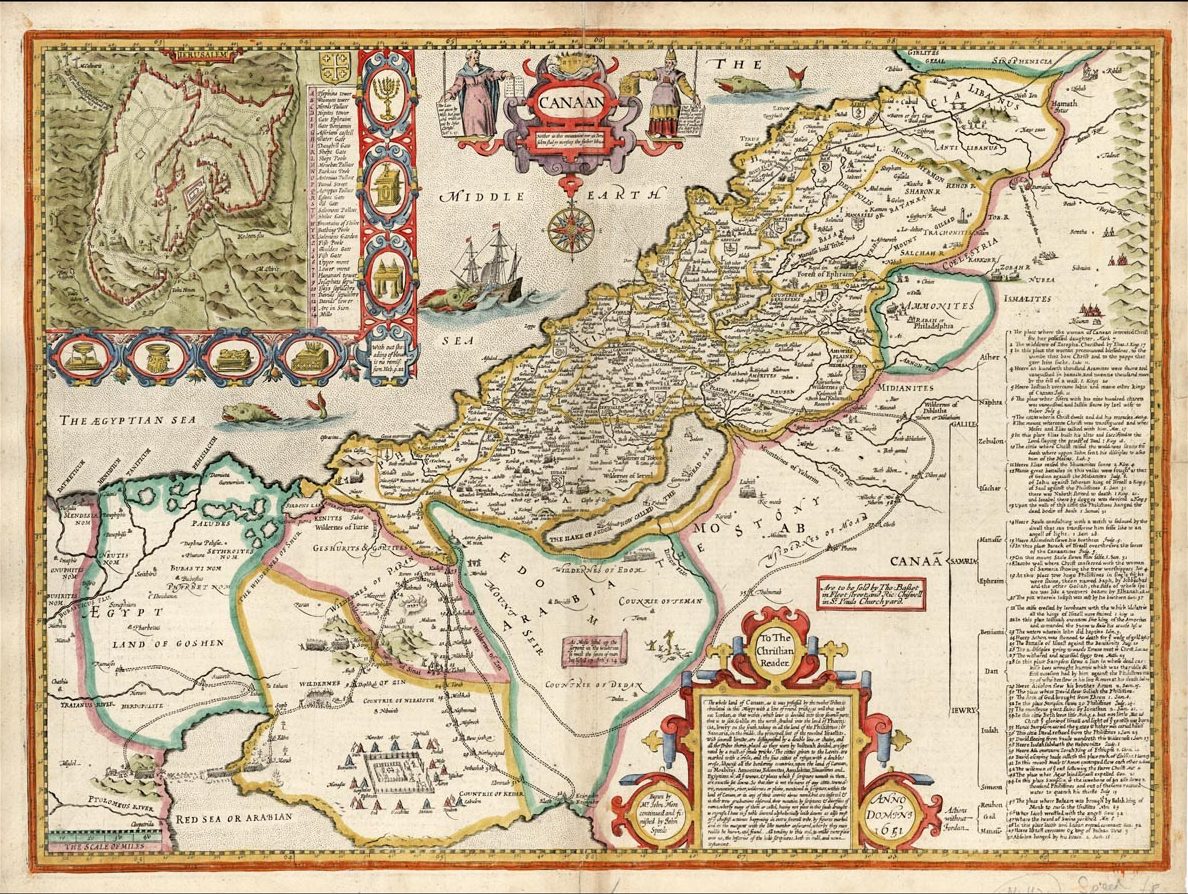
The two folio maps are apparently identical in terms of title, and geographical information. One, however, has the signature of Renold Elstrack as engraver, below the note “Begun by Mr. John More.” This plate has hatchuring for the sea, while the other has stippling.
The folio versions are, apparently, reductions of a fourteen sheet wall map of Canaan, published by Speed at about this time, of which there is no known example. Existence of such a map would seem to be proved by two advertisements, placed by Robert Green, in the Term Catalogues:
“An Advertisement of a large Map of Canaan. This Map was first drawn by Mr. More, a learned Divine, Author of the Sacred Chronology that bears his Name, etc., first Fellow of Christ’s Colledge, Cambridge, and afterwards Minister of St. Andrew’s in Norwich: a Person so well acquainted with the Hebrew Text, that one calls him ‘another Jerome; and so exact in this Map, hathe spent a great part of his Life in it. After his Death, which was 1592, it was published by the industrious Mr. John Speed” (12).
“For as much as the plates for Mr. Moor’s accurate Map of Canaan were destroyed in the late dreadful Fire; at the desire of several Learned persons. it has been revised, and is now reprinting. The map consists of fourteen sheets, besides six of description …” (13).
It would seem that Green was had a complete example of Speed’s version, from which he was able to have new plates engraved. Green’s version is similar enough to the two folio plates by Speed to confirm a common source-map, and to preserve for modern researchers Speed’s original map, albeit at second hand. Green’s edition sold for thirty shillings to subscribers, while the plan of Jersualem, which comprised two of the fourteen sheets could also be purchased separately, for 2 shillings, or 5 shillings, coloured and laid on cloth.
On October 30th 1611, Speed secured a ten year privilege from King James (14), which ordered that the Genealogies were to be inserted in every copy of the Authorized version of the Bible sold in England, and this privilege was later extended for a further seven years (15) in 1617 (16).
Evidence of the financial rewards accrued by Speed from this patent can be found in the records of a meeting between a committee appointed by the Stationers’ Company and Speed, in regard to this patent, recorded in the Company’s Register, for November 23rd 1615:
“whereas the Master and keepers [of the Company] … by theire Indenture [dated March 25th 1612] … have Covenanted … & agreed to and with the said John Speed for ev’ye booke Intituled (The Geneologies of the Holye scriptures and mappe of Canaan) in the volume called Quarto, the some of ten pence … Nowe the said John Speed because the Master warden and assistants shall use and employe their best meanes and indeavors that no bibles … shall dureing the said terme of the said Indenture be bound up or uttered, unles one of the said Geneologies and Mappes be inserted … is content … that the … Master … shall pay to the said John Speed for every Geneologie and Mapp in quarto only eight pence …” (17).
The patent was subsequently the cause of considerable dispute between the Company and Speed’s son and heir. Finally, Doctor John Speed approached the Company, on November 19th 1638, and offered to sell the patent to the company. Agreement was reached on November 23rd. The Stationers’ Company purchased the patent, with the existing stock, and the “… Material’s for printing the Genealogies” from him for six hundred and fifty pounds, with an additional payment of fifty pounds already owed to Speed (18), which was a substantial amount, but which must accurately reflect what the Company felt the patent to be worth.
NOTES
9. Arber, Transcript, 1640-1708, II, p.219-20
10.Campbell, no.23.
11. Cumming. no.77 and see no.70
12. Easter Term, licensed May, 1683; Arber, II, p.22
13. Hilary Term, 1682, licensed June; Arber, I, p.50(1-I
14. C.S.P. Dom Calendar of State Papers, Domestic Series, 1603-1610, p.639).
15. C.S.P. Dom Calendar of State Papers, Domestic Series 1611-1618, p.431
16. Jackson, p.78.
17. Jackson, p.78
18. Jackson, p.317-8.
SELECT BIBLIOGRAPHY
Arber, Edward The Term Catalogues 1668-1709, 3 vols., (London, 1906)
[Various] A Transcript of the Register of the Company of Stationers 1640-1708, 3 vols. (London, 1913-1914)
Campbell, Tony “The Jansson-Visscher Maps of New England”, in R.V. Tooley, Mapping of America, London, 1985
Cumming, William P. The Southeast In Early Maps, 2nd Edition (Chapel Hill, 1962)
Fuller, Thomas Worthies of England, (London, 1662)
Granger, Thomas Biographical History of England, Vol. III (London, 1779)
Hodson, Donald County Atlases of the British Isles, vol. I (Welwyn, 1984)
Koeman, Dr. I.C. Atlantes Neerlandici, 6 vols., (Amsterdam, 1967-1985)
Laor, Eran Maps of the Holy Land (New York, 1986)
Nicholson, Nigel The Counties of England A Tudor Atlas by John Speed (London, 1988)
Skelton, R.A. Bibliographical Note to the Facsimile of Speed’s Prospect, (Amsterdam, 1966).
Smith, David Antique Maps of the British Isles (London, 1982)
Smith, Thomas (ed.) Gulieljmi Camdeni et Illustrium Viroroum Ad Camdenum Epistolae (London, 1691)
Tyacke, Sarah London Mapsellers 1660-1720 (Tring, 1978)
Worms, Laurence “Mapsellers at the Royal Exchange”, Part 1, The Map Collector, no.34 (March, 1986).