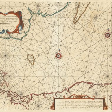
mapforumOctober 12, 2022 15th IssueCollation: The New Fierie Sea-Colomne, 1640 [Koeman: J. Col 24 ]Library of Congress G1793 .C6 1640b; Phillips 3332 by Jason Hubbard As in the…
mapforumOctober 4, 2022 13th IssueEphemera: Colin Lamont Unusual broadside catalogue/advertisement for Colin Lamont, advertising himself as seller of sea-atlases and charts, related scientific and timekeeping…
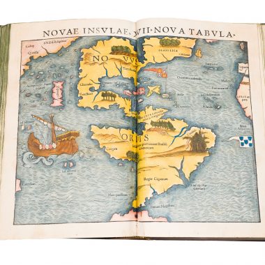
mapforumAugust 5, 2022 MapForum ArticlesCollations: Munster’s Geographia (1540, 1542, 1545) Munster’s Geographia: 1540 GEOGRAPHIA / VNIVERSALIS, VETVS ET NOVA, / COMPLECTENS / CLAVDII PTO- / LEMAEI ALEXANDRINI ENARRATIO-…
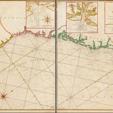
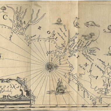
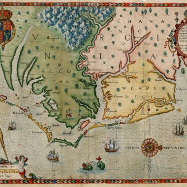
mapforumJuly 19, 2022 MapForum ArticlesPrinted Charts of the Carolinas 1. [1648] DUDLEY, Sir Robert state 1Carta particolare della Virgi= / nia Vecchia è Nuoua. / La longitu:ne…
6th Issue MapForum Articles Treacle & Vinegar:Publisher’s Adverts From the 1670’s through to the 1760’s publishing maps and atlases in London was a fierce and cut-throat… mapforumMay 5, 2022
mapforumMay 3, 2022 MapForum ArticlesThe Charting of Cape Fear, N.C., 1525 to 1800 The first European to see the Cape Fear peninsula was Giovanni da Verrazzano in 1524. Verrazzano was a…
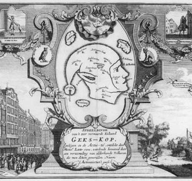
mapforumMarch 16, 2022 MapForum ArticlesSatirical Cartography: The Isle of Mad-Head [ANONYMOUS / Henri Abraham CHATELAIN ?]AFBEELDINGHE van’t zeer vermaerde Eiland GEKS-KOP. geligen in de Actie-ze, ontdekt door Mons.r…
mapforumFebruary 28, 2022 MapForum ArticlesPrinted Maps of the Carolinas: 1590 – 1800 This checklist is based on research work done over a period of some ten years while assembling a…
mapforumFebruary 18, 2022 MapForum ArticlesJohn Speed: Subsequent Ownership of Speed’s Plates While Dr. John Speed inherited some of his father’s maps and books, the materials for the History and Theatre were the property…
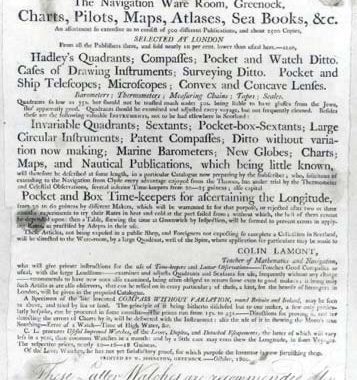
3rd Issue MapForum Articles The Zulu War: Isandhlwana & Rorke’s Drift STANFORD’S / LARGE SCALE MAP / OF ZULU LAND / WITH ADJOINING PARTS OF / NATAL, TRANSVAAL &… mapforumFebruary 18, 2022