From the 1670’s through to the 1760’s publishing maps and atlases in London was a fierce and cut-throat business, working within a relatively small internal market. This competition is reflected in the advertisements issued by individual members of the trade. This was the heyday of the advertising broadside, which over the years became increasingly elaborate, as the publisher sought new ways to keep his stock before the public, and persuade the public to buy his maps, rather than a competitors. While many are overblown examples of purple prose some are very revealing about the state of the London map trade in that period.
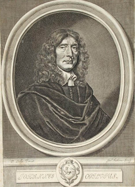
In 1669 John Ogilby issued broadside proposals for his English Atlas, in which he wrote:
Whereas Mr. OGILBY … [being] enabled, encouraged and still covetous of Fame … he is forced for his Divertisement as well as Profit, to prosecute whilest he hath vigour and abilities, the Business of the Pen … He now … resolves to overcome, breaking through all Difficulties, a far greater and higher Design looking down on Pernassus, Greek and Latine Paper-Kingdoms, girding himself couragiously for no less than the Conquest of the whole World, making the Terrestrial Globe his Quarry, by a new and Accurate Description of its four Quarters, viz. EVROPE, ASIA, AFRICK, and AMERICA, and teaching them English, bring home in triumph illustrated with large Maps, and embellished with various Sculptures of their several Concerns, adorning with their most Famous Cities, and other Rarities and New Remarks, the product of our later Discoveries.
Ogilby, who had achieved some success with translations of Virgil’s Eclogues, Georgics and Aeneid, had obviously been heavily influenced by the Classical style!
Also in 1669, John Seller Sr. (in his Praxis Nautica) appealed to the nationalism of his customers by referred to his projected series of sea-atlases thus:
Courteous Reader, These may be to inform you, that whereas being frequent complaints made that the English hath not as yet manifested that forwardness in the promotion of things of public concernment, for the general benefit of Navigation, as the Hollander hath done, in the making of Waggoners and Charts for the Sea, and things of that nature, although we come not behind them in any Theoretical Knowledge … [and this] gives advantage to our neighbours the Hollanders to be furnishing us with Waggoners, Charts and Draughts, and such things, whereby great treasure of Money is transported out of our Native Countrey to the enriching of them, and to the impoverishing of ourselves. Therefore (worthy Gentlemen) I do hear make known unto you, that I intend, with the assistance of God, and am at the present upon making (at my own cost and charge) a Sea Waggoner for the whole World… We have made use of the Dutch Waggoners and Charts in many of our Navigations, wherewith (for want of better) we have been sometimes constrained to accept of many Errors and Impertinencies, to our dishonour, and their great Interest and Advantage.
Mild indeed: the Dutch impertinent! Whatever next!
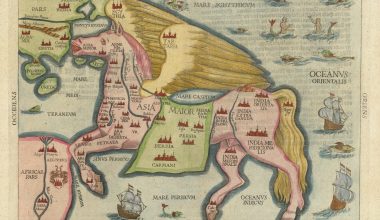
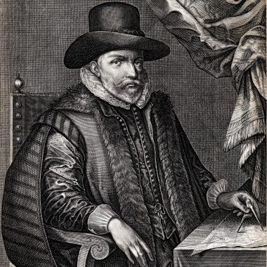
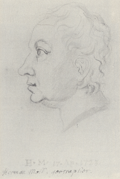
With the arrival of Herman Moll from Germany the London trade gained a master of abuse. From 1708 onwards he began to issue a series of two-sheet maps of the countries of the World, which were eventually to form his elephant-folio atlas, The World Described. Other mapmakers, concerned not to leave blank spaces in their maps, filled the gaps with vignette scenes featuring the native population, animals and fabulous creatures, ships, or panels of informative text. This was not to Moll’s taste. Instead, he filled the space with attacks on rival mapmakers, and their methods. A less favoured option was to attack the Dutch, but a French mapmaker would get the most acid bile.
Moll on Dutch and French mapmakers, from his World map of 1709:
As for y.e Dutch Maps all of ’em yet extant, are much alike, and far enough from Correctness, Now it being a great hazard we run in Undertakings of this nature, and we labouring under y.e frequent hardships, of having our Maps Copy’d upon us in Holland &c. brought over hither, publickly advertised and sold under other names, to their Profit, and to y.e manifest defrauding of us, as well in point of Reputation, as otherwise; to prevent this evil Practice, as much as in us lyes, we propose to go on gradually with y.e four Quarters &c. at y.e Subscription of 1.s – 6.d a Piece…
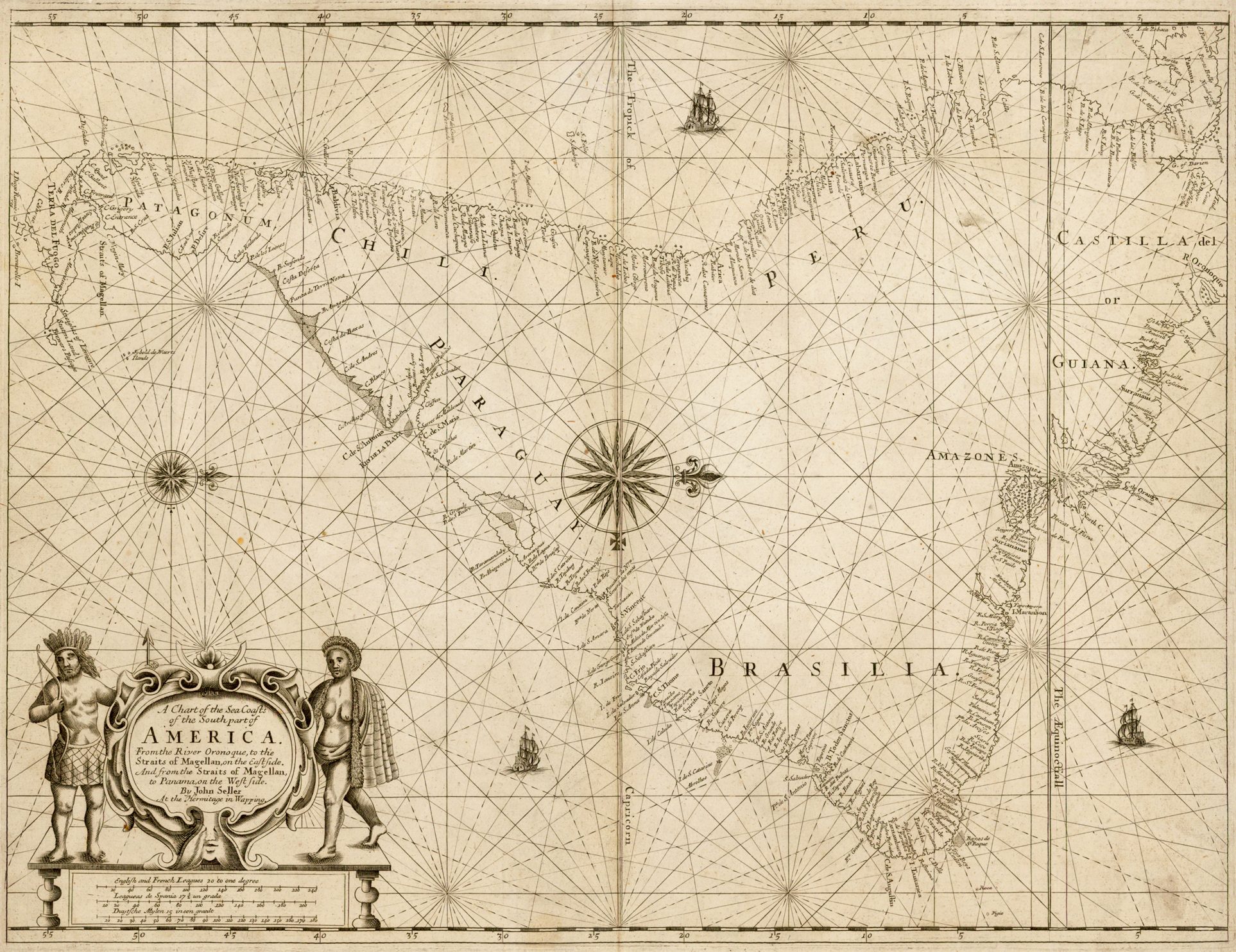
From his map of South America, circa 1710:
The World is in nothing more scandalously imposed upon, than by Maps put out by ignorant Pretenders, who most falsly and impudently assume y.e titles of y.e Queen’s Geographers, more particularly they that have publish’d two several Copies, each of two-sheets, of a falsly projected French map of South America, done at Paris in 1703, and to deceive mankind have dedicated both to Dr. Halley, Savilian Professor of Geometry at Oxford, and they are pretend in y.e dedication that it is Corrected by his own Discoveries… these false Maps differ from D.r Halley’s and all other late Observations, and consequently make our Sailing to y.e South Sea less by about a Thousand Miles than really it is, every body may easily judge what a Dangerous consequence these maps may produce, if ever they should be us’d at Sea, and y.e wrong notions they must give others at land are no less apparent. NB. that y.e Projection of these Maps is also notoriouly false.
However, to be fair to Moll, he seems to have been relatively even-handed. In the final analysis, he does not seem to have had a good word for anyone!
Moll on the map trade in general, and Guillaume de l’Isle and Pierre Mortier, of Amsterdam, who may well have been the publisher of the map of Spain mentioned, from Moll’s map of Spain, 1711:
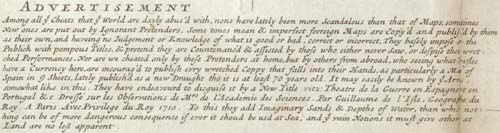
Among all y.e Cheats that y.e World are dayly abus’d with, none have lately been more Scandalous than that of Maps, some times New Ones that are put out by Ignorant Pretenders, Some times mean & imperfect forreign Maps are Copy’d and publish’d by them as their own, and haveing no Judgement or Knowledge of what is good or bad, correct or incorrect, They basely impose on the Publick with pompous Titles, & pretend they are Countenanc’d & assisted by those who either never Saw, or despise their wretched Performances. Nor are we cheated only by these Pretenders at home, but by others from abroad, who seeing what Trifles have a Currency here, are incourag’d to publish every wretched Coppy that falls into their Hands, as particularly a Map of Spain, in 9 Sheets, lately publish’d as a new Draught tho it is at least 70 years old. It may easily be known by y.e Arms, somewhat like in this. They have endeavoured to disguise it by a New Title vitz: Theatre de la Guerre en Espagne et en Portugal &c. Dressé sur les Observations de M.rs de l’Academie des Sciences. Par Guillaume de l’Isle, Geographe du Roy. A Paris Avec Privilege du Roy. 1710. To this they add Imaginary Sands & Depths of Water, than which nothing can be of more dangerous consequence if ever it shoud be used at Sea, and y.e vain Notions it must give others at Land are no less apparent.
Moll on fellow map-sellers in London, from the printing catalogue accompanying the earliest issue of the World Described, circa 1717:
I have been the more particular in describing these Maps, that Gentlemen may know them from others, and not be imposed upon; for there are Persons who sell Setts of Maps, under the Notion of their being all mine, but leave out the Principal of them, viz. Europe, England, Ireland, Germany, France, Spain, Flanders, &c. and put Old and Erroneous ones of their own in the room of them. This they do to under-sell, to the confounding of the whole: Books have been sent me with Complaints of this base way of Dealing; in which, if those who have been guilty do persist, I shall expose their Names publickly in Print, that all Buyers may be aware of such Impositions. … SINCE the beginning of this New Set of Maps, now completely finish’d, several ignorant Pretenders have started up, and with great Shew and Noise frequently advertis’d their trifling Performances; calling them Cheap, Curious, Useful and Correct: As to the first Epithet, they are really Dear at any Price; in the second place, every Body may see they are Wild, Confused and Poorly Engraven; as for their Usefulness; they tend only to lead People into Errors and Dangers; lastly, they are so far from being Correct, that the Fundamental or Projection of their Principal Maps is Notoriously False.
While John Senex and George Willdey are the obvious candidates as producing rival sets of two-sheet maps, I think the principal target was Henry Overton (I), who issued a number of two-sheet maps at this time, obviously copied from Moll.
Moll was not the first to publish personal attacks. John Ogilby had particular trouble with plagiarists, in particular Richard Blome. Having published a prospectus for his Britannia in 1671, Ogilby cannot have been pleased to see Blome’s county atlas of 1673 also called the Britannia. He issued another broadside prospectus for his work (circa 1673), describing Blome’s atlas thus:
The Author seriously considering that whatever of this nature has been hitherto attempted, comes infinitely short of the Perfection the Importance of the Subject requires … as Mr. Norden complains, No Actual Dimensuration was ever perform’d, but a Computation of Distances, by a Cursory Perambulation, made up the Original Work, from whence, whatever Mr. Cambden, Speed, or of late one Blome have since done, are but onely Copy’d, with this ill Fate, That as the Original Errors were not onely transferr’d to, but augmented by the additional ones of the later Mapps; so now lastly, the very Performance it self rendred much worse than the meanest of what was before Extant.
The abuse was rarely one-sided. John Overton on his principal competitor Robert Walton (broadside catalogue, ca. 1673)
These and many other sorts of Printed Maps and Copy-Books, are Printed and sold by Iohn Overton Stationer, at the signe of the White Horse without Newgate who scorns to sell anything pittyfully done, and he hath more then ten times the choice and stock that R[obert]. W[alton]. hath, though he vapors that he is the oldest man. It was formerly Mr. Peter Stent’s shop the Antientest and Chiefest of that way in England. If any Book-sellers or others in the Countrey desires to have any of these things to sell, If they send but a line to Iohn Overton dwelling as above expressed, he will take as exact care to furnish them as if they were themselves present, and at as cheap prices.
Robert Walton’s riposte to Overton (broadside catalogue, ca. 1673)
AND this R[obert].W[alton]. is the oldest in London of this way, and J[ohn]. O[verton]. and several others are but Intruders into that which they were never brought up to, and employ simple people as understand little, either of Arts or Reason in their work, though they please or serve fools, and therefore I still truly say as doth the Poet G. VV.
When each man keeps to his own Trade,
Then all things will be better made.
… though I[ohn]. O[verton]. hath the confidence as to averr such Notorious Falsities in his Catalogue, on Is his Choice and Stock, but that is like the Map of Germany that hee about 1673. Presented the World with as new, and called it a Map of three sheets, whereas he presented the same Map about two Years before publikely as one sheet, and so indeed it is; for it is a Map that hath been common, I am sure, above this 30 if not above 40 Years ago; but I[ohn]. O[verton]. hath Equivocations, Reservations and Distinctions enow, if not too many; Another thing in his Catalogue utterly false is, that he saith, that the shop he now hath was Master Peter Stents, whereas P. Stent never kept that shop, nor any other elsewhere, but in Gilt-spur Street: but I conclude, P[eter]. S[tent]. his Tools could not teach I[ohn].O[verton]. to print or colour, or if they, or P[eter]. S[tent]. his boy, or T[homas]. C[ockerill]. his boy did not, I would willingly know who did, (if he will say he can do them) for before he bought P[eter]. S[tent]. his things, sure I am, that he knew as little of Printing or Colouring as you that read this paper, if you never either Printed nor Coloured, and what his meaning is, not only to use my very titles, but also to scratch my name out of my Prints, the which is as my Land-Mark, I will leave you to judge, I am sure it is such a thing as I never heard of was done by the worst of men, but I will let him go as he is, and only wish you to make use of your eyes, and Reason, and let them judge, whether he or I speak the real plain truth, and let him prove any one thing I have here said false if he can …
Back to Moll, this time on his English rivals, and Moses Pitt’s English Atlas; (1680-1684), from his World map of 1719:
ADVERTISEMENT. Having finish’d a New and Compleat Atlas or Set of 27 Two-sheet / Maps, and omitted no Pains to have them very correctly done, according to the Newest Observations and latest Discoveries, which are well known to have been very many within the Compass of a few Years; I hope Noblemen, Gentlemen and others, will not suffer themselves to be imposed upon by Old, incorrect and falsly projected Maps, under what denomination soever they may be represented to the Publick, without taking a litle Care to look into and examine them. It is within y.e Memory of many living, that Moses Pitts Bookseller undertook to publish a New English Atlas, his Proposals were very plausible, and Persons of great Note, who were to inspect and give their Assistance, nam’d therein, among whom was Prince Rupert, by whose Direction I drew several New Draughts for that work. but notwithstanding the vast Incouragement Pitts had by the subscriptions of Persons of Quality and others; he had so little Regard to do ’em Iustice, according to his Proposals, that he purchased an Impression of Old and Incorrect Maps for his Pretended New Atlas; adding only a few poorly perform’d Plates to it, which I hope will be a sufficient Caution to every body, not to take any thing of this kind for the future upon Trust and unexamined.
Alas, once Moll had completed the World Described he concentrated on smaller maps and atlases, which did not have the room for such outbursts. Then, with his death, in 1732, the English map-trade went into a lean period. While there were a small number of innovative map-makers (for example John Rocque and Thomas Jefferys Sr.), the principal publishers from about 1730 to 1770 (Senex, the Bowles family, the Overtons, and so on) lacked real ambition and, in some ways, the character went out of the business.
Certainly the high personal and emotional attacks disappear from the official literature of the publishers. It may be that the Copyright Act played a part in this, in affording map-makers greater protection under the law, but this period also saw a decline in the status of the mapmaker, so that individual egos were less prominent. Whatever the reason, it is regrettable that such highly personal evidence of relationships within the map trade is not so readily available for the period after 1730.