Nicolas de Fer (1646-1720) was one of the leading publishers of maps in Paris at the end of the seventeenth and early eighteenth century. His father, Antoine de Fer, was also a famous mapseller and publisher. In turn, Nicolas was succeeded by two of his son-in-laws, Guillaume Danet and Jacques-François Danet and then their heirs, who continued the business until about 1760.
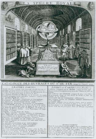
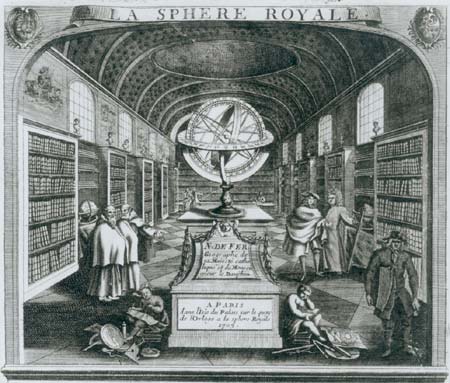
This fascinating piece of ephemera depicts the interior of de Fer’s bustling shop, at the sign of ‘La Sphere Royale’, in 1705; the walls are lined with bookcases, with several globes visible, while in the foreground maps and other instruments are shown.
Below the image is an engraved catalogue of de Fer’s stock, focussing on the large wall-maps that were the early basis of his reputation. Also mentioned are several of his books, including the Atlas Curieux, the most famous of his publications, a quarto atlas of the countries of Europe and the world, published from 1700 onwards, and the Forces de l’Europe, a series of plans of the principal towns and cities of Europe, but also including a few non-European cities such as Quebec.
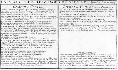
Such catalogues often provide important evidence for the stock in trade of such dealers, and can often help in dating the undated. Sadly, while some catalogues list the prices of the items, none are given here. Being ephemeral in nature, such items only rarely survive.
The image of the shop is one of the few delineations of the interior of mapsellers’ shops that I have encountered; unfortunately, as a promotional piece, the interior has been tidied up, so it is not very informative about the range of the map stock, the way it was displayed, or the type of people who would come in to buy or browse through the goods. Nevertheless, it is an interesting snapshot of a subject that modern commentators have so much difficulty in reconstructing.
Illustration by courtesy of Jonathan Potter Ltd.
