William Darby was an American geographer and cartographer of Irish descent, born in Pennsylvania on August 14th 1775. In 1799 he settled in Mississippi Territory, as a cotton planter. It was apparently about this time that he commenced gathering material for a map of the Territory and Louisiana. In 1804 he gave up his plantation and took up a post of deputy surveyor in the United States General Land Office. During the War of 1812 he served with Andrew Jackson as a topographer. In later life he worked in the General Land Office in Washington, and died there in 1854.
In the preface to the Geographical Description Of The State Of Louisiana, which accompanied the completed map, Darby supplied a very brief auto-biographical note:
“Extensive as is the range of his work, the author has visited the most important parts; he has examined the rivers, soil, and productions; carefully noted the manners of the inhabitants, in his excursions through the valley of the Mississippi; and, in a residence of sixteen years, has felt all the changes of climate; has beheld the separation of the people from a despotic government; their incorporation into a government of law and reason; and has seen demonstrated how deserving those people are of all the benefits resulting from rational legislation”.
In a subsequent note, Darby wrote that it was:
“… in the first part of the year 1800 that I first formed the design to make a map of, and write a statistical account of the region of country, including the State of Louisiana and parts adjacent. From the time mentioned to the month of August 1811, I kept the plan in view, though only incidentally collecting material; but thence forward, until late in 1814, my attention was turned and my time devoted almost exclusively to the project…”
quoted by Ristow
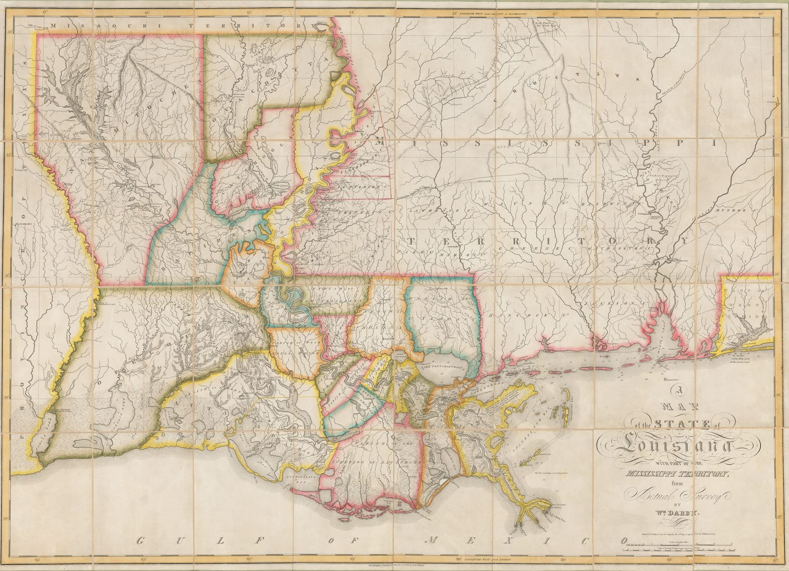
The map,’A Map Of The State Of Louisiana With Part Of The Mississippi Territory…, was published by John Melish, in Philadelphia in 1816. It proved particularly influential, and much of the survey work was subsequently incorporated into other maps by Melish, including his very important map of the United States, published in 1819. This map was subsequently used as a base map in boundary negotiations between Spain and the United States. Later works by Darby were published by Henry Schenk Tanner, brother of Darby’s second wife Elizabeth.
Darby wrote a number of books and articles about the southern states, many illustrated with maps, including The Emigrant’s Guide To The Western and Southern States (1818), a Memoir On The Geography, And Natural History Of Florida (1821), and A View Of The United States, published by Tanner in 1828, collated here.
The copy described contains 14 maps, also present in the British Library’s example of the book (Maps.12.a.5), but is interesting as being extra-illustrated, having a fifteeenth map bound in immediately after the Copyright statement. The map, and the engraved prospectus below relates to the sale of 200,00 acres of land in Pennsylvania, with the prospectus describing the land, its position, soil, and so on, signed by John Keating.
Of the set of maps, thirteen (without the map of the mouth of the Mississippi), seem to have also been used in Tanner’s A New Pocket Atlas Of The United States, published in 1828 (Phillips, Atlases, 4524).
Collation: A View of the United States
Locations of features on the map are marked to a notional grid: 1 – 5 horisontally, a – e vertically.
“ob” signifies outside border
VIEW / OF THE / UNITED STATES, / HISTORICAL, GEOGRAPHICAL, AND / STATISTICAL; / EXHIBITING, IN A CONVENIENT FORM, / THE NATURAL AND ARTIFICIAL FEATURES / OF THE / SEVERAL STATES, / AND EMBRACING THOSE LEADING BRANCHES OF / HISTORY AND STATISTICS BEST ADAPTED TO DEVELOP THE / PRESENT CONDITION OF THE / NORTH AMERICAN UNION. / ILLUSTRATED WITH MAPS, &c. / [rule] / BY WILLIAM DARBY. / [rule] / PHILADELPHIA: / PUBLISHED BY H.S. TANNER. / [dotted rule] / 1828.
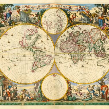
| 1. WORLD. [3e] | 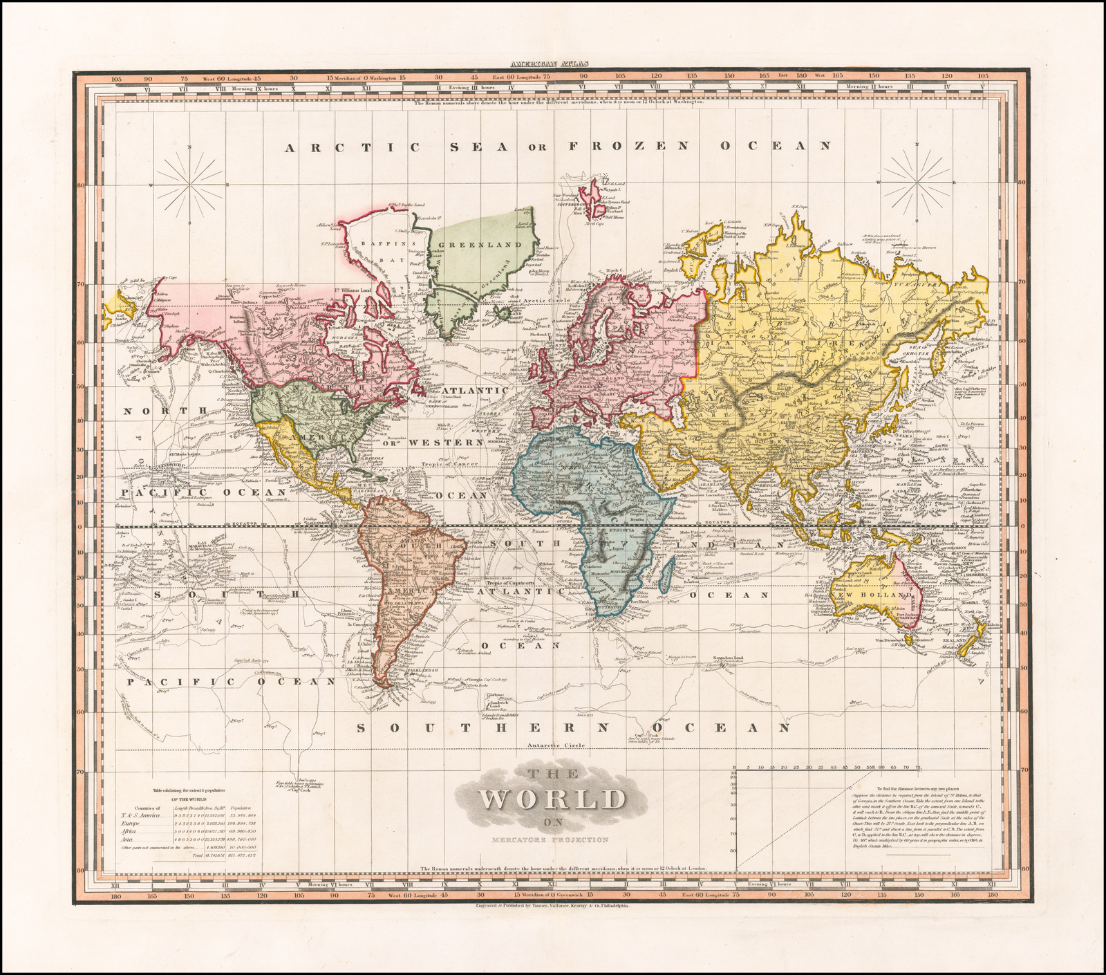 124 x 165 |
| 2. GEORGIA / AND ALABAMA. [5b] J. Knight Sc. [5e, ob] | 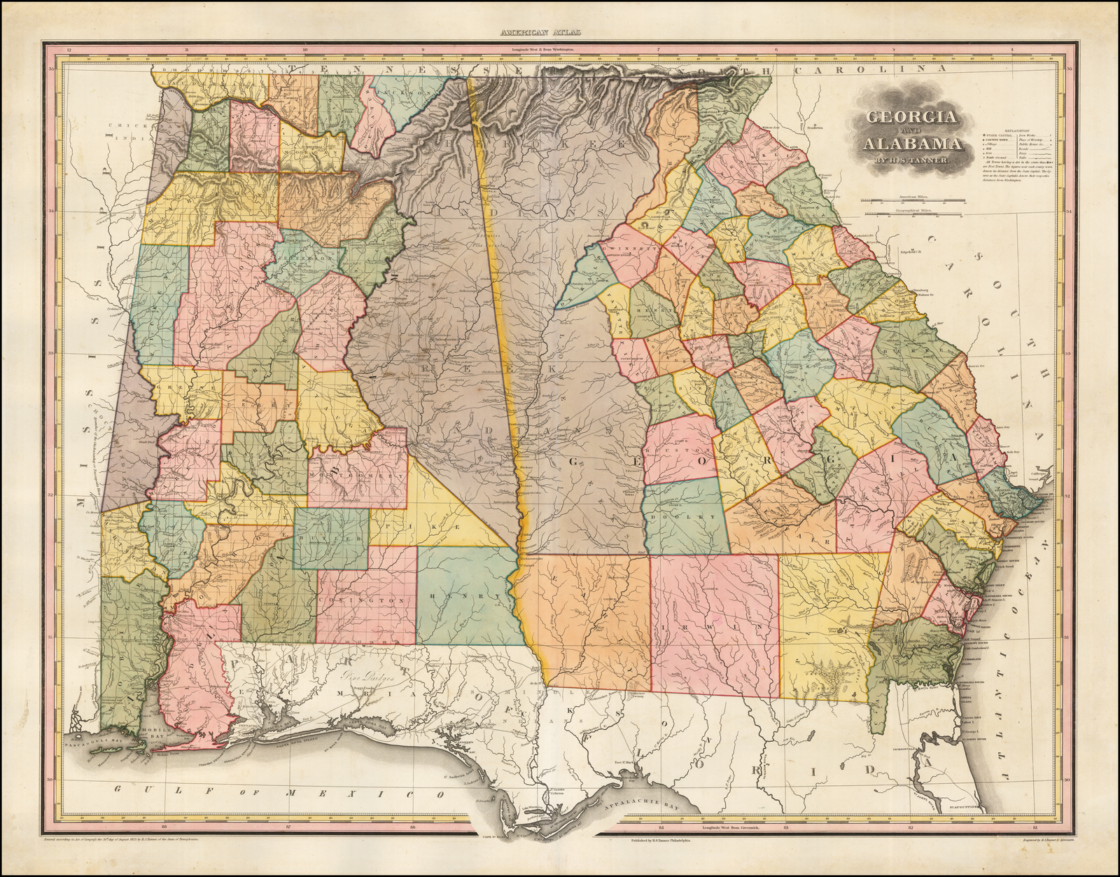 119 x 167 |
| 3. NORTH & SOUTH / CAROLINA. [4d] J. Knight Sc. [5e, ob] | 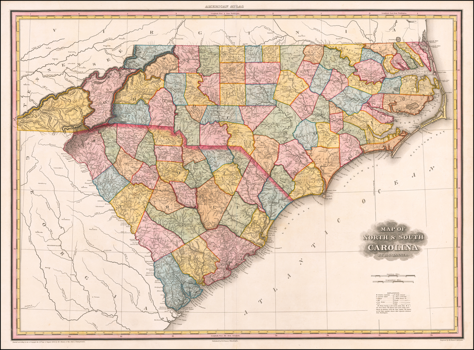 124 x 157 |
| 4. VIRGINIA / MARYLAND / AND / DELAWARE. [1a] J. Knight Sc. [5e, ob] | 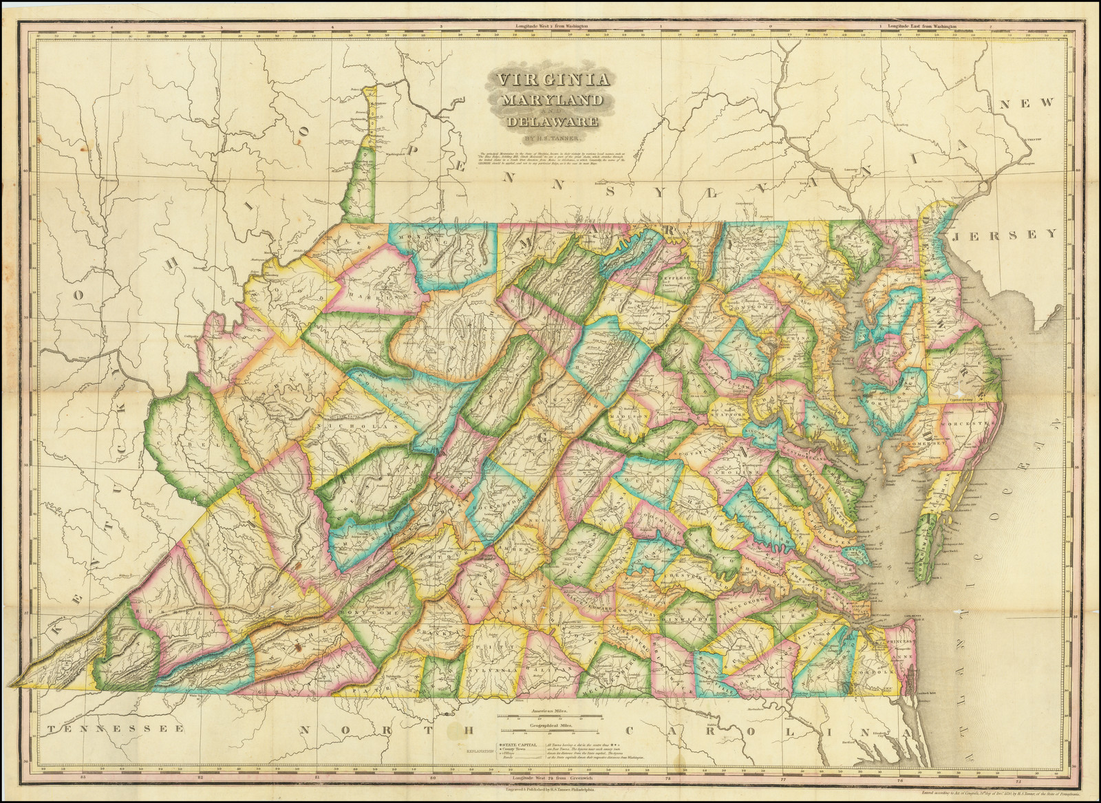 124 x 160 |
| 5. PENNSYLVANIA / and / NEW JERSEY. [1d] | 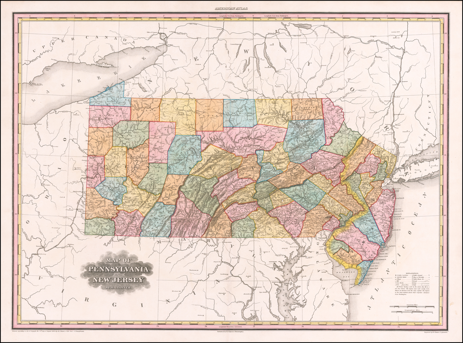 123 x 156 |
| 6. NEW YORK. [2c] | 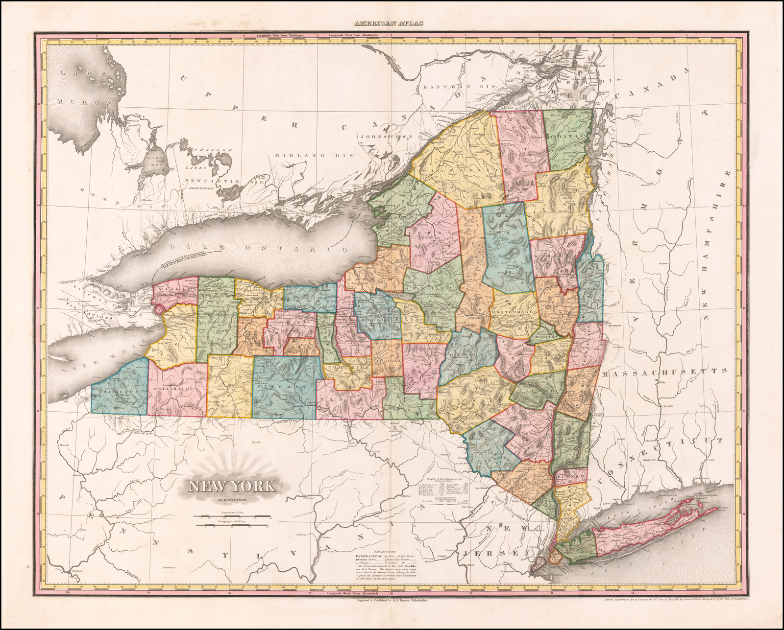 126 x 161 |
| 7. NEW ENGLAND. [5d] | 161 x 127 |
| 8. FALLS OF NIAGARA / AND ADJACENT COUNTRY. [1b] | 120 x 151 W: 120 x 154 |
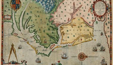
| 9. LOUISIANA / AND / MISSISSIPPI. [2b] J. Knight Sc. [5e, ob] | 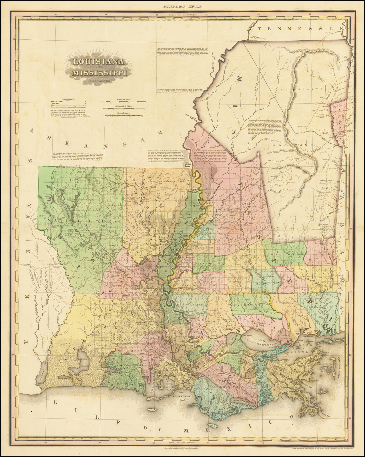 160 x 128 |
| 10. PART of / LOUISIANA; / Delta of the Mississippi. [4b] | 118 x 157 |
| 11. KENTUCKY / AND / TENNESSEE. [1a] J. Knight Sc. [5e, ob] | 128 x 166 |
| 12. ILLINOIS / AND / MISSOURI. [2b] J. Knight sc. [5e, ob] Inset: ‘MISSOURI RIVER / West Part’ [2d] 21 x 29mm | 161 x 129 |
| 13. PART OF / MAINE &c. / with the Boundary claimed by / GR.T BRITAIN. [2b] | 152 x 121 |
| 14. OHIO / and / INDIANA. [5d] | 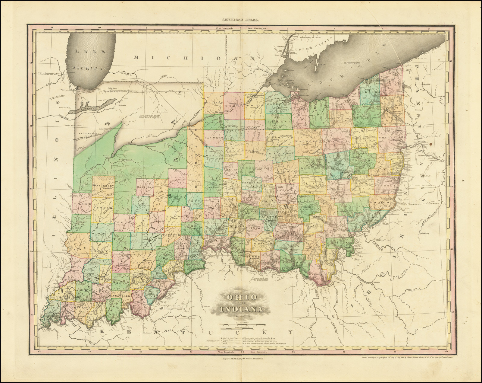 124 x 160 |
| * Map of the Routes / in / NEW YORK, NEW ENGLAND & PENNSYLVANIA / Drawn for the / NORTHERN TRAVELLER. [2b] Childs & Lehman Lith.rs Phil.a [1e, ob] [text below] For Sale to Actual Settlers. / 20,000 acres of land scituate in the Counties of Potter and M.cKean, in the State of Pensylvania, and on or near / the division-line between the States of New York and Pennsylvania. / [description of the land, soil, climate, access, stage routes, and so on] / The above tract is shaded in the annexed Map, whixch indicates its position at the head of the Navigation of / the Alleghany and Susquehanna, and its connexion with the atlantic Cities of Philadelphia, New York & Baltimore. / [signed] John Keating. | 146 x 156 W: 348 x 220 |
Walter W. Ristow, American Maps and Mapmakers Commercial Cartography in the Nineteenth Century (Detroit: Wayne State University Press, 1985), p.142-145 gives a brief biography of Darby (the basis for this note), and illustrates the map of Louisiana.
Illustrations by courtesy of the Author.