Referring to the Zee Atlas, Koeman wrote:
“This chartbook by Arnold Colom … is one of the most important atlases in the well known category of Dutch sea-atlases. It is not the first of the group: Joannes Janssonius’ Atlas Maritimus (1650), which constitutes volume 5 of the Novus Atlas opens the series … Contrary to the rather unhomogenous set of charts by Janssonius, Arnold Colom assembled a coherent group of 15 charts, later increased to 17 plus a world map. … Arnold Colom’s three charts of the oceans are on the same scale (1:14mill.) as Portuguese and Spanish charts of that time. It marked the first time that such charts were published as atlas sheets …”
(Atlantes Neerlandici, IV, p.115).
The Zee-Atlas is one of the largest format sea-atlases published in Amsterdam of the period, and also one of the scarcest. This may reflect the dominance that publishers like Johannes Janssonius enjoyed, or perhaps that the format was simply too large for convenient use.
That the atlas, and his other cartographic ventures, were not successful would seem to be confirmed also by the fact that Colom fell heavily in arrears with his rent. In a notarial act of 1663, Colom gave his landlord, another prominent cartographic publisher Nicolaas Visscher (II), security for the debt, which included the eighteen printing plates for the ‘Zee-Atlas.’ It would appear that Colom died, in 1668, without redeeming the plates, for no later editions by him are known.
References
Koeman, Ir. C. Atlantes Neerlandici Volume IV Celestial and maritime atlases and pilot books (Amsterdam: Theatrum Orbis Terrarum Ltd, 1970): Colom, Arnold & A.Col. 1 -3 & Doncker, Hendrick, & Don.16 – 29;
With the following additions and amendments:
Many of the charts appear to have had Colom’s street address re-engraved, but not his name, or shop sign. In these cases the lettering is significantly different, and frequently cramped to fit the available space.
The two British Library examples are described as being Koeman’s second and third edition respectively. In fact, both are his second edition, without the Pacific map.
The Nordenskiold Collection, in Helsinki University Library contains a French text edition of the Zee-Atlas, not noted by Koeman.
The accompanying table lists six examples, showing variants in the number of charts, and plate numbers.
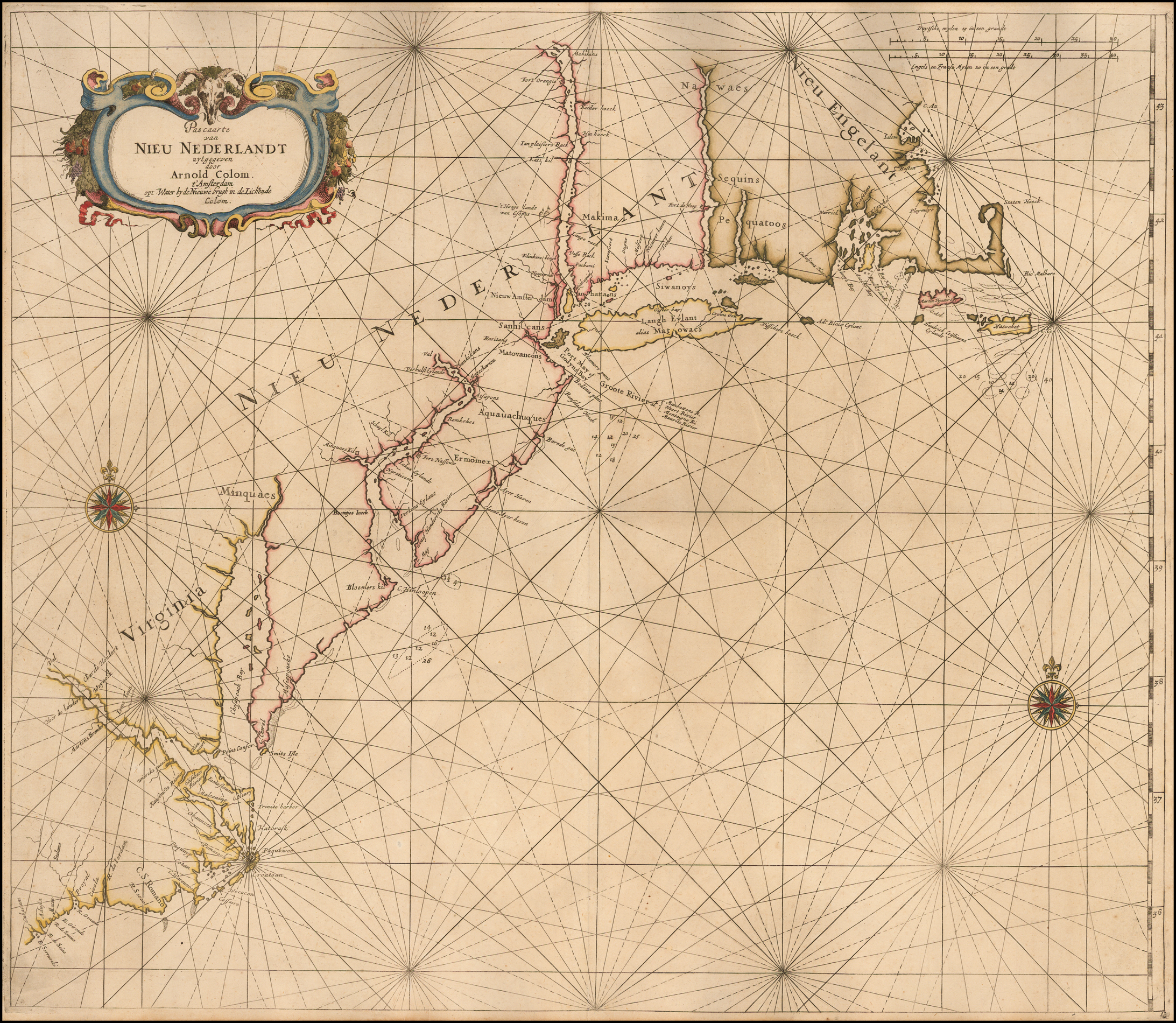
1: Het Kongelige Bibliotek, Copenhagen (described briefly by Koeman), with the ascribed date 1654, with 16 charts, not seen by this writer but presumably lacking the chart ‘Pascaerte van Nieu Nederlandt …’, which is dated 1656.
2: Amsterdam, Maritime Museum
3: BL, Maps C.26.f.24;
4: BL, Maps C.26.f.25;
5: Nordenskiold Collection Catalogue, I, 53;
6: the example being collated, by courtesy of E. Forbes Smiley III.
The first British Library example also contains a dedication to the Board of the Admiralty in Rotterdam, not referred to by Koeman:
Aen de Wel-Edele Mogende Heeren / DE HEEREN / GECOMMITTEERDE / RADEN / Ter / ADMIRALITEYT / Tot / ROTTERDAM.
{
Van wegen {
{ //
GELDERLAND, Joncker Evert van Deelen, Heere tot Laêr, Burger- / meester tot Harderwijck, &c.
De Ridderschap van HOLLANT, Joncker Willem van Matenes, Heere tot / Rasquaert, &c.
DORDRECHT, Mijn Heer M.r Diderich Hoeuft, Heer van Fontaine Peu- / reuse, uyt den Oudt-raadt.
DELFT, Mijn Heer M.r Arent van de Graef, Raad ende Vroedschap.
ROTTERDAM, Mijn Heer Adriaan Hartman, Regeerend Burger- / meester.
GORINCHEM, Mijn Heer Brieuen Manson, Oud Schepen, Raad en- / de Vroedschap.
SCHIEDAM, Mijn Heer Pieter Ionasz. Oud Burgermeester.
BRIEL, Mijn Heer Symon van der Poth, Oud Burgermeester.
ZEELANT, Mijn Heer Nicolaas Kien.
UYTRECHT, Mijn Heer Gijsbert de Wijckersloot, Oud Burgermeester.
VRIESLANT, Joncker Schelto van Ieltinga.
OVER-YSSEL, Joncker Iohan van Steenwijck, tot Bockenhaven.
De Heer M.r Michiel van de Broek, Advocaat Fiskaal.
De Heer M.r Pieter Splinter, Secretaris.
De Heer Adriaen van Berkel, Ontfanger Generaal.
Contents | States | 1 | 2 | 3 | 4 | 5 | 6 |
| Title | Latin | Dutch | Dutch | Dutch | French | Dutch | |
| Leezer | Latin | Dutch | Dutch | Dutch | French | Dutch | |
| Text | Latin | Dutch | Dutch | Dutch | French | Dutch | |
| Ded: Amsterdam | Dutch | Dutch | Dutch | French | Dutch | ||
| Ded: Rotterdam | Dutch | ||||||
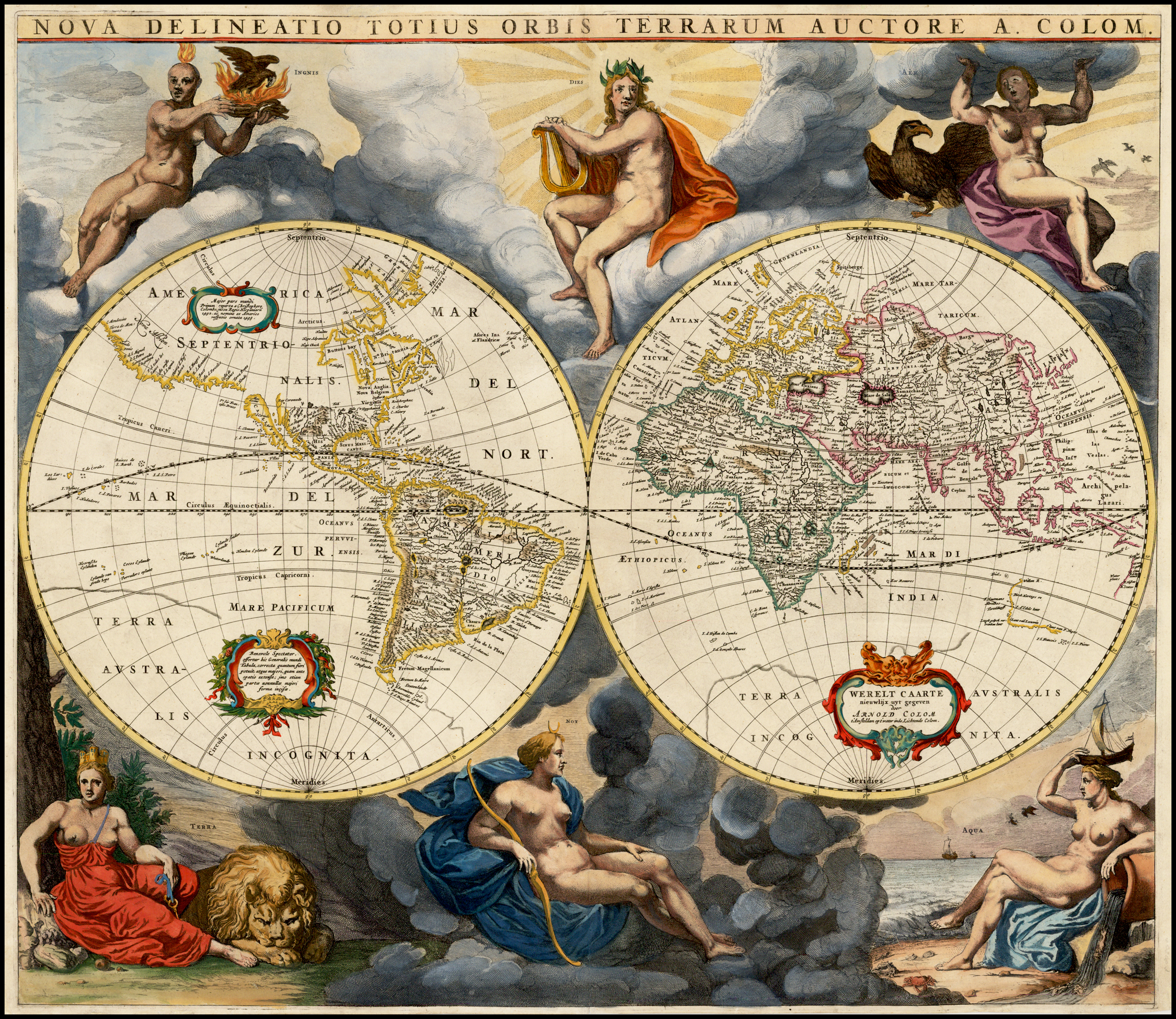
| World | 1 | 1 | 1 | [1] | [1] | ||
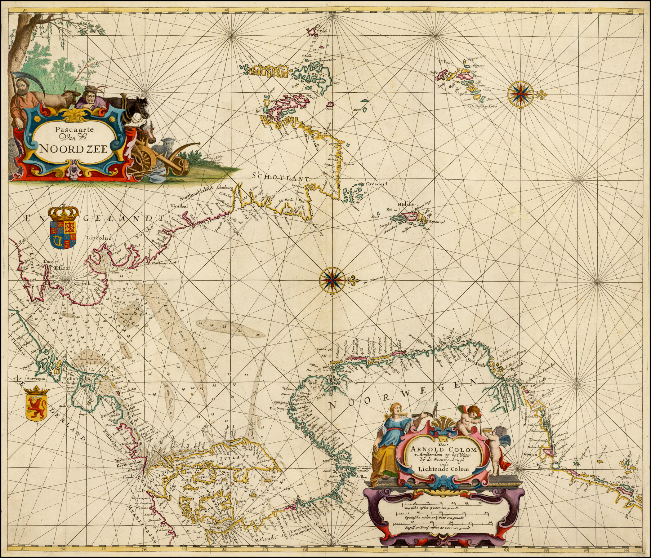
| Noord Zee | 2 | 1 | 1 | 1 | 1 | ||
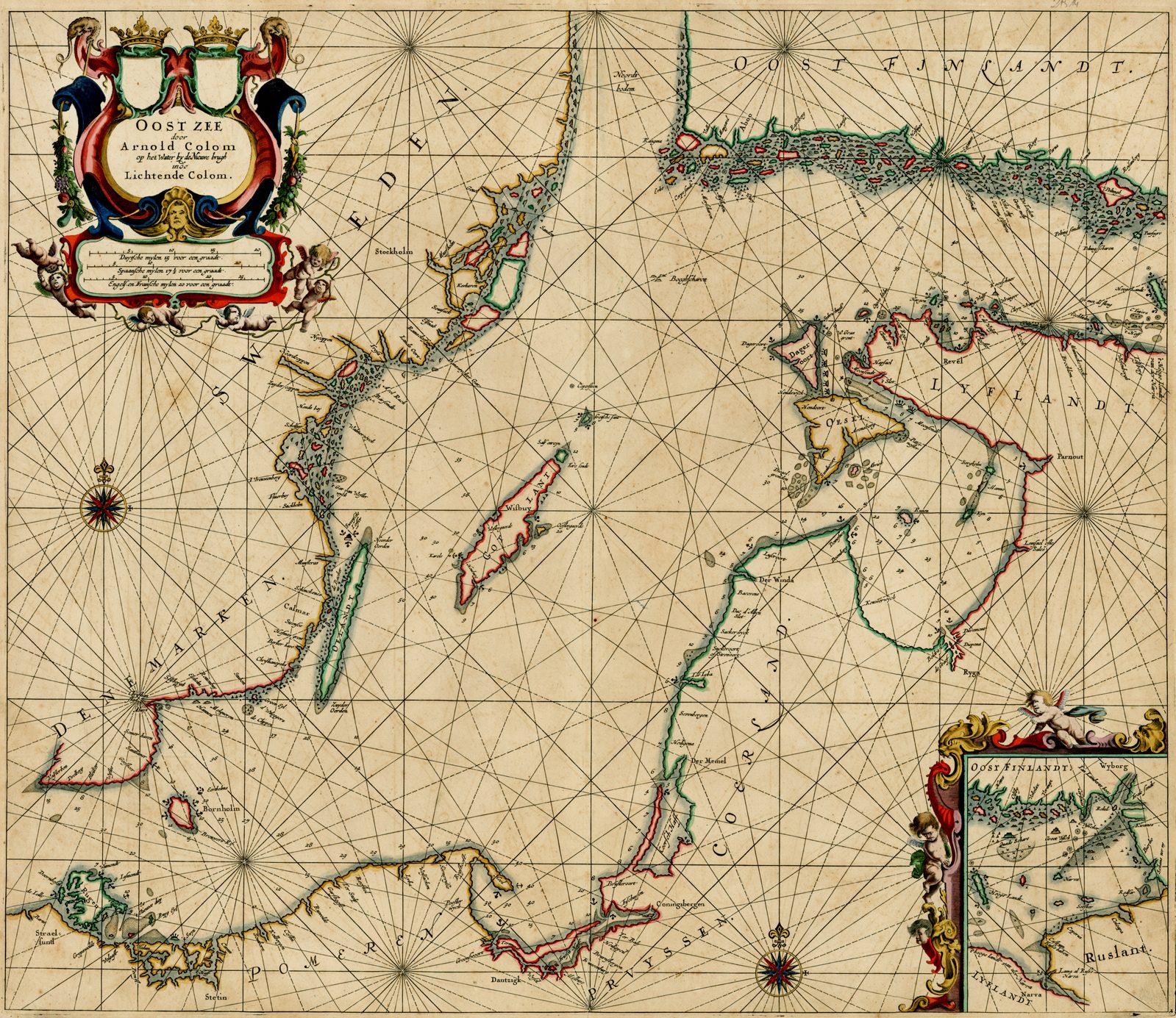
| Oost Zee | 3 | 2 | 2 | 2 | 2 | ||
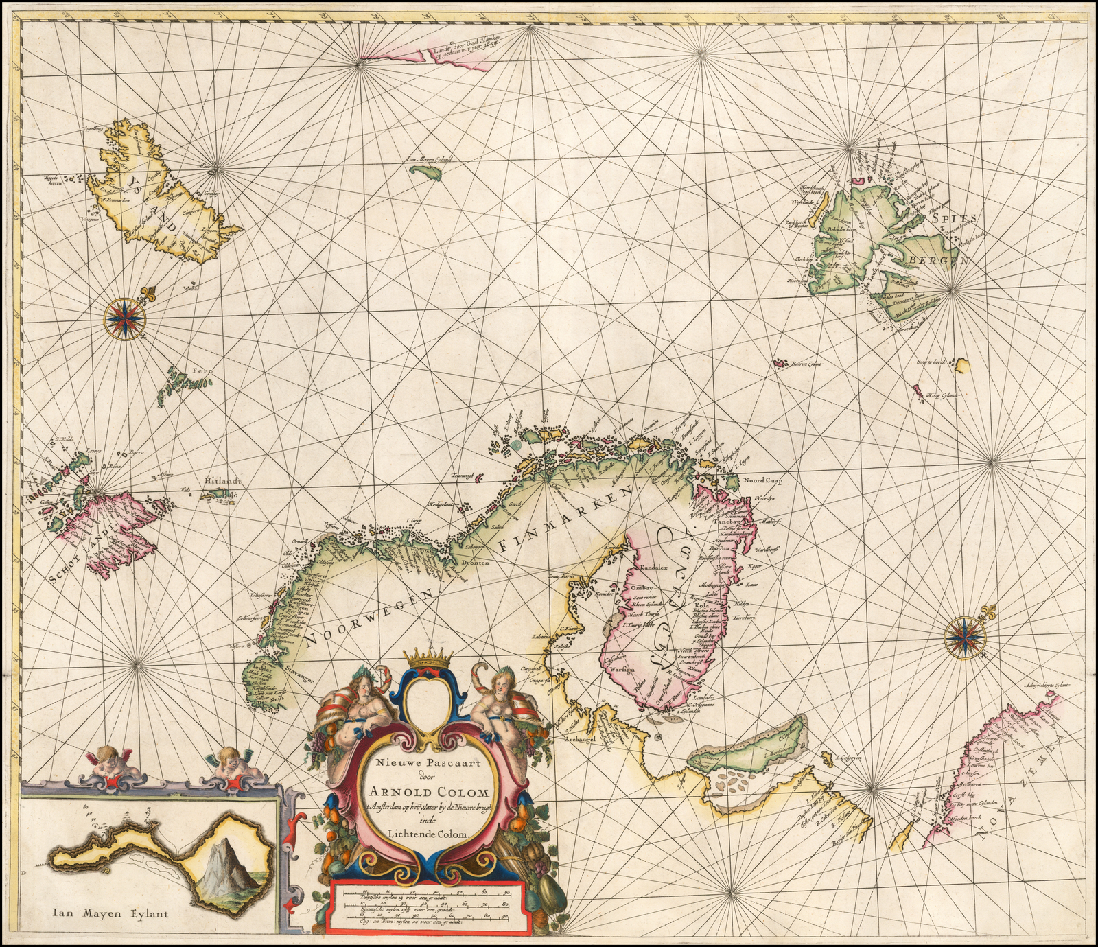
| Scandinavia | 4 | 4 | 4 | 4 | 4 | ||
| Canaal | 5 | 5 | 5 | 5 | 5 | ||
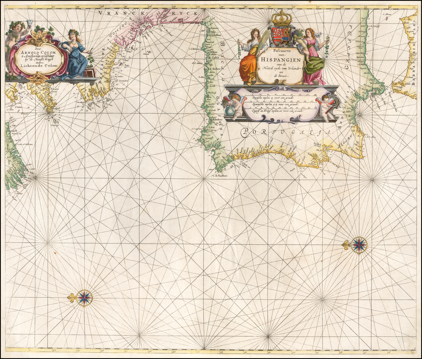
| Hispangien | 6 | [6] | [6] | [6] | [6] | ||
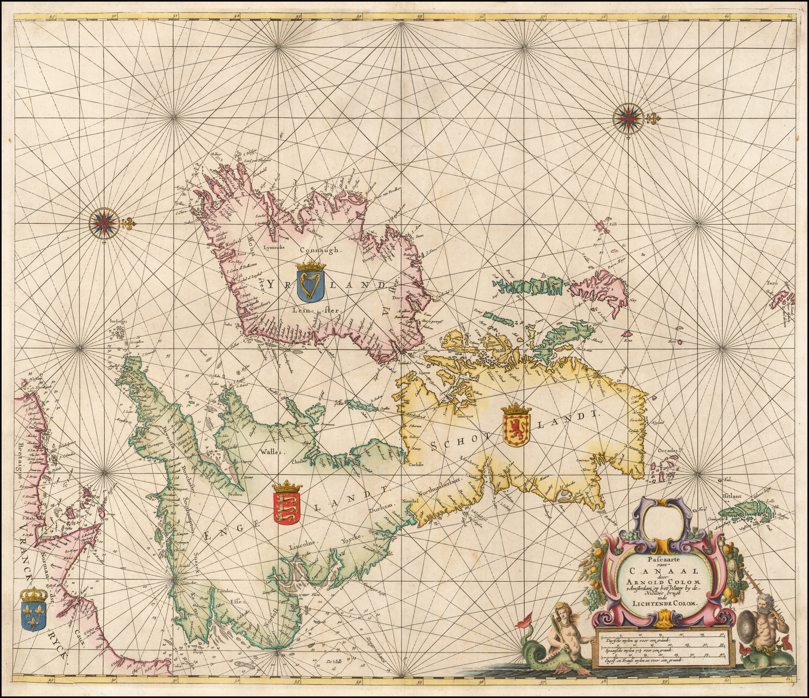
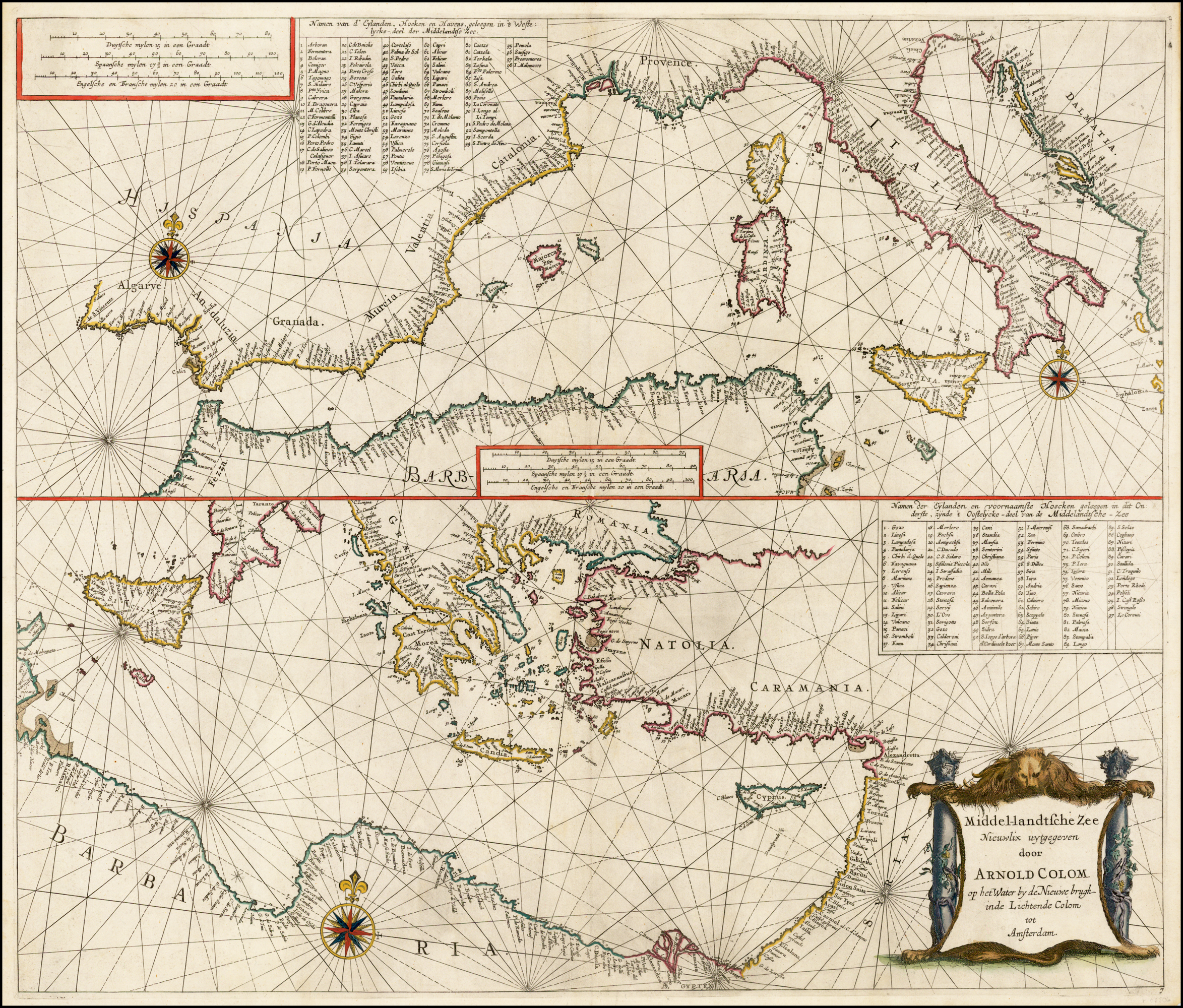
| Middel-landtsche | 7 | 7 | 7 | 7 | 7 | ||
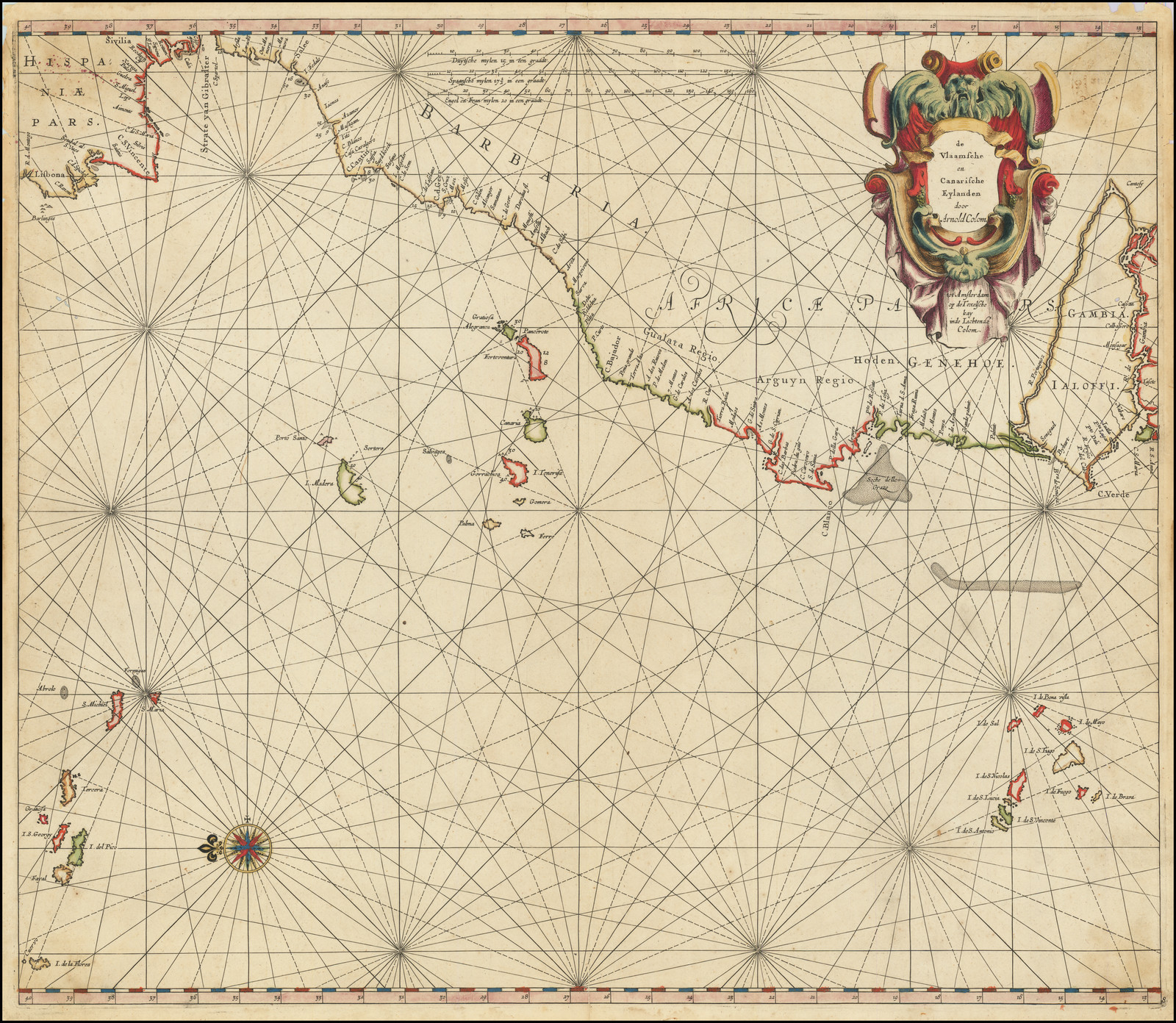
| Vlaamsche | 8 | 8 | 8 | 8 | 8 | ||
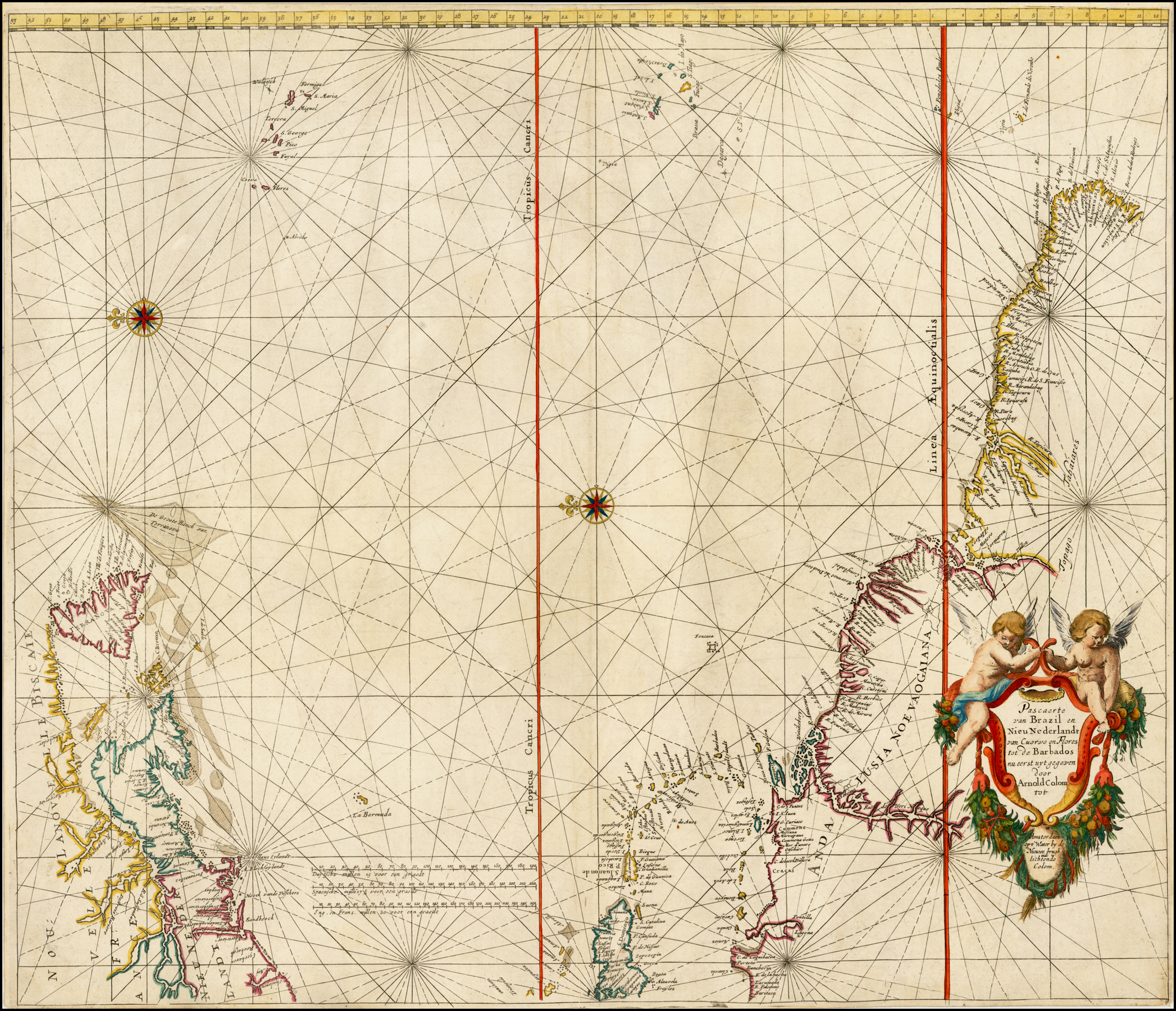
| Brazil | 9 | 12 | 12 | [12] | [12] | ||
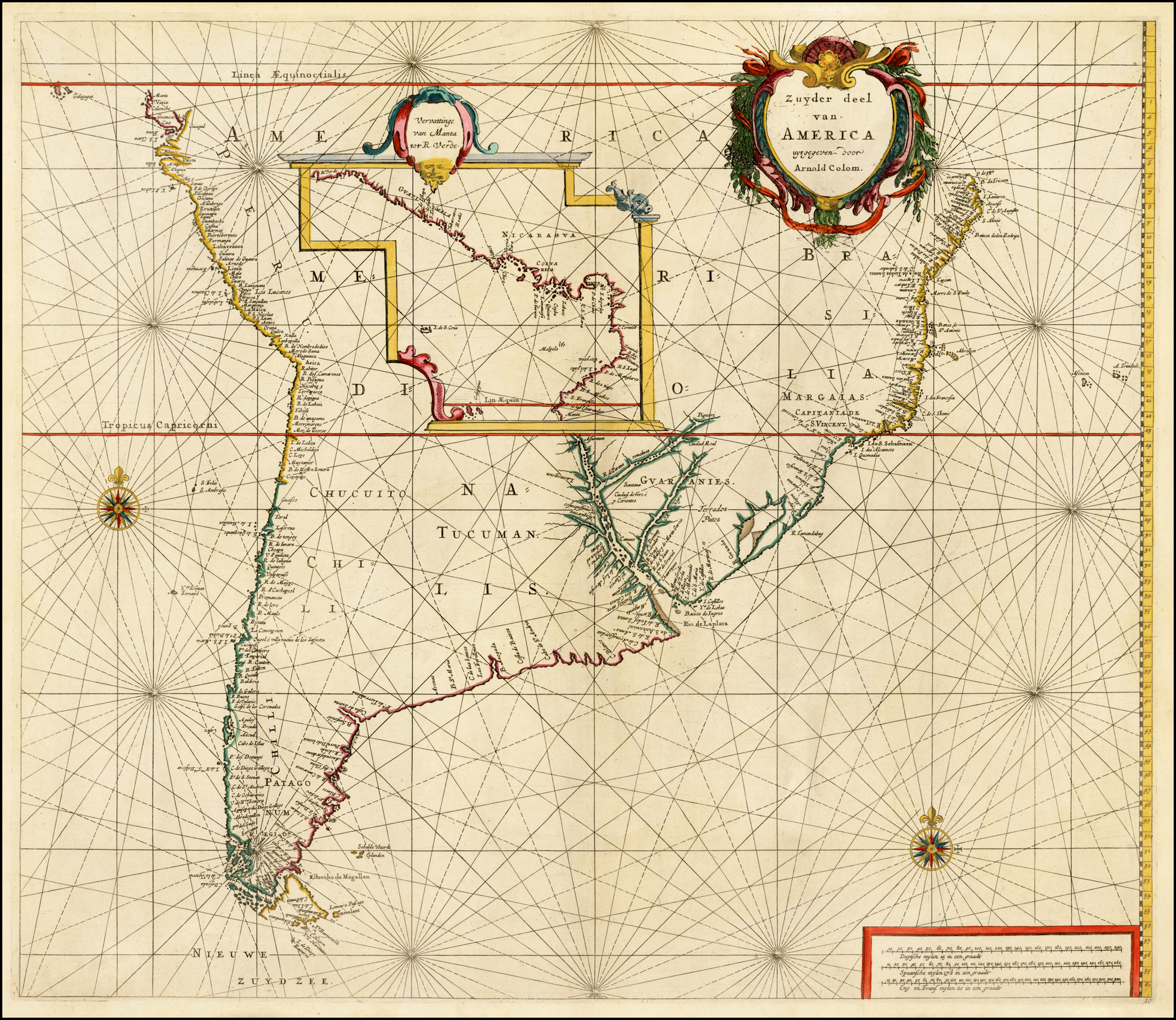
| Zuyder Deel | 10 | 13 | 13 | 13 | 13 | ||
| West Indies | 11 | 14 | 14 | 14 | 14 | ||
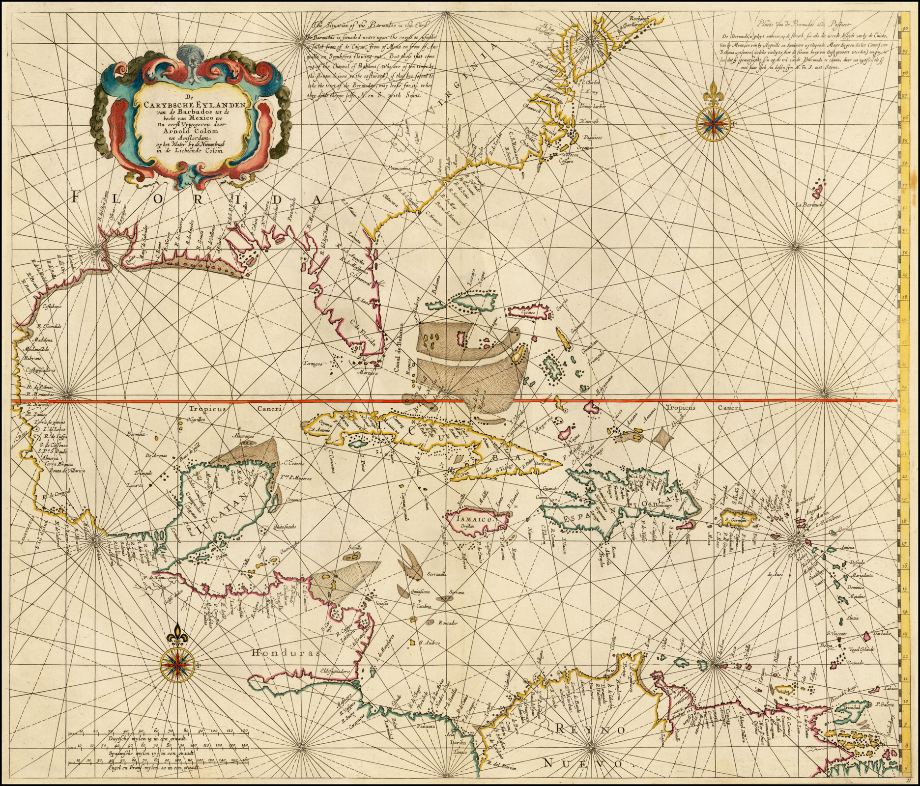
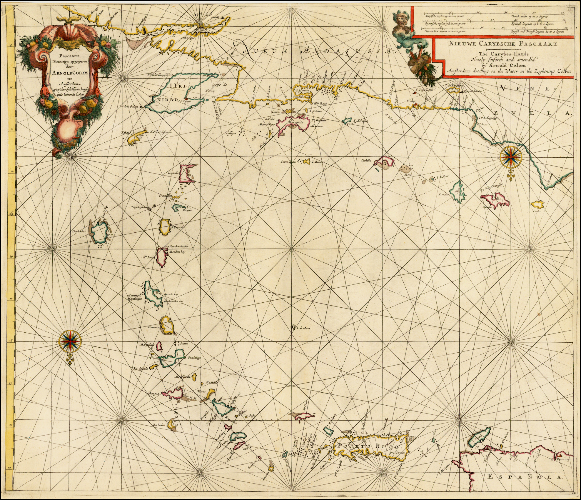
| Carybsche Pascaart | 12 | 15 | 15 | 12 | [15] | ||
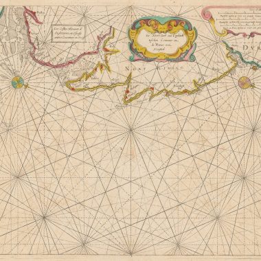
| Nieu Nederlandt | 13 | 16 | lost | 16 | 16 | ||
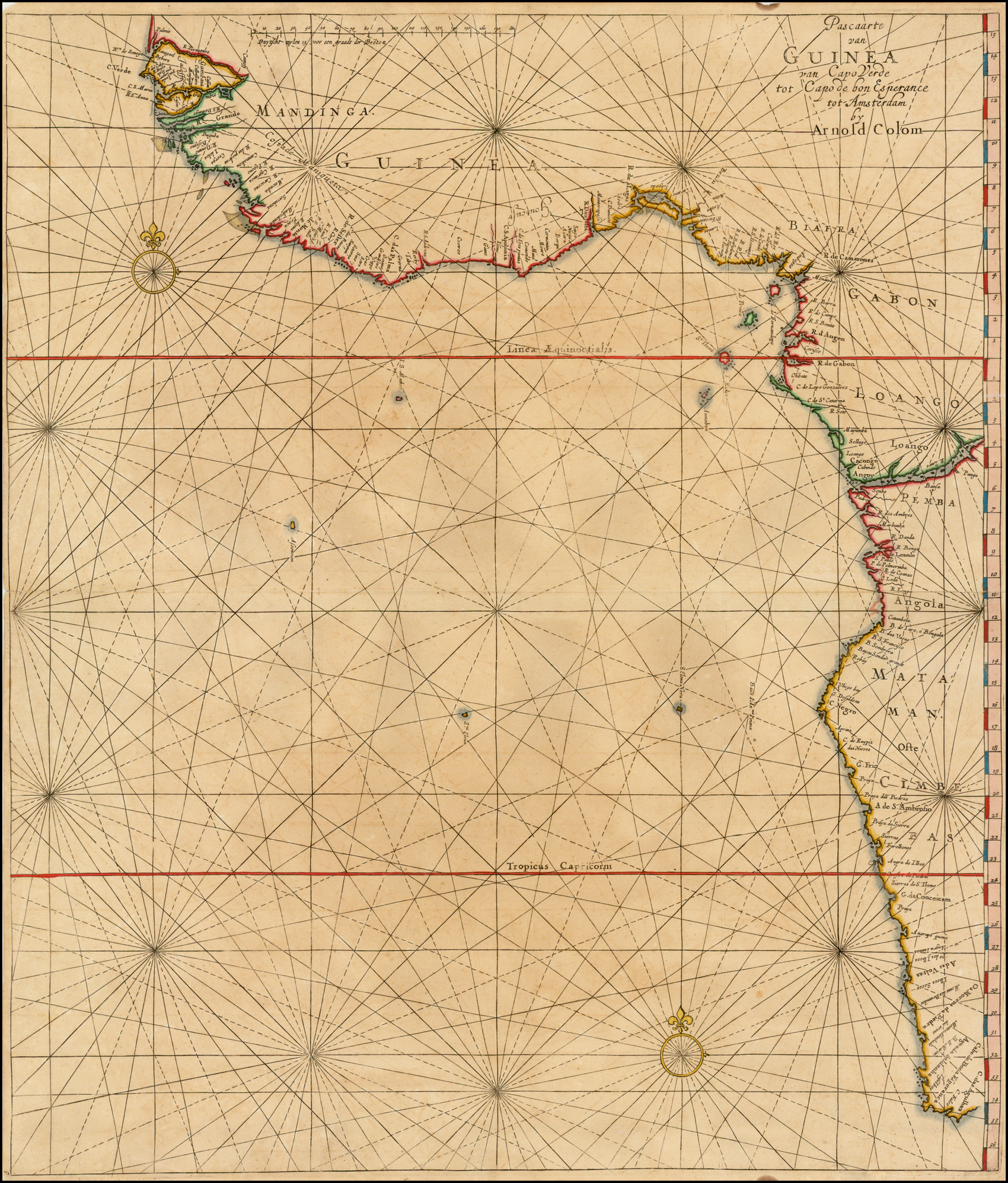
| Guinea | 14 | 9 | 9 | 9 | 9 | ||
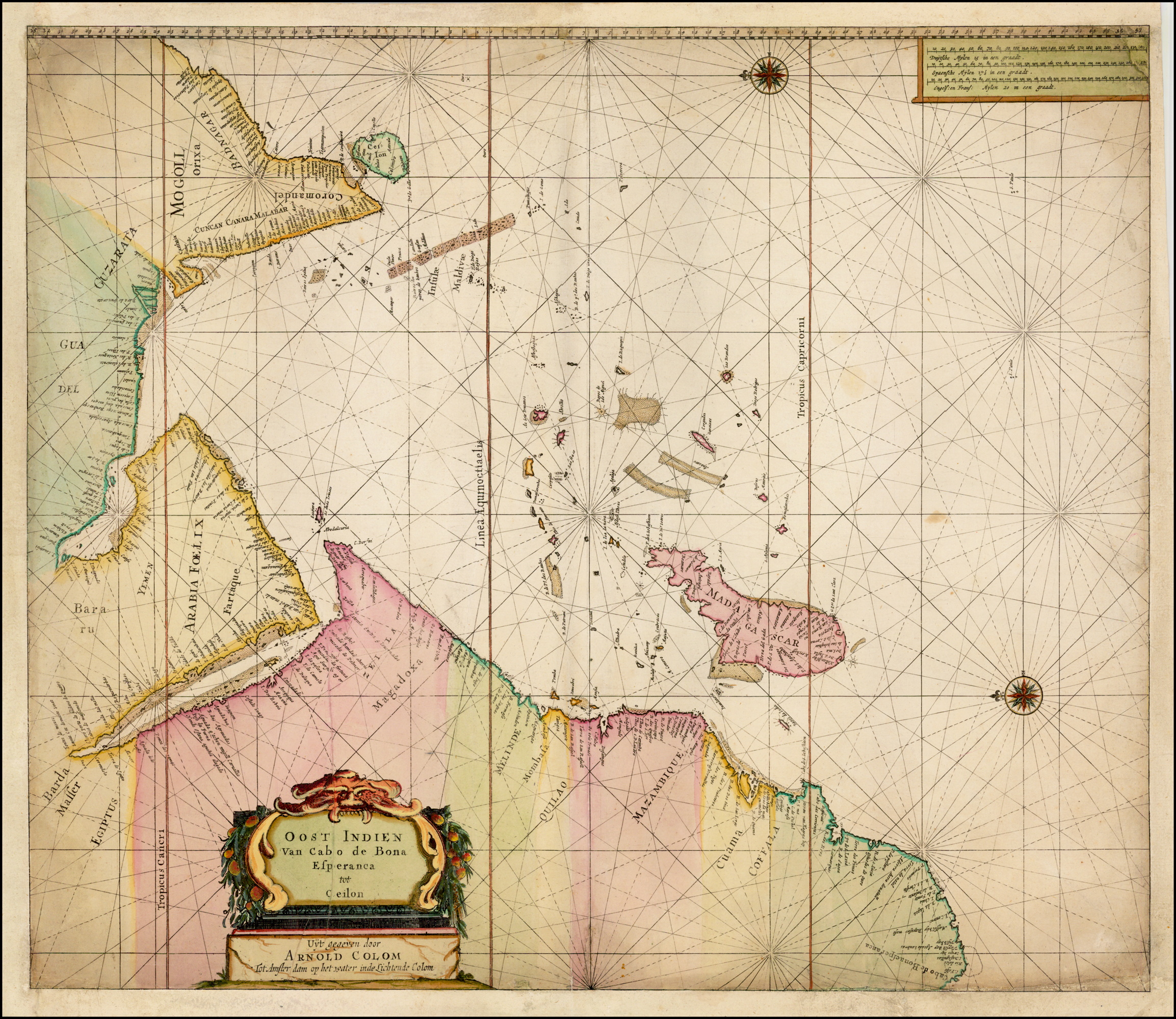
| Cape tot Ceilon | 15 | 10 | 10 | 10 | 10 | ||
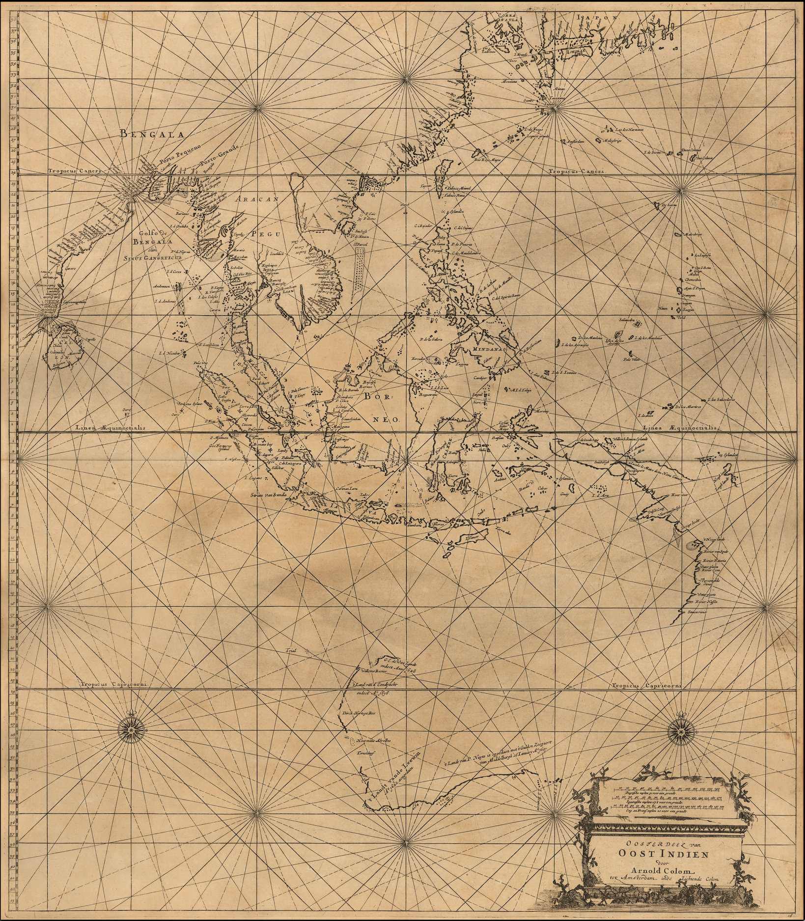
| Oost Indien | 16 | 11 | 11 | 11 | 11 | ||
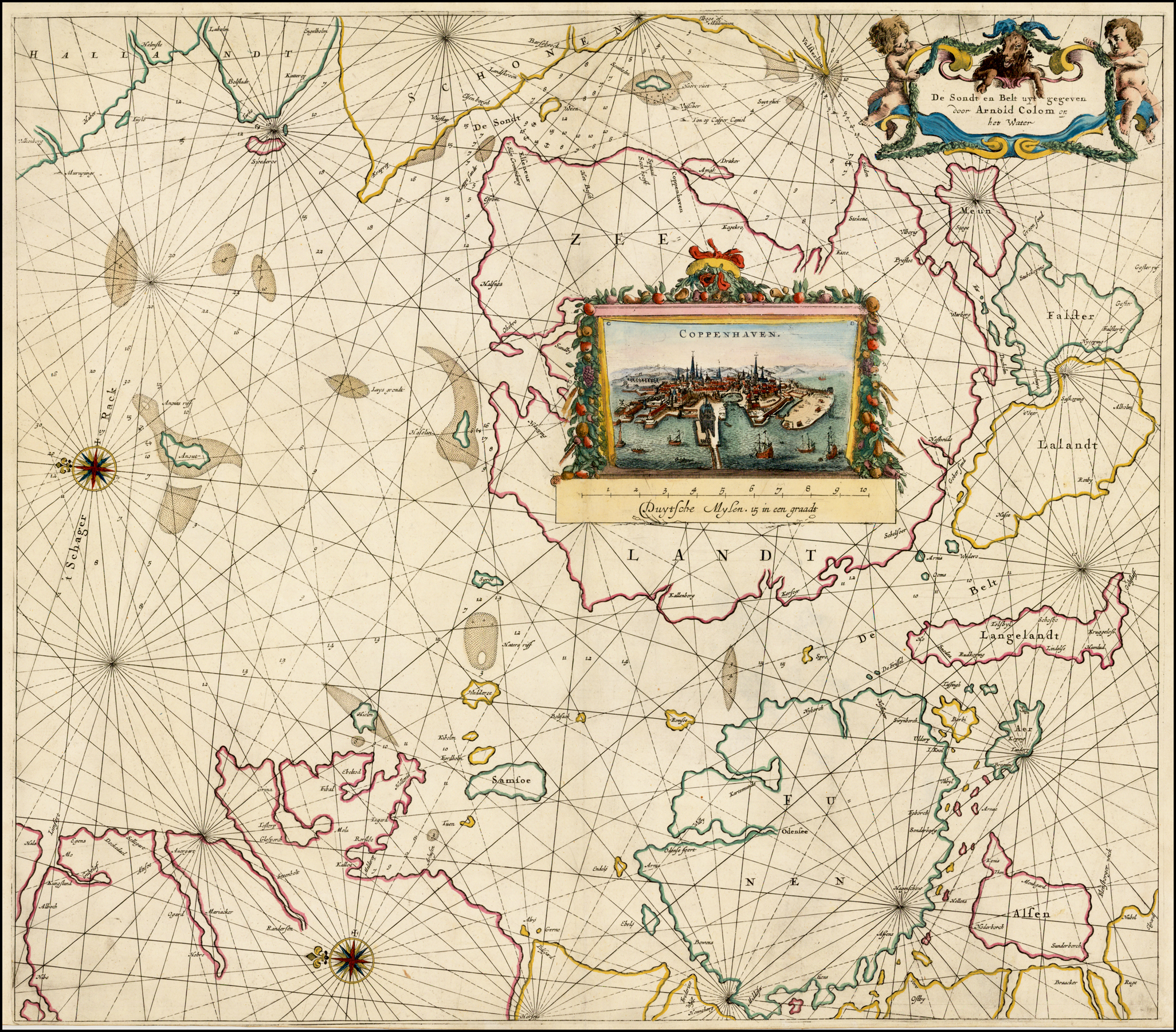
| Sondt En Belt | 17 | 3 | 3 | 3 | 3 | ||
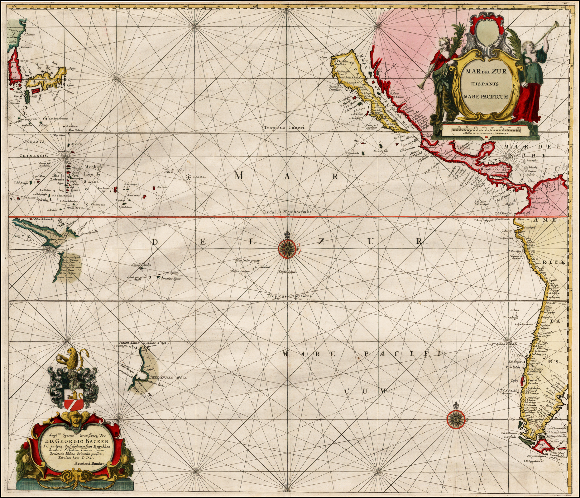
| Pacific | n/p | n/p | n/p | [17] | [17] | ||
| Index | 16 Maps |
COLOM’S SEA ATLAS