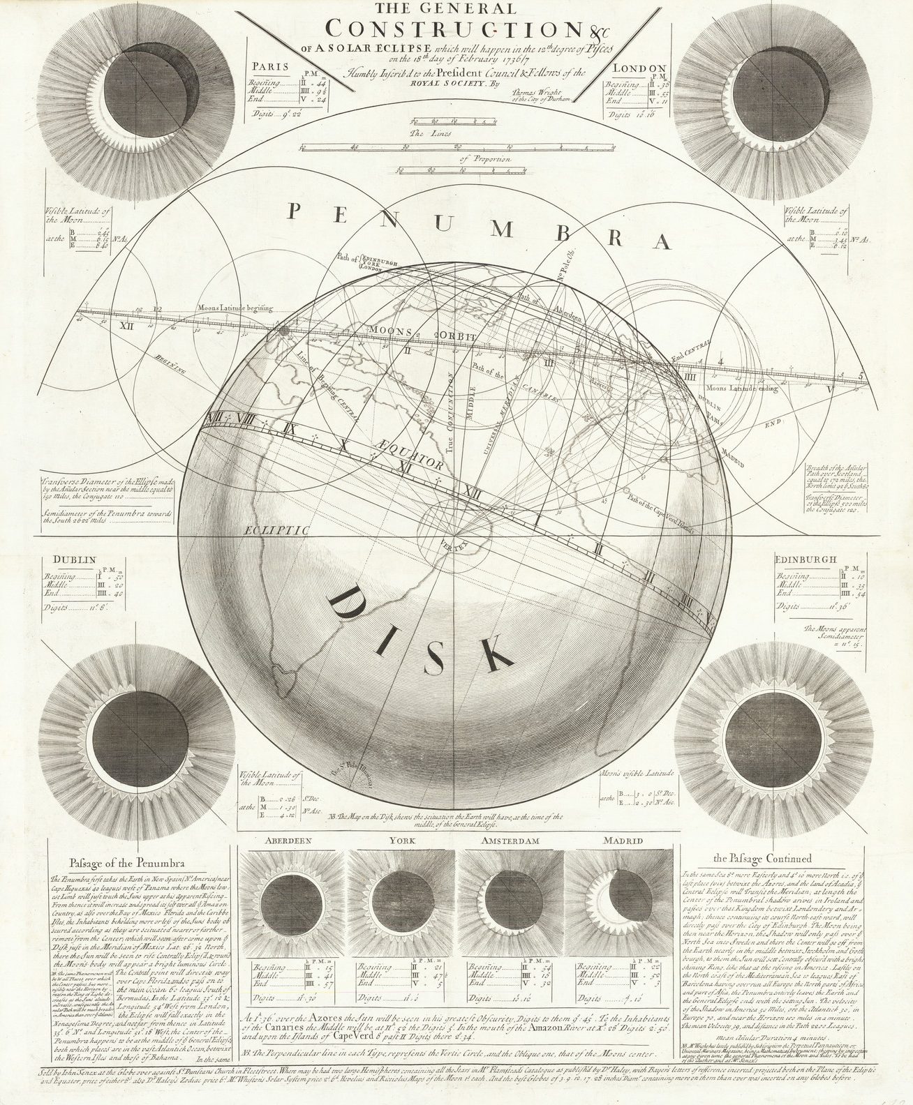
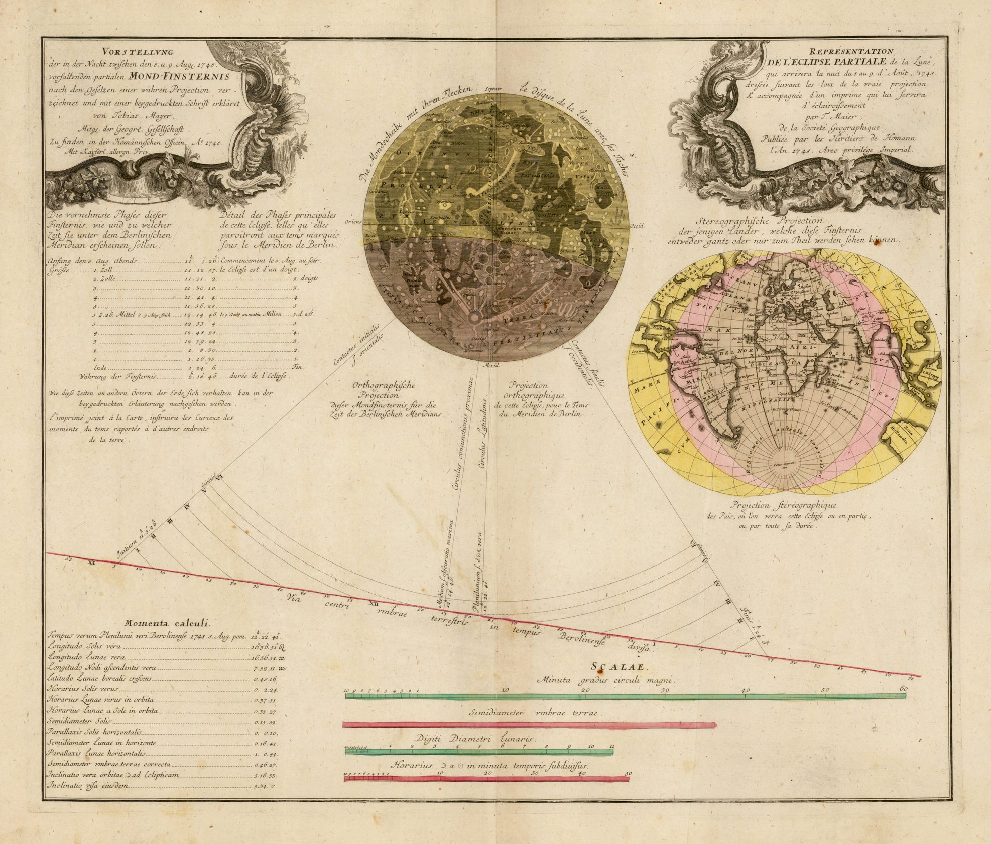
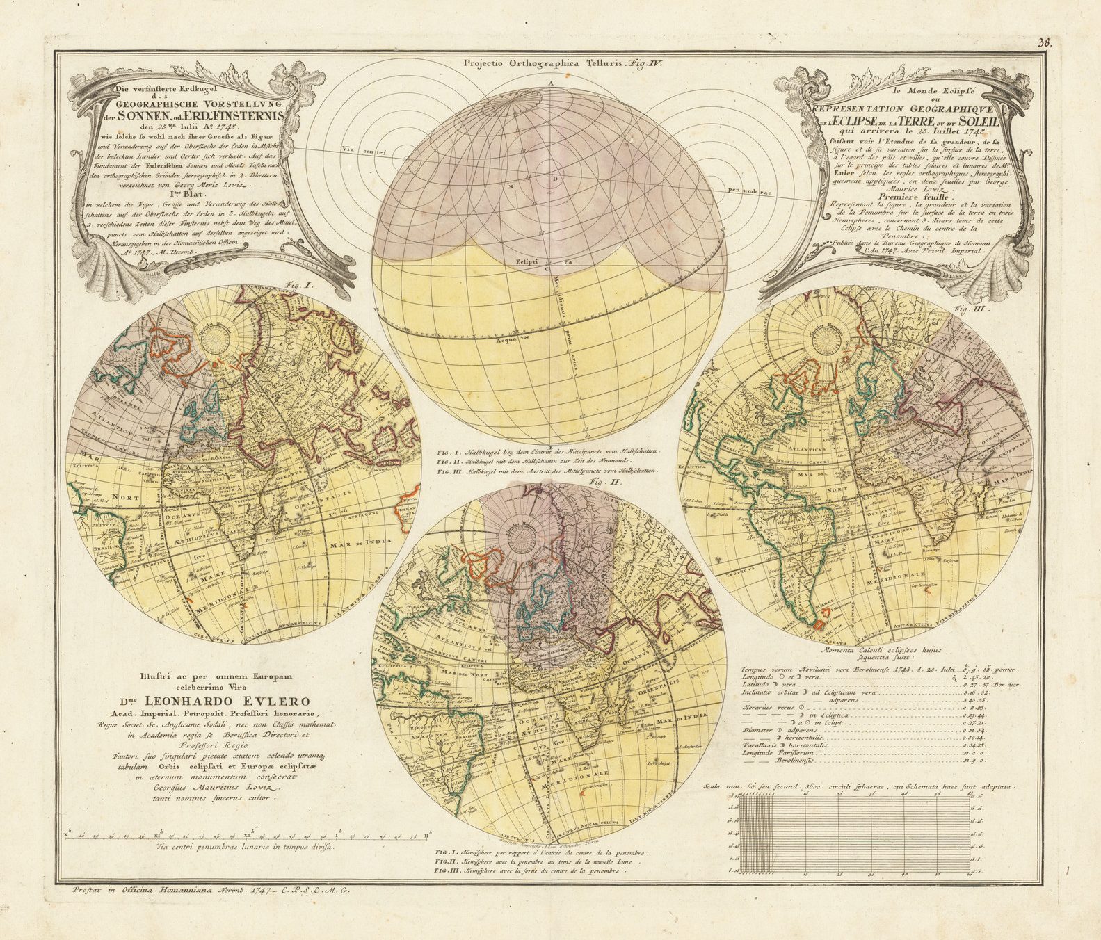
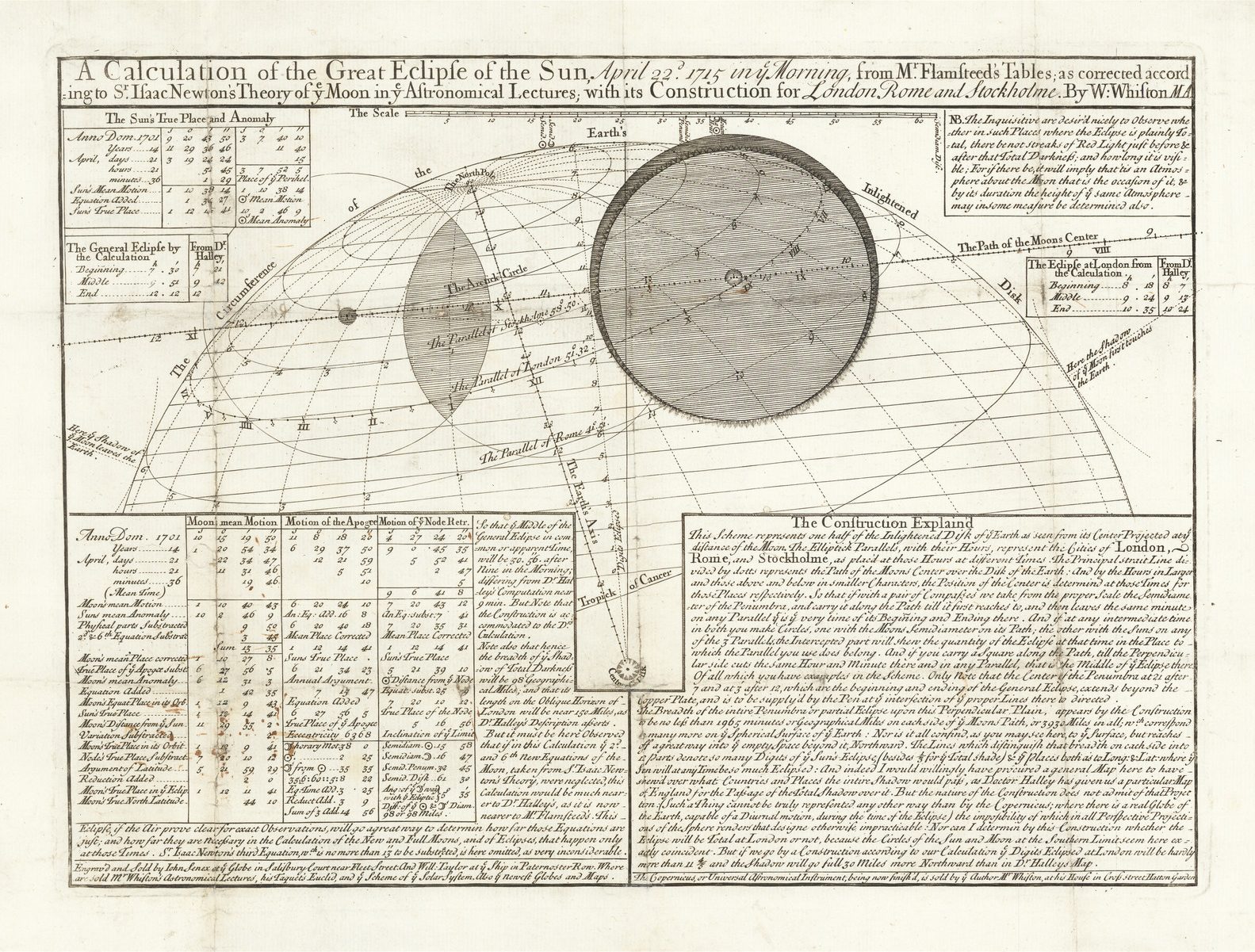
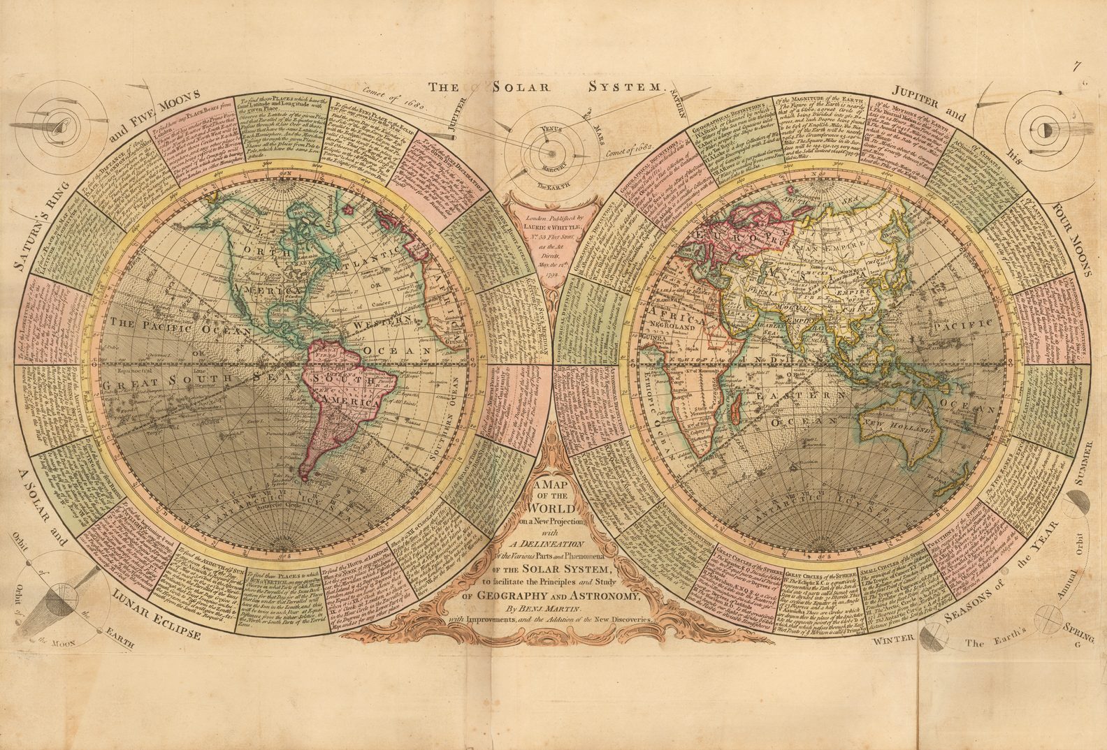
Although nowadays we regard eclipses of the sun as natural albeit spectacular astronomical events, even as late as the eighteenth century they were thought to be the work of the devil. Eclipses have been predicted and diagrams drawn of them from at least the time of Aristotle and Claudius Ptolemy, but true eclipse maps, in the sense of geographical maps showing the paths of eclipses are a phenomenon of the eighteenth century onwards. Diagrams of solar eclipses occur in the Renaissance versions of Ptolemy’s astronomical work the Almagest and, for example, Peter Apian’s Cosmographicus first published in 1524. Accurate predictions, however, did not emerge until Edmond Halley (1656-1742) revolutionised astronomy and introduced the eclipse map and many other scientific thematic maps which influenced map-makers for the rest of the century and beyond.