The cost of producing a copperplate map, or even an atlas, represented a considerable investment for any publisher (a later article will discuss some of the evidence for the time and cost involved). In order to maximise the potential income for their expenditure, individual publishers – from leading names like Abraham Ortelius and Johannes Blaeu downwards – did everything in their power to extend the printing life of a particular plate, often long beyond the point where the geographical information contained had been up-dated.
In order to illustrate some of the techniques involved, physical evidence from the maps themselves, and to give an insight into publishers’ practices, the printing history of two rival maps, depicting the English county of Cornwall, serves as a useful case-in-point.
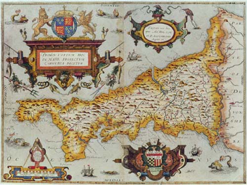
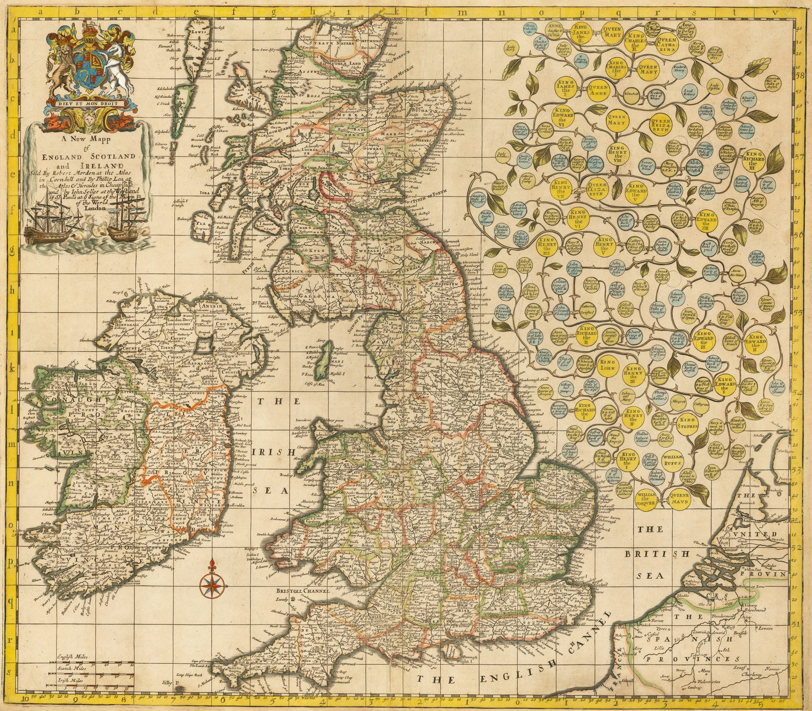
The first was published by Christopher Saxton in 1579, as part of his untitled county atlas of England and Wales, the first printed county atlas of England and Wales. The plates for Saxton’s atlas remained in circulation, and use, until about 1775, passing through the hands of a variety of publishers, before ending up in the possession of Cluer Dicey. A printing life of almost two hundred years represents remarkable – but not unparalleled – longevity.
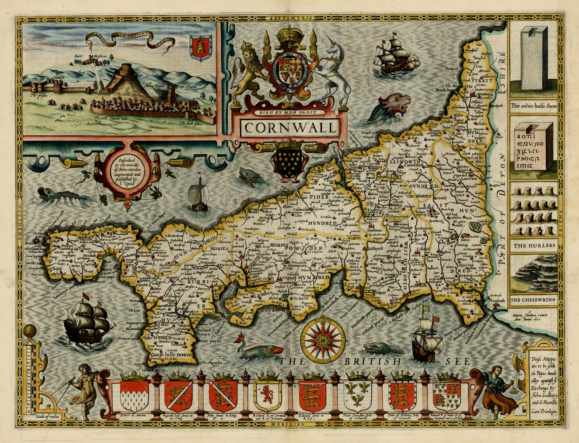
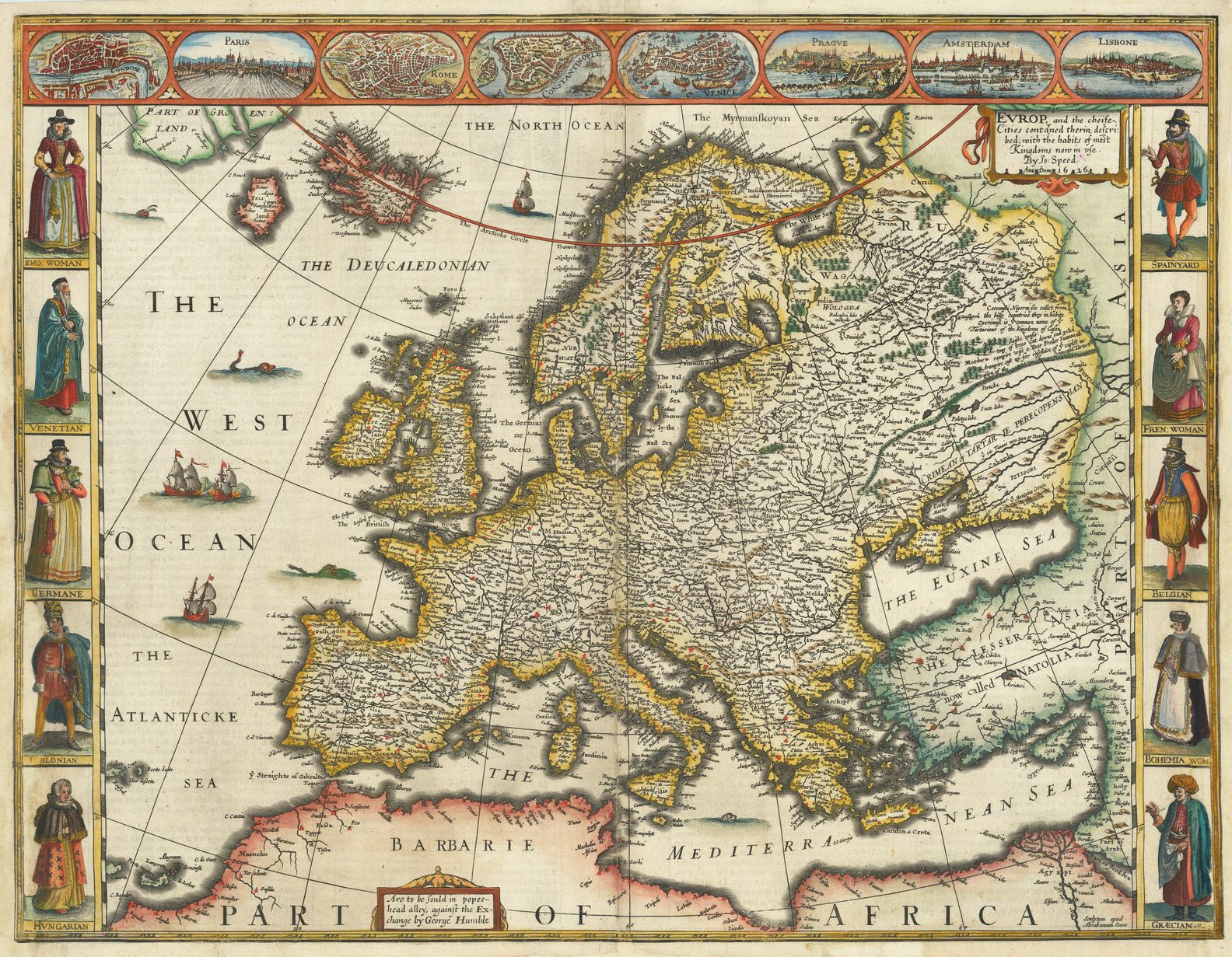
The second was prepared by John Speed, and first published in Speed’s The Theatre of the Empire of Great Britaine, in 1612, which was the first printed atlas of the British Isles. With the publication of Speed’s atlas, Saxton’s atlas was supplanted as the standard delineation of the counties. Indeed, Speed’s atlas was to be the most popular of all county atlases until the 1750’s, with miniature editions being produced to satisfy a demand from those unwilling or unable to purchase the full-size volume.
One feature of Speed’s maps, as appearing in formal editions of the atlas, was two-pages of letterpress text printed on the reverse. One page contains a potted history of the county, supplemented with a general introduction to the county, its air, soil, commerce and so on. The second page is an alphabetical gazetteer of the principal cities, towns and villages of the county, giving the division of the county the place was to be found. This was an important improvement on Saxton, whose maps were issued without any accompanying text.
Here also, Speed’s plates had a long life-span. They, too, came into the possession of Cluer Dicey, who reprinted them in the 1750s and 1760s. Dicey was a printer and publisher of chap-books, cheap printed items which were circulated through a network of chapmen – hawkers and pedlars who would travel around England, attending markets, fairs and so on, offering the books, ballads, portraits and topographical prints. The two series of county maps, which were principally sold as separate sheets, seem to have filled an important, and profitable, gap in the range of items Dicey offered, which may explain why he bought the Saxton plates, while also owning the parallel series of plates from Speed’s atlas.
Evidently, the owner of the Saxton plates agreed, as the plates seem to have disappeared for a period from about 1595, or thereabouts, to the first years of the 1640s, when they emerge in the possession of the London printseller, William Webb, who published an edition of the maps in 1645. Webb made no real attempt to update the plates, beyond changing existing dates to 1642 and, in the majority of the maps, altering the Royal Arms, or accompanying initials to ‘C[arolus].’ ‘R[ex].’ Here Webb’s principal intention was to tap into the market for maps of the parts of England arising from the English Civil War, and presumably felt that would-be purchasers would accept the maps without him having to materially revise or update them.
In a similar fashion, the owner of the Speed plates, now William Humble, son of one of the original publishers, re-issued the Speed atlas, in 1646. At other times, he issued bound collections of the maps, but without text. The example illustrated, extracted with from one such collection, is accompanied by a manuscript gazetteer, apparently laboriously copied from a printed example.
Sales of both sets of maps seem not to have been very successful, judging by the very few sets to have survived. One important feature entirely lacking from both series, that could have made an important difference, was information on the contemporary road systems.
By about 1665, and possibly only shortly before that year, the plates for Saxton’s maps came into the hands of an anonymous publisher. Unfortunately, there is no evidence for whom this might have been, while there are equally few potential candidates among the mapsellers of the period. While there is an outside possibility that Peter Stent is a candidate, I personally favour the possibility that it was a bookseller who had come into possession of the plates, but this can be no more than utterly speculative.
This publisher was prepared to undertake a new edition of the atlas, but felt that the plates, as acquired, required improvement and updating. So, and inevitably, the publisher looked to Speed’s maps as a source and, insofar as possible, remodelled the Saxton plates in the image of the Speeds. For the map of Cornwall, obvious additions are the inset view of Launceston, the arms of previous Dukes of Cornwall, and the vignettes of the various antiquities and monuments.
However, it seems clear that the plates were never completed, and no edition of the atlas in this form is known. However, there is enough evidence, described by Harold Whitaker (1), and then taken on by Skelton (2), to make virtually certain that the plates were revised at this date. One can reasonably assume that the project was curtailed either by the Black Death, which ravaged London in 1665, or the Great Fire of London (or a combination of the two).
By coincidence, the owners of the Speed plates, Roger Rea the Elder and Younger, were planning an edition of the Theatre at the same time. The partners, father and son, were content merely to insert their imprint on the plates. The printing was completed in 1665, but then the majority of the print run was destroyed in the Fire of London. At about the same time, one of the two partners also disappears, and these two events seem to have prevented any further editions.
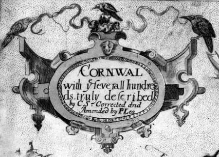
Saxton’s plates were acquired by Philip Lea, circa 1685, or perhaps later. Lea was newly established in business, so the acquisition of the constituent plates for a county atlas must have been of great appeal. Lea’s first edition is believed to have been published in 1689. His principal contribution to this edition was to complete the changes begun by the anonymous editor, although not all the changes are found uniformly across the set, further evidence of two publishers rather than one re-editing the maps. Lea also inserted his name, crosses to denote market towns, crowns to denote parliamentary boroughs and mires for bishoprics. The extent to which the additional place names are the work of the anonymous editor or Lea must remain uncertain, but the balance of probability is that the majority of these changes date from 1665.
In this form, the individual maps, and the Cornwall is no exception, look crudely executed. Almost immediately Lea began to rework the plates, adding additional information, but a more important revision was to re-engrave many of the existing map-titles, not only to improve the appearance of individual maps, but also to achieve more uniformity within the series.
At this juncture, between about 1689 and 1694, when the revised edition was completed, Lea also made a more important addition, inserting roads, copied from John Ogilby’s Britannia, first published in 1675. Lea’s maps were the first set of folio county maps to include this information (the first series to do so was a pack of miniature playing cards), and this represents an important improvement.
At about the same time, Christopher Browne, the new owner of the Speed plates, seems to have planned to re-issue the plates. However, possibly in face of the success of Lea’s second edition (which, with the exception of the original Saxton edition, is the most frequently encountered), Browne did little more than add his imprint to six of the plates, including the Cornwall, before abandoning the project. Two, or perhaps, three examples of Browne’s “edition” only are known.
Following Philip Lea’s edition of circa 1694, no subsequent owner of the Saxton plates made any material attempt to revitalise the geography, merely contenting themselves with alterations to the imprint. The principal explanations are that the plates came into the hands of publishers content to leave the plates unchanged, and the lack of any new source which could be easily used for revisions. Another possibility is that Saxton’s maps, with the roads, had re-captured the initiative from the Speed plates.
In response, 1720, Henry Overton (I), while adding his imprint to the Speed plates, took the opportunity to insert roads, again copied from Ogilby, to bring the two sets back on par, and this was to prove the last important revision of Speed’s plates.
While the two series continued to be sold for the next forty or fifty years, the emergence of pocket-sized or quarto-atlases, from 1720 onwards, and then from 1749 onwards, sheets from The Large English Atlas represented new competition, more in tune with the needs of the time. Jefferys’s catalogue of circa 1765 refers to ‘Saxton’s Counties, being the Oldest Maps of England extant, from which the Quarter-Master’s Map was compiled by order of Oliver Crowell. price 1l. 1s. in boards’ (quoted by Donald Holdson, p. 148).Then, completion of The Large English Atlas reduced the role of both sets to antiquarian curiosities only.
In the course of re-modelling and updating the two series, the publishers concerned also faced numbers of problems, part and parcel of working with copper.
The principal problem was that copper is a soft metal, ideal for the engraver, when he was working up the image, but a problem for the printer because, with the stresses on the plate during the printing process, the plate could quickly become worn, so that the engraved lines which would hold the ink became shallower and shallower, and the printed image would become successively paler.
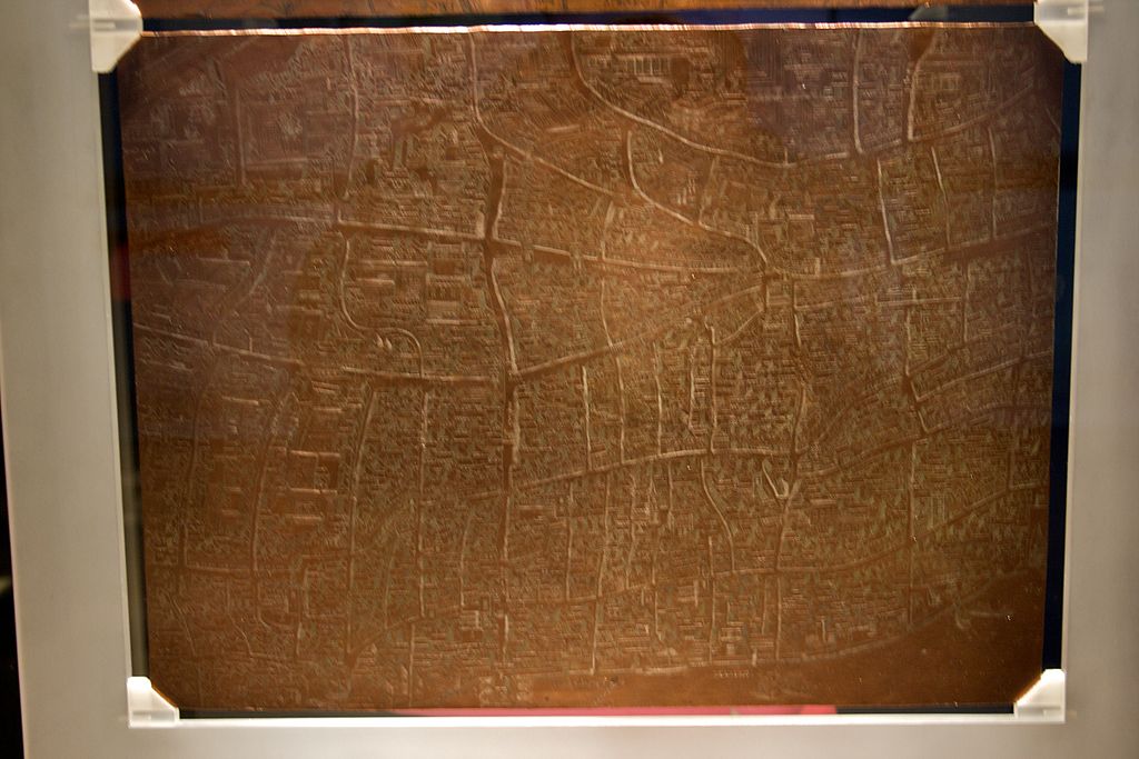
While no-one really knows how many impressions, or individual prints, could be taken from a copperplate before it deteriorated, estimates seem to range from about 1,000 to 3,000 prints. At this point the publisher could have the plate re-worked, with an engraver going back over the plates, to recut the lines, making them deeper again.
Frequently, this work would be confined to geographical detail, so these lines might appear strong, while the lines of the decorative elements, title cartouche, vignettes, and so on would appear much paler by comparison.
Similarly, when inserting new geographical detail, the new lettering and symbols often stand out from the neighbouring detail by the strength of the impression, differences in the style of the lettering and, often, by the fact that the new lettering had to be cramped to fit the available space.
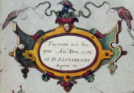
Another problem associated with the softness of metal was that the plates were easily scratched, particularly while being moved between the press and store cupboard, or while in storage. For example, in the original Saxton plates, between 1576 and 1590, a series of light parallel scratches appear behind the cartouche containing the reference to Queen Elizabeth, but then they disappear again.
In more extreme cases, the copperplate itself would crack. While it was often possible to disguise such a crack, particularly if only a short print run was involved, in many cases, as a last resort, the publisher was compelled to replace the plate. Saxton’s map of Cornwall exhibits a crack in the plate throughout its printing life. Unusually, while the crack seems to have thickened out, it did not materially increase in length, which is most unusual.
In the course of printing, cracks act like any engraved line. They take in the ink, which remains trapped until the paper and plate are forced together. In most cases, cracks start from the edge of the printing plate, into the border, and are readily identifiable by their jagged and irregular shape, and frequently follow lines of weakness in the plate, such as engraved lines of latitude and longitude, or some such. More rarely they can be found within the plate area, apparently originating from careless reworking, where the engraver has actually worked right through the plate.
NOTES
(1) Harold Whitaker The Later Editions of Saxton’s Maps, in Imago Mundi III (Reprint Edition: Amsterdam: Nico Israel, 1967), p.72-86, especially p.74-77).
(2) R.A. Skelton County Atlases Of The British Isles 1579-1850 A Bibliography 1579-1703 (Reprint edition, London: Dawsons, 1978), no.80.
CHRISTOPHER SAXTON’S CORNWALL
| 1. | PROMONTORIVM HOC / IN MARE PROIECTVM / CORNVBIA DICITVR. [2b] LEN / AERT TER / WOORT: / ANTVER= / PIANVS / SCVLP SIT. [2d] Factum est / hoc opus An[n].o D[omi]ni 1576 / et D: ELYZABETHE / 18. [4b] Proof: pre-atlas proofWith: [Arms of Queen Elizabeth with the initials ‘E’ ‘R’, and additional motto ‘DIEV ET MON DROYT] [2a] [Arms of Thomas Seckford, with the motto ‘PESTIS PATRIAE PIGRICIES’] [4e] | State 1: proof form. The four compass points look as though they have been hurriedly added. A name has been erased north-east of Truro. The hundreds are not yet shown. The only example seen is in the so-called Bughley-Saxton collection of proofs. |
| 2. | PROMONTORIVM HOC / IN MARE PROIECTVM / CORNVBIA DICITVR. [2b] Christophorus . Saxton . descripsit. [2e] LEN / AERT TER / WOORT: / ANTVER= / PIANVS / SCVLP SIT. [2d] Factum est / hoc opus An[n].o D[omi]ni 1576 / et D: ELYZABETHE / 18. [4b]Proof: pre-atlas proofWith: [Arms of Queen Elizabeth with the initials ‘E’ ‘R’, and additional motto ‘DIEV ET MON DROYT] [2a] [Arms of Thomas Seckford, with the motto ‘PESTIS PATRIAE PIGRICIES’] [4e] | State 2: a second proof form ? Saxton’s name has been added to the scale bar, which has been re-engraved to accommodate this addition. The divisions in the scale bar have now been increased to 12. Within the map, ‘Cohor flu=’ (Kerier Hundred) [2d] and ‘Sct Knyg.h.tons’ (West Hundred) [4d] are named.Tree symbols have been inserted, primarily in East Hundred: two south of TREGNY [3d], one north of Pentuar, in a park [3d], two north of Sct Blaies [4d], six south of Helegen [4c] five at Blisland [4c], one at Bickton, in a park [4d], two at Newton, in a park [4d] three west and two south-east of Pillton [4d], ten along the west bank of the Tamar, between Bradston and Caulstoke, from the north, three pairs, one single then a group of three, and one at Warely, Devon, in a park [4d] |
| 3. | PROMONTORIVM HOC / IN MARE PROIECTVM / CORNVBIA DICITVR. [2b] Christophorus . Saxton . descripsit. [2e] LEN / AERT TER / WOORT: / ANTVER= / PIANVS / SCVLP SIT. [2d] Factum est / hoc opus An[n].o D[omi]ni 1576 / et D: ELYZABETHE / Reginæ 18. [4b]From: [Saxton County Atlas Without Title, London, 1579]With: [Arms of Queen Elizabeth with the initials ‘E’ ‘R’, and additional motto ‘DIEV ET MON DROYT] [2a] [Arms of Thomas Seckford, with the motto ‘PESTIS PATRIAE PIGRICIES’] [4e] | State 3: The word ‘Reginæ’ has been added to the date panel, and the cartouche slightly reworked to accommodate this addition. The hundred boundaries, and names, are now added. In the following, names are transcribed as engraved on the map:There are two new names: Vny lalant (Penwith) [2c] and Sct. Anthony (Kerrier) [2d].A few rivers have been extended: ‘Low flu’, from the ‘L’ of Liskerd to Sct Clare [4c], the unnamed river from Low now extends to Brodok and Pinrok [4d]; the river from Sothan Bay now extends above Sct Clare [4c], and the river from SALTASHE has been extended from Quethiok to Bickton [4c]Bridges have been added in West Hundred at Sct Neot, Brodok, LOW and Tregovik [4d]A number of names have been revised: Gwyndraith baye (previously Gwyndriath baye; Powder) [3c] Atre flu (previously Arte flu; East) [4b], Sct Iue (previously ?; East) [4d], Tamerton follye (previously Tamerton flu; Devon) [4d]. |
| 4. | PROMONTORIVM HOC / IN MARE PROIECTVM / CORNVBIA DICITVR. [2b] Christophorus . Saxton . descripsit. [2e] LEN / AERT TER / WOORT: / ANTVER= / PIANVS / SCVLP SIT. [2d] Factum est / hoc opus An[n].o D[omi]ni 1576 / et D: ELYZABETHE / Reginæ 18. [4b] From: [Saxton County Atlas Without Title, London, 1579]With: [Arms of Queen Elizabeth with the initials ‘E’ ‘R’, and additional motto ‘DIEV ET MON DROYT] [2a] [Arms of Thomas Seckford, with the motto ‘PESTIS PATRIAE PIGRICIES’] [4e] | State 4: The only alteration appears to be the addition of a building symbol on Sct. Michaels mount [2d]There appears to be two distinct phases in the printing of this state. Earlier impressions show numbers of scratches running from the upper border to the frame of the date panel, particularly on the right side [4b] These are visible on state 3. In later impressions these are not so visible, while a number of scratches have appeared running diagonally from the two borders in the lower right corner, below the large sea-monster. These scratches are visible in the Webb state also. |
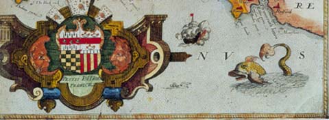
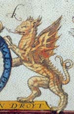
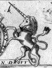
| 5. | PROMONTORIVM HOC / IN MARE PROIECTVM / CORNVBIA DICITVR. [2b] CORNWAL / with y.e severall hundre= / ds, truly described / 1642. [4b] Christophorus . Saxton . descripsit. [2e] LEN / AERT TER / WOORT: / ANTVER= / PIANVS / SCVLP SIT. [2d] [With] [Arms of Charles I with the initials ‘C’ ‘R’] [Arms of Thomas Seckford, with the motto ‘PESTIS PATRIAE PIGRICIES’] [4e]From: Saxton / Webb All The Shires Of England … London, 1645 | State 5: The Arms of Charles I (with a chained unicorn in place of the dragon) have been substituted for those of Queen Elizabeth. The English title has been engraved within the date panel. |
| 6. | CORNWAL / with y.e severall hundre= / ds, truly described / [date ?] [4b] Christophorus . Saxton . descripsit. [2e] LEN / AERT TER / WOORT: / ANTVER= / PIANVS / SCVLP SIT. [2d] From: [Saxton / Anonymous Projected County Atlas, apparently never published, London, ca. 1665]Inset: ‘LAVNCESTON OR ANCIENT DVNHEVET’ [2b] ‘The other Halfstone’ [1b] [Doniert’s Stone] [1b] ‘The Hurlers’ [3b] ‘The Chesewring’ [3b] [Arms of Charles I with the initials ‘C’ ‘R’] [2a] With: ‘THE ARMES / of Persons / Dy[g]nifyed / w.th y.e title of / CORNWALL. / [rule] Note, That euer / since K: Edw: y.e 3.d / The title of / Duke of / CORNWALL, / belongeth to y.e / Kings eldest / Sonne.’, in two rows (upper): ‘Rob: de Morton / Ea: of Cornwall’, ‘Regnald ba: sonne / of Hen: y.e first’, ‘Iohn sonne to K: / Henry y.e 2.d’, ‘Rich: so: to K: Iohn / & K: of Romans’ (lower) ‘Edw: son: to / King Edw: y.e first’, ‘Piers Gaueston Ea: / of Cornwall’, ‘Iohn of Eltham / son of Edw: y.e 2.d’, ‘Edw. y.e bla: prince / Duke of Cornwall.’ The arms of Piers Gaveston have only one bird, in the upper left corner. | State 6: a hypothetical, but logical state: The Arms of Charles I (with a chained unicorn in place of the dragon) remain (for Charles II ?); the insets have been engraved in place of the original Latin title, and the new panel of arms (see below) in place of Seckford’s Arms. Grid markings have been added along the upper and left hand borders (respectively a-i, k-q, and a-i, k-l), covering only the body of the map.Substantial additions have been made in the map, with the exception of Stratton Hundred. The names are transcribed:PENWITH: The Kilguth; Gul rock; Carraglouse; Pedman dow; Bolerum prom; Armed Kt.; Penros; Port Cutuo; Canyjeck; Bosuergus; St. Mich= cha:; Tre-o-worgains; Pender; Kirthies; Trewose; Botalleck; Bossassil; Carnonbigh; Kerne Inis; Terladinas; Driffe; Tregenno; Rosmordon; Lalant; Treweruenith; Talnar; Golsury; Trerene; Bodrigy; Pokenhor; Caswin; Rudwary; Garlyn; Trewnard; Relubas; Treswithin; Nans; Mawla; symbol added on the hill south of Cambern.Revisions: HV= DRED [previously HV=), Sct Sener ca: (Sct Sener); Sct Peran Vthno (Sct Pera Vthno); the coast between Sennan and St. Ives has been heavily re-engraved, with Brefan Insull moved, and new rivers addded at Botalleck, near the H of Halemouth, and near the L of Luggan, where a circle is added. Cliffs have been added between Roskesall and Mousehole Insull.KERRIER: Binerton; Meynanber; Trithall; Antron; S.t Iohns; Penins; Portleuan; Merthernny; Treuet=hoc; Spargor; Reskyer; Brallock; Marthen; Pen=warren; Skyberio; Bochin; Kestle; Skues; Mudgian; Bonython; Tre=wothath; Trembrose; Goonhilly Downes; Trisie; Lesard; Ocrinum or The Promo: of y.e Danmonij; Aborrowes (with symbols); MOARES; S.t Day; Guarnack; Treuens; Pensiguance; Magdalen cha=; Theram; Parkellyes; Ruscew; Enis; Kensew; Gluius; Trerose; Nase poynt; Revisions: Sct Martyn (previously Sct); the coastline along the foot of the Lizard peninsula has been re-engraved.PIDER: Trelestick; Windsor; Lanbrigam; Ruan; Newies; Treuenner; Pello= montayne; Burlace; Royalton; Gunhaskin; The Danmonij; Thinco; Trethian; Prediaux; Burgus; Trewynon; Pellees; Tre=druston; Pollmarique; Trewullock; Trewath; Thereck; S.t Benet. ‘S.t’ has been added above Lanherne; a building symbol has been added at Treryse.Revisions: Sct Cullan (previously Sct. Collan); the ‘Sct’ of Sct Maughan has been erased; the coastline has been re-engraved;POWDER: Penhall; als Sct. Michaell; Trehan; MOARES; Tragardon; Trethurse; Trenowth; Benalack; Treuilleck; Court; Trelowith; Trenitlick; Treuacius; Rascosa; Treuona; Ruan; Tregare; Lappery; MOARES; Ash-fend; Pridiaux hert; Towyn; Tresil; Polinere; Trinitie; Lanladren; Barete; Colquite; Polkeries; Menehilly. A beacon has been added at Roch; cliffs have been added along the southern coast.TRIGGE: Tregargett; Bedwyn; Trewindle; Polteruoray; Porthilly; Michael cha:; Treguit; Burnere; Buckley; Bedue; Tresmere; Tregarden; Zwallock; Arthurs hall; Penpont; Y.e MOARES (partly in LESNEWTH); Pendre; Leuetham; Buckeren; Denmer bridg; Pensherret.Revisions: the coastline has been re-engraved.WEST: Dosinery poole; Trethcuy stones; Trewargy; Tremaly; Tophonses; Lemard R; Lanrest; Poole; Premodart; Lanwarnok; Westnorth; Bindon; W. LOW; hills and symbols have been added near Moruale.Revsions: E. LOW (previously LOW). LESNEWTH: Treuellet; Tamyll; Tredegy; Treberock; Tregernon; Besill; Y.e MOARES’ (partly in Trigg);Revisions: HV= DRED (previously HV=); = TREVENA = aly.s BOSSINY (previously TREVENA); the coastline has been re-engraved;EAST: Tregoodok; Betonet; Caradon beacon; Trecarell; Kilmore; Chesewring (with symbol); y.e Hurlers (with symbol); Manyton; Trenouth; Kern; Haye; bridg; Trebigh; Penerek; Tregrall; Trelauke; Port; Heston ford; Bake; Treyanth.DEVON: New bridg. |
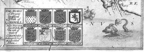
| 7. | CORNWAL / with y.e severall hundre= / ds, truly described / by C.S. Corrected and / Amended by P. Lea. [4b] Christophorus . Saxton . descripsit. [2e] LEN / AERT TER / WOORT: / ANTVER= / PIANVS / SCVLP SIT. [2d] From: Saxton / Lea All The Shires Of England And Wales … London, [1689]Inset: ‘LAVNCESTON OR ANCIENT DVNHEVET’ [2b] ‘The other Halfstone’ [1b] [Doniert’s Stone] [1b] ‘The Hurlers’ [3b] ‘The Chesewring’ [3b]With: [Arms of Charles II with the initials ‘C’ ‘R’] [2a] | State 7: throughout the map, crosses have been added to denote market towns:PENWITH: PE[N]SANCE; Merca Iue; Redreuth;KERRIER: HELSTON; PE[N]RYN; PADSTOW; ST. COLUMBE MAG[N]A.POWDER: TRURO; TREGNY; GRAMPOUND; Sct Austell; LESTIETHIEL; FOYE.TRIGGE: BODMAN.WEST: W. LOW; LISKERD.LESNEWTH: BOSCASTLE; CAMLEFORDE.EAST: LAVNSTON.STRATTON: STRATTON.Proof: pre-atlas proof HOLSWORTHYE; LYFTON; TAVESTOCK; PLYMMOVTHE; |
| 8. | CORNWAL / with y.e severall hundre= / ds, truly described / by C.S. Corrected and / Amended by P. Lea. [4b] Christophorus . Saxton . descripsit. [2e] LEN / AERT TER / WOORT: / ANTVER= / PIANVS / SCVLP SIT. [2d]From: Saxton / Lea All The Shires Of England And Wales … London, [1689]Inset: ‘LAVNCESTON OR ANCIENT DVNHEVET’ [2b] ‘The other Halfstone’ [1b] [Doniert’s Stone] [1b] ‘The Hurlers’ [3b] ‘The Chesewring’ [3b] With: [Arms of Charles II with the initials ‘C’ ‘R’] [2a] | State 8: In the title for the panel of arms, the letter ‘g’ has been overlaid on the ‘n’ of ‘Dynifyed.’; roads have been added throughout the map.Crowns have been added to denote two borough towns: Michaell als Sct. Michaell (Powder) [3c] and LAVNSTON (which has two crowns) (East) [4b]Crosses, to denote market towns, have been added to: PE[N]SANCE’ [2c] HELSTON [2d] PE[N]RYN [2d] TRVRO [3C] TREGNY [3d] GRAMPOVND [3c] SCT COLVMBE MAGNA [3c] PADSTOW [4b] Sct austell [4d] FOYE [4d] BODMAN [4c] LESTETHIEL [4d] BOSCASTLE [4b] CAMLEFORDE [4c] LISKERD [4d] W. LOW [4d] STRATTON [4b] LYFTON (Devon) [4c] TAVESTOCK (Devon) [5d] PLYMMOVTHE [4d] |
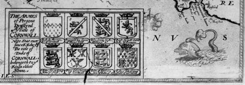
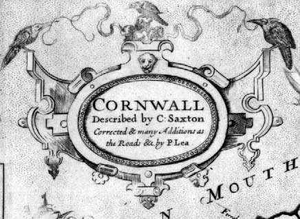
| 9. | CORNWALL / Described by C: Saxton / Corrected & many Additions as / the Roads &c. by P. Lea.. [4b] Christophorus . Saxton . descripsit. [2e] LEN / AERT TER / WOORT: / ANTVER= / PIANVS / SCVLP SIT. [2d]From: Saxton / Lea The Shires Of England And Wales … London,1694 Inset: ‘LAVNCESTON OR ANCIENT DVNHEVET’ [2b] ‘The other Halfstone’ [1b] [Doniert’s Stone] [1b] ‘The Hurlers’ [3b] ‘The Chesewring’ [3b] With: [Arms of Charles II with the initials ‘C’ ‘R’] | State 9: In the panel of arms, Piers Gaveston’s arms are completed, with the addition of two more birds. An outer line has been added around the panel of arms, and the inset view of Launceston. Within the inset, ‘The Castle Mount’ is so named.A number of additions or alterations to names have been made within the map, primarily in Stratton Hundred. Crosses and crowns have been added, or corrected across the map:PENWITH: S.t IVES (with a cross and crown); Gudreny I (with symbol) [2b]Revisions: Merkit Iue (previously MercaIue) [2d], the cross at PE[N]SANCE has been re-engraved [2d]; KERRIER: Falmouth (with symbol, and cross) [2d]; HELSTON and PERYN have had crowns added [2d];POWDER: Sct. Manies cast; TRVRO, TREGNY, GRAMPOVND [2d] and FOYE [4d] have had crowns added; TREGNY, GRAMPOVND and FOYE have had their crosses re-engraved;TRIGGE: Repryne [4c]; BODMAN has a crown added [4c];WEST: W. LOW and E. LOW [4d], and LISKERD [4d] have crowns added; E. LOW has had its cross re-engraved.LESNEWTH: CAMLEFORDE and TREVENA have had crosses added [4b].EAST: Newport [4b]; Kellington, Sct. Germans and SALTASHE have had crowns added [4d]; LAVNSTON [4c], Kellington and SALTASHE [4d] crosses.STRATTON: Ham; Batsboro; Manyng; Duckpan; Meere; Penseng; Penallom; Wadefast; Pulfath; Landon; a bridge has been added at Wolfston. The hundred boundary with LESNEWTH Hundred has been re-engraved, so that it starts on the coast at Whaleboro, rather than at BOSCASTLE, as previously [4b].DEVON: Borden [4b, on the Cornwall side of the Tamar]; HARTON [4a], TAVESTOK and PLYMMOVTHE [4d] have had crosses added, and TAVESTOK has had its cross re-engraved. |
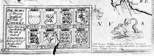
| 10. | CORNWALL / Described by C: Saxton / Corrected & many Additions as / the Roads &c. by P. Lea.. [4b] Christophorus . Saxton . descripsit. [2e] LEN / AERT TER / WOORT: / ANTVER= / PIANVS / SCVLP SIT. [2d] Sold by Geo: Willdey at the Great Toy, Spectacle, / China ware, and Print Shop, the Corner of Ludgate Street / near S.t Pauls London. [5e]From: Saxton / Willdey The Shires Of England And Wales … London, [1732] Inset: ‘LAVNCESTON OR ANCIENT DVNHEVET’ [2b] ‘The other Halfstone’ [1b] [Doniert’s Stone] [1b] ‘The Hurlers’ [3b] ‘The Chesewring’ [3b]With: [Arms of Charles II with the initials ‘C’ ‘R’] | State 10: with Willdey’s imprint added in the lower right hand corner. |
| 11. | CORNWALL / Described by C: Saxton / Corrected & many Additions as / the Roads &c. by P. Lea.. [4b] Christophorus . Saxton . descripsit. [2e] LEN / AERT TER / WOORT: / ANTVER= / PIANVS / SCVLP SIT. [2d] From: Saxton / Jefferys The Shires Of England And Wales … London, [1749] & Saxton / [Dicey] The Shires Of England And Wales … London, [1770 ca.]Inset: ‘LAVNCESTON OR ANCIENT DVNHEVET’ [2b] ‘The other Halfstone’ [1b] [Doniert’s Stone] [1b] ‘The Hurlers’ [3b] ‘The Chesewring’ [3b]With: [Arms of Charles II with the initials ‘C’ ‘R’] | State 11: with Willdey’s imprint crudely erased from the lower right hand corner, leaving an unstippled area of sea [5e]. |
TITLES
ROYAL ARMS
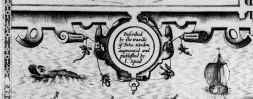
| 1. | CORNWALL. [3b] Described / by the travills / of John Norden / augmented and / published by / I. Speed. [2b] Theise Mappes / are to be solde / in Popes-heade / alley against y.e / Exchange by / John Sudbury and G. Humble. / Cum Privilegio. [5e] Separate publication: pre-atlas proof Inset: LAUNCESTON OR ANCIENT DVNHEVET [no key & no names] [no scale] [1a – 2a] The other halfe stone [Doniert’s Stone] ‘THE HURLERS’ ‘THE CHESEWRING’ With: [Royal Arms, with additional motto] ‘DIEU ET MON DROIT’ [3b] [Arms of the Duke of Cornwall] [3b] With: [Arms of the Dukes of Cornwall] Robert de Morton.’ / ‘Regnald basse sonne to W. Conq.’ / ‘John sonne to King H. 2.’ / ‘Richard E. of Cornwall and K. of Romains.’ / ‘Edward sonne of K. Ed. I.’ / ‘Piers Gaveston, Erle of Cornwall.’ / ‘John of Eltham, Erle of Cornwall.’ / ‘Edwards P. of Wales D. of Cornwall and 2. of Chest.’ | 383 x 508 PM: 387 x 513 Launceston (ib): 105 x 180 State 1: proof form: lacking Hondius’ signature, and the names in the inset of Launceston. |
| 2. | CORNWALL. [3b] Described / by the travills / of John Norden / augmented and / published by / I. Speed. [2b] Iodocus Hondius Caelavit / Anno Domini 1610. [4d] Theise Mappes / are to be solde / in Popes-heade / alley against y.e / Exchange by / John Sudbury and G. Humble. / Cum Privilegio. [5e] From: Speed The Theatre Of The Empire Of Great Britain … London, 1611-1612 | State 2: with the addition of Hondius’s signature, and the names added in the inset of Launceston. |
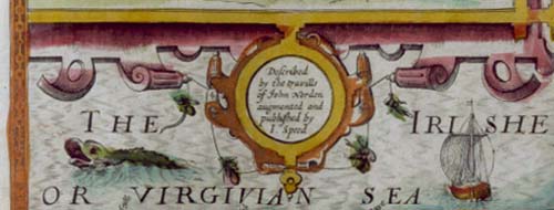
| 3. | CORNWALL. [3b] Described / by the travills / of John Norden / augmented and / published by / I. Speed. [2b] Iodocus Hondius Caelavit / Anno Domini 1610. [4d] Theise Mappes / are to be solde / in Popes-heade / alley against y.e / Exchange by / John Sudbury and G. Humble. / Cum Privilegio. [5e] From: Speed The Theatre Of The Empire Of Great Britaine … London, 1614 [1623] | State 3: with the addition of Latin names within the map: ‘ANTIVESTIUM’ and ‘BOLERIVM Prom.’ (at Lands End) [1c], ‘OCRINVM siue DANMONIORVM prom:’ [Lizard Point) [2d] , ‘CENIONI flu: Ostiu’ (Falmouth Haven) [2d], ‘THE DANMONII’ (Pider Hundred) [3c], ‘VZELLA’ (West Hundred) [4c], ‘TAMARI Ostium’ (Plymouth Sound) [4d]. ‘THE IRISHE / OR VIRGIVIAN SEA’ is now so named [2b] |
| 4. | CORNWALL. [3b] Described / by the travills / of John Norden / augmented and / published by / I. Speed. [2b] Iodocus Hondius Caelavit / Anno Domini 1610. [4d] Theise Mappes / are to be solde / by Roger Rea / the Elder and / younger at the / Golden Crosse in / Cornhill against the / Exchange / 1662. [5e] From: Speed / Roger Rea the Elder & Younger The Theatre Of The Empire of Great Britaine …, London, [1665] | State 4: with the substitution of the imprint of Roger Rea the Elder and Younger. |
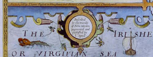
| 5. | CORNWALL. [3b] Described / by the travills / of John Norden / augmented and / published by / I. Speed. [2b] Iodocus Hondius Caelavit / Anno Domini 1610. [4d] Are to be sold by Thomas Bassett in Fleetstreet, and Richard Chiswell in S.t Pauls Churchyard. [1b – 2b] From: Speed / Basssett & Chiswell Theatre Of The Empire of Great Britain … London, 1676 | State 5: Roger Rea the Elder and Younger’s imprint has been replaced by the Arms of ‘Hen: eldest Son / of King Iames.’ [5e]. The new imprint is engraved in the lower frame border of the inset of Launceston. Within the map, a number of names have been re-engraved in larger lettering: ‘S.t Iue’ [4d] ‘S.t Austell’ [3d] and ‘Redruth’ [2c] |
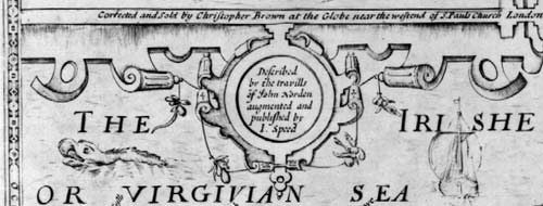
| 6. | CORNWALL. [3b] Described / by the travills / of John Norden / augmented and / published by / I. Speed. [2b] Iodocus Hondius Caelavit / Anno Domini 1610. [4d] Corrected and Sold by Christopher Brown at the Globe near the westend of St. Pauls Church London.’ [1b – 2b] From: Speed / Christopher Browne [Theatre: Projected Edition, London, 1695?] | State 6: Christopher Browne’s imprint has been substituted for that of Bassett and Chiswell. |
| 7. | CORNWALL. [3b] Described / by the travills / of John Norden / augmented and / published by / I. Speed. [2b] Iodocus Hondius Caelavit / Anno Domini 1610. [4d] Sold By Henry Overton At The White Horse without Newgate London. From: Speed / Henry Overton England Fully Described … London, [ca. 1720] | State 7: The imprint of Henry Overton has ben added to the plate, leaving the imprint of Christopher Browne unchanged. |
| 8. | CORNWALL. [3b] Described / by the travills / of John Norden / augmented and / published by / I. Speed. [2b] Iodocus Hondius Caelavit / Anno Domini 1610. [4d] Sold By Henry Overton At The White Horse without Newgate London. From: Speed / Henry Overton England Fully Described … London, 1743 | State 8: The plate has been extensively retouched to strengthen the impression. Christopher Browne’s imprint has been crossed through. |
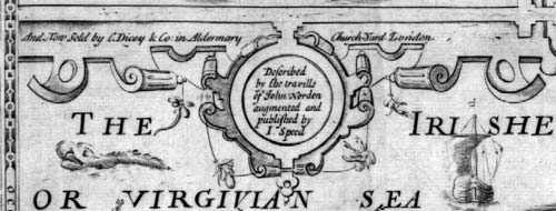
| 9. | CORNWALL. [3b] Described / by the travills / of John Norden / augmented and / published by / I. Speed. [2b] Iodocus Hondius Caelavit / Anno Domini 1610. [4d] And Now Sold by C. Dicey & Co, in Aldermary Church-Yard London. [1b – 2b] From: Cluer Dicey [Untitled County Atlas, London, 1756 on] | State 9: With Cluer Dicey’s imprint substituted for that of Christopher Browne, and Overton’s deleted. |