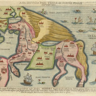
mapforumMay 6, 2022 MapForum ArticlesCuriosities: Asia in the Shape of a Pegasus One of the most unusual works relating to the Bible was composed by Heinrich Bunting, and first published…
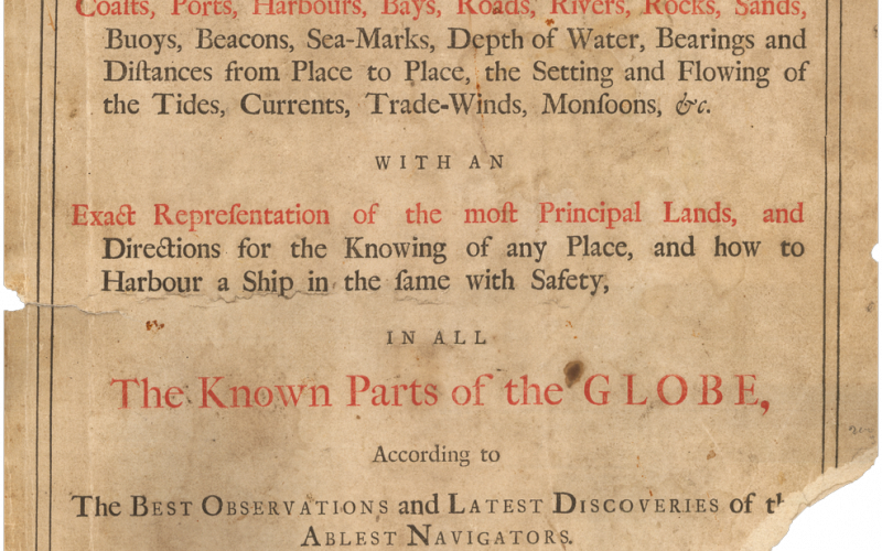
mapforumMay 5, 2022 MapForum ArticlesTreacle & Vinegar:Publisher’s Adverts From the 1670’s through to the 1760’s publishing maps and atlases in London was a fierce and cut-throat…
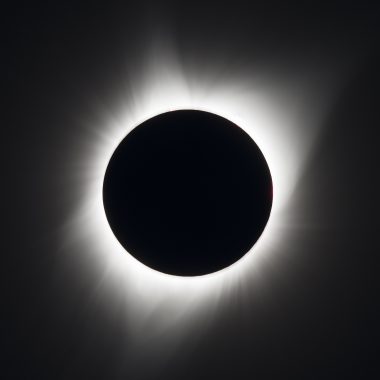
mapforumMay 4, 2022 MapForum ArticlesFerguson’s Machine for Timing Solar Eclipses Transcribed from the Universal Magazine for July 1755. A Description of a Piece of Mechanism contrived by James Ferguson, for…
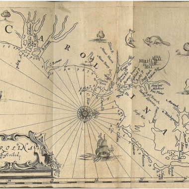
mapforumMay 3, 2022 MapForum ArticlesThe Charting of Cape Fear, N.C., 1525 to 1800 The first European to see the Cape Fear peninsula was Giovanni da Verrazzano in 1524. Verrazzano was a…
6th Issue MapForum Articles Collation: The ‘Atlas Maritimus’ John Seller Sr. (d.1697) is one of the most important figures in the early history of the map… mapforumMay 2, 2022
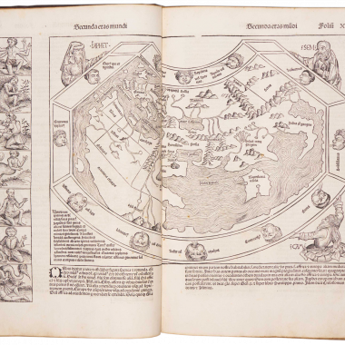
Fletcher HuntleyMarch 23, 2022 MapForum ArticlesHartman Schedel and The Nuremberg Chronicle One of the most fascinating printed books from the fifteenth century is Hartman Schedel’s ‘Liber Cronicarum ..’ or,…
mapforumMarch 22, 2022 MapForum ArticlesBeginner’s Guide: Coloring on Antique Maps All early maps are printed in black and white: the British Ordnance Survey maps were not printed in…