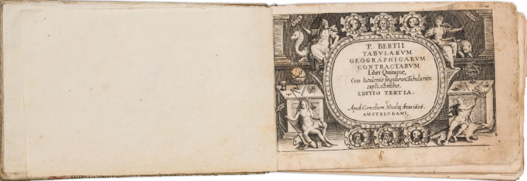
Recently the London dealer, Graham Franks of J.A.L. Franks acquired an untitled edition of Barent Langenes’ miniature atlas, which contained a number of supplementary maps performed by the English engraver Benjamin Wright, that I had never seen (or more importantly, perhaps) heard of. As I am currently working on a carto-bibliography of maps by British and Irish mapmakers and publishers, it was clear that additional research was required, as representing a substantial, and very interesting addition to his known corpus.
A preliminary examination showed three groupings of maps: the majority were from plates used in the 1598 and later editions of Langenes’ Caert-Thresoor, the second those engraved by Wright (who worked in Amsterdam circa 1596 to circa 1603, and perhaps later) and a smaller number of maps engraved in a later, mid-seventeenth century style.
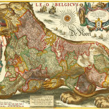
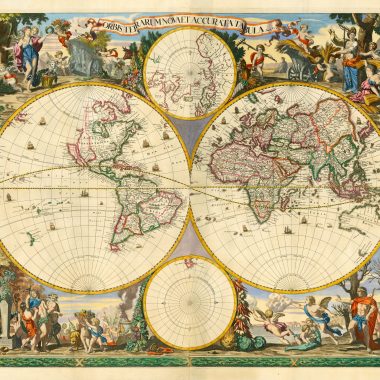
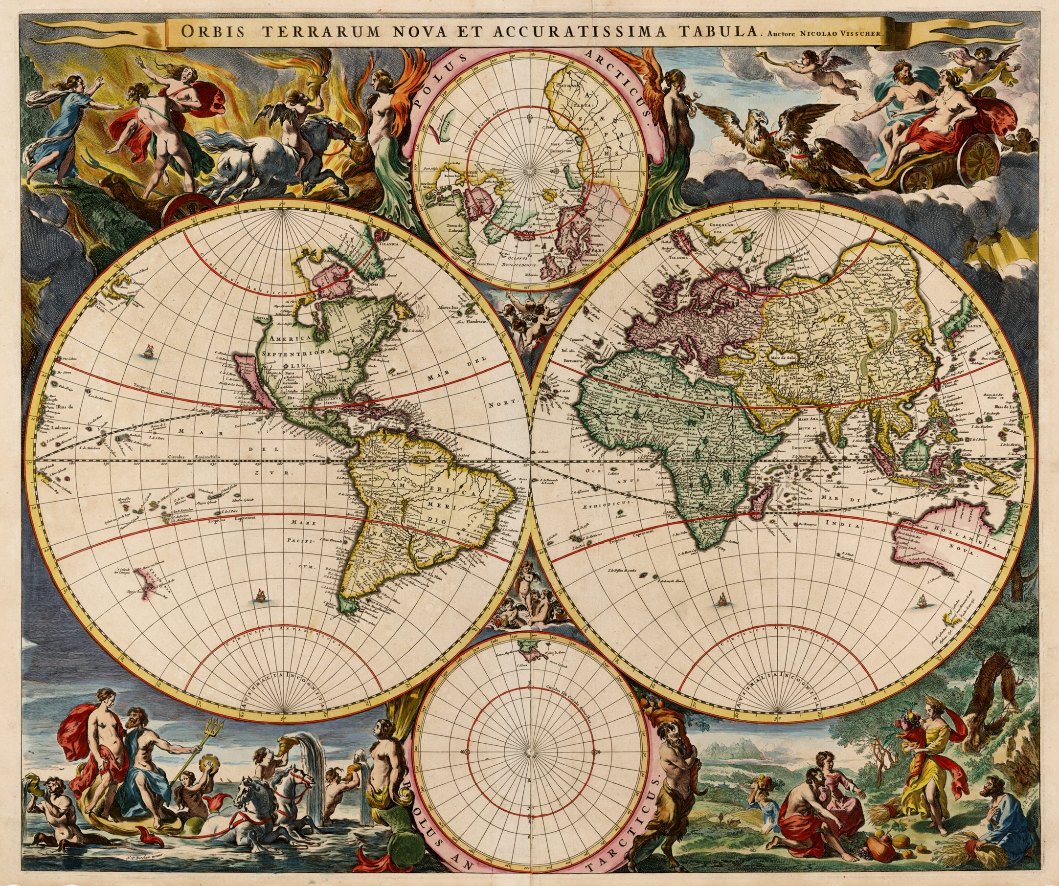
Two initial clues presented themselves. Two maps, of the World and Germany, were signed by Claes Jansz. Visscher, while both world maps had been re-engraved to show the discoveries of Tasman in Australia, in the 1640’s.
Fortunately, the British Library’s Map Library was at hand. In their vast collections is located the only example cited by Koeman of Visscher’s Tabularum Geographarum Contractarum (published in 1649) (Atlantes Neerlandici, vol. III, Vis. 4). There the atlas is described, without collation, as “A reissue of, most probably, the original basic text, with the old plates of the Caert-Thresoor by Langenes. For this edition, Visscher engraved new title pages, and enlarged the number of plates”.
The atlas is composed of eight books, without text, lettered a to h. Five are devoted to Europe (a with 29 maps; b, 40 maps; c, 29 maps, d, 28 maps and e, 34 maps). F, with 37 maps, is devoted to Asia, g (20 maps, not 29 as given by Koeman) devoted to Africa, and h (25 maps) to the Americas. In total, the atlas contains 10 engravings (title-pages etc) and 242 maps and view.

A cursory examination showed that the Franks atlas was a second example of three of the eight books (a, b and e), albeit issued without the preliminary material, and the celestial map.
While the initial intention was to collate the Franks copy, it became clear that the number of very interesting and important maps in the other five books made collating the entire atlas a priority. However, it should be noted that all the illustrations accompanying the collation are taken from the Franks copy. While not ideal, I could discern no difference in the maps, or indeed, in the strength of impression, between the two examples.
As a preliminary conclusion, it would seem that, by 1649, Visscher had come into possession of the original Langenes plates, which were owned by Cornelis Claesz, the Amsterdam publisher, before passing to his business successsor Hendrick Laurentsz, who re-printed the atlas in 1609 and 1612. Their whereabouts after this date is uncertain. Of the maps engraved by Wright, I have, so far, traced only one in a contemporary publication, (map no. 12 in the collation), in the 1603 edition of Lucas Jansz. Waghenaer’s Den Grooten Dobbelden Nieuwe Spieghel Der Zeevaert, conveniently also published by Claesz (and also conveniently in the BL’s Map Library). This map is one of 12 miniature maps engraved by Wright found printed set in the text. The similarity of style and engraving between the two groups is so close as to lead to the conclusion that they were engraved as one series, perhaps for the Caert-Thresoor, but perhaps also for the Spieghel der Zeevaert, as the majority of the maps have a maritime theme.
The final group of engravings were presumably prepared by Visscher to supplement the existing plates. The only changes that Visscher seems to have made to the existing plates were to re-engrave the two world maps, and add volume and plate numbers to each of the maps. In this state, they are only rarely found described in the standard regional carto-bibliographies, such as Rodney Shirley’s Mapping Of The World.
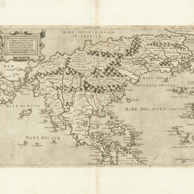
If Wright’s engravings date from circa 1603, which seems plausible, they include very early delineations of parts of Mauritius, Borneo and the Philippines, of Havana harbour, Puerto Rico, the island of Sta. Margareta (to the west of Trinidad), the coast of Venezuela, Pernambuco, Rio de Janeiro, and the Magellan Straits.
However, the two most important items are to be attributed to Visscher. Map 196, ‘T’ LAND VAN / DE EENDRACHT’ is a map of Australia (or rather such parts known at the time) and is the earliest printed map of that Continent known to the writer, and which is not noted, inter alia, by Gunter Schilder in his ‘Australia Unveiled’. The second, map 197: ‘Anthoni van Diemens Landt…’ depicts the coast of South Australia, and Tasmania (although only the southern coast is marked), and again much pre-dates anything else the writer knows of.
The writer would like to acknowledge the kindness of Graham Franks in allowing his atlas to be collated and illustrated.
A Collation of Barent Langenes’ 1649 Tabularum Contractarum
Part A
| No. | Title | Size | Publisher |
| 001 | [Untitled Celestial Chart In Two Hemispheres] a 2. [4e] | 60 x 122mm Border: 83 x 123mm Plate: 87 x 125mm | Langenes |
| 002 | TYPUS ORBIS TERRARUM [2a, ob – 4a, ob] DOMINI EST TERRA ET PLENITVDO EIUS. / CIVisscher Excudit. [2e, ob – 4e, ob] a 3 [4d] Unrecorded second state, with the southern continent deleted, and the Australian coast inserted. | 60 x 120mm B: 83 x 122mm P: 85 x 126mm | Langenes |
| 003 | [Untitled Double Hemisphere Map Of The World] CIVisscher Excudit [2e, ob – 4e, ob] IEHOVA [3a, ob] a 4 [4d, ob] Unrecorded second state, with the southern continent deleted, and the Australian coast inserted. | 69 x 123mm B: 85 x 123mm P: 87 x 126mm | Langenes |
| 004 | EUROPA [5c] Iodocus Hondius cæla. [5c] a. 5 [5e] | B: 85 x 123mm | Langenes |
| 005 | [Untitled Map Of Iceland] Petrus / Kærius cælavit. [1e] a. 6 [4e] | 85 x 124mm | Langenes |
| 006 | HIBERNIA [5a] a. 7 [4d] | 83 x 122mm | Langenes |
| 007 | SCOTIA. [5d] a 8 [4d] | 83 x 122mm | Langenes |
| 008 | Alata castra Scotiæ / Regia urbs et Metrolis / Vulgó Edimburgum. [5e] Ben: Wright cælator. [2e] a. 9 [4d] | 80 x 119mm | Claesz |
| 009 | ANGLIA. [5d] Pe. Kærius fecit [4e] a 10 [5d] | 83 x 122mm | Langenes |
| 010 | CAMBRIA. [5d] a. 11 [5e] | 83 x 123mm | Langenes |
| 011 | Milfort extre[m]us / Angliæ portus in / Cambriæ provinciæ [1e] B.W. fe.[4e] a 12 [5e] | 84 x 116mm | Claesz |
| 012 | Promontorium Angliæ / Cornubia. Iuxta quod / genuina hicdatur Situatio / Insularum Sorlingarum. / adquas multæ illidunt / naves. Ben. W. cælator. [1a] a. 13 [4e] | 82 x 121mm | Claesz |
| 013 | Tamesis, Britanniæ / nobilissimum flumen Lon= / dinum regiam urbom / præterlabens. [5e] BW / cælater. [1d] a. 14 [5d] | 82 x 118mm | Claesz |
| 014 | Septen= / triona / lium re= / gionu[m] / descrip. [5e] Petrus Kaerius / fecit et cælavit. [4e] a. 15. [5e] | 83 x 121mm | Langenes |
| 015 | Nortcaep. [5a] [Scandinavia] a. 16. [5e] | 85 x 124mm | Langenes |
| 016 | Norwegia. [5a] a. 17. [4e] | 85 x 112mm | Langenes |
| 017 | Vera deliniatio et / situs insulæ Wardhuys- / iæ ex inspectione ocu- / lari efformatæ per / Ioannem Hugonis Lin- / schotanum Anno / 1594. [1e] B.W. caelator. [5e] a. 18. [5d] | 81 x 118mm | Claesz |
| 018 | Delineatio vera / Insulæ Kilduyn. [1e] B.W: caela. [5e] a. 19. [5d] | 82 x 117mm | Claesz |
| 019 | DANIA. [5c] Pe: Kærius fecit. [5d] a. 20 [5e] | 85 x 123mm | Langenes |
| 020 | Fretum hoc Sondæ nomine / celebre est in quo aduna[m] / Omnes hares traseuntes, Regi / Daniæ Telonium coguntur persoluere. [1e] B.W. caela.t.or [4e] a. 21. [4d] | 83 x 119mm | Claesz |
| 021 | Fretici Danici or / Sundt accuratis / delineatio. [5c] Beniamin Wright cælator. [1e] a. 22 [4e] | 83 x 118mm | Claesz |
| 022 | Topographia Insulæ Huenæ / in celebri porthmo Regna / Daniæ, quem Vulgo Oersunt / uocant. [1a] B= W= cælator. [5e] a. 23 [5d] | 83 x 118mm | Claesz |
| 023 | GOTIA. [5e] a: 24 [5e] | 85 x 123mm | Langenes |
| 024 | [Untitled Map Of ‘Got / land’] a. 25. [5e] | 84 x 122mm | Langenes |
| 025 | PRUSSIA. [5e] a. 26. [5e] | 86 x 124mm | Langenes |
| 026 | Situs Opidi Gedani Vulgo / Dantzick. ubiquotidie plus / mille onera Tritici Siliginisq / permutantur. [erasure of a date]. [1a] Beniamin Wright cælator. [2e] a. 27. [5e] | 83 x 118mm | Claesz |
| 027 | LITHUA / NIA. [1d] a. 28. [5e] | 87 x 127mm | Visscher |
| 028 | Livoniæ / descrip. [1c] a. 29. [5e] | 86 x 124mm | Langenes |
| 029 | Vrbs Riga ab exteris / longe expetua ob divers= / sarum ibidem mercium / æbundantiam. Insula / Oisalia in longitudinem / 14. in latitudinem 7 mili- / aeia extenditur. [1a] B.W.cælator. [2e] a. 30. [4a-5a] | 84 x 118mm | Claesz |
Part B
| 030 | GERMANIA. [1e] CIVisscher excudit. [2e, in border] b.1 [5d] | 85 x 123mm | Langenes |
| 031 | [Untitled Map Of ‘FRI= / SIA / ORI= / ENTALIS’] Petrus Kæri= / us cælavit. [1e] b. 2. [4e] | 85 x 123mm | Langenes |
| 032 | Mara ostia fluminium flu= / entorumq Weseræ saluet / et Albis torúmq genuinus / Sitas: pequentia nauigationis / celeberrima. [1a] B.W. cæla. [5e] b. 3. [5d] | 82 x 120mm | Claesz |
| 033 | Comitatus / OLDENBORG. [3a] b. 4. [5e] | 87 x 131mm | Visscher |
| 034 | THIET / MARSIA. [5a] b. 5. [5e] | 86 x 121mm | Langenes |
| 035 | DUC. / HOLSA / TIA. [1e] b.6. [4e] | 89 x 129mm | Visscher |
| 036 | MEKLENBVRG / DVCATVS. [1a] b. 7. [5e] | 86 x 128mm | Visscher |
| 037 | POMERANIA. [3a] b 8. [4e] | 86 x 124mm | Langenes |
| 038 | Brandenburg. [5e] b. 9. [5e] | 85 x 123mm | Langenes |
| 039 | Ducatus LUNEBUR / GENSIS. [4a] b. 10 [5e] | 89 x 126mm | Visscher |
| 040 | Westphalia. [5a] b. 11. [4e] | 85 x 123mm | Langenes |
| 041 | OSNABRUGEN / SIS / Episcopatus. [5e] b 12 [5e] | 89 x 127mm | Visscher |
| 042 | PADERBORN [2a] b. 13. [5d] | 83 x 123mm | Visscher |
| 043 | MONASTERIENSIS / Episcopatus. [5a] b. 14. [5d] | 82 x 123mm | Visscher |
| 044 | CLIVIA / Ducatus. [1e] Petrus Kærius cæla. [5a] b. 15. [4e] | 83 x 120mm | Langenes |
| 045 | COLONIENSIS / DIOECESIS. [1e] Petrus Kærius cælavit. [1a] b / 16. [5e] | 82 x 121mm | Langenes |
| 046 | NASSOVIA / Comitatus. [1a] b. 17. [5d] | 85 x 122mm | Visscher |
| 047 | HASSIÆ DESCRIPTIO. [5a] b. 18 [5e] | 87 x 122mm | Visscher |
| 048 | THURINGIA [1e] b. 19. [4e] | 89 x 128mm | Visscher |
| 049 | SAXONIA THU / RINGIA, MISNIA. [1e] b. 20 [5e] | 85 x 122mm | Langenes |
| 050 | SILESIA. [2d] b. 21. [4e] | 85 x 125mm | Langenes |
| 051 | Oswieczime[n]sis et / Zatoriensis Duc. [5e] b. 22. [5e] | 86 x 125mm | Langenes |
| 052 | Tra[n]ssilvania. [3a] b. 23 [5e] | 85 x 124mm | Langenes |
| 053 | BOHEMIA. [5e] b. 24 [5e] | 85 x 123mm | Langenes |
| 054 | FRANCONIA. [1a] b / 25 [5e] | 85 x 123mm | Langenes |
| 055 | Territorium / NORIMBERGENSE. [1a] b 26 [5d] | 88 x 127mm | Visscher |
| 056 | PALATINA= / TUS RHENI [3e] b. 27. [4e] | 82 x 121mm | Langenes |
| 057 | ERPACH / Comitatus. [4d] b / 28. [5e] | 86 x 124mm | Visscher |
| 058 | ALSATIA. [4a] b. 29. [4e] P. Kærius / cælavit. [4b] b. 29 [4e] | 82 x 121mm | Langenes |
| 059 | SABAUDIA / Ducatus.[5c] b. 30. [4e] | 82 x 122mm | Visscher |
| 060 | HELVE / TIA. [1b] b 31 [5e] | 84 x 124mm | Langenes |
| 061 | GRISONS / en / VELTOLINA. [1a] b / 32. [5e] | 89 x 124mm | Visscher |
| 062 | SVEVIÆ / NOVA / TABULA. [1a] b. 33 [4e] | 88 x 127mm | Visscher |
| 063 | BAVARIA. [5e] b. 34 [5e] | 85 x 121mm | Langenes |
| 064 | NORI / CUM. [1c] b.35 [5e] | 84 x 121mm | Langenes |
| 065 | TIROLIS / COMITA. [5a] b. 36 [5e] | 84 x 121mm | Langenes |
| 066 | Salisburgen / sis Dioecesis. [5e] b 37 [5e] | 85 x 124mm | Langenes |
| 067 | Austria. [1e] b 38 [5e] | 84 x 121mm | Langenes |
| 068 | HUNGARIA. [5e] b. 39. [4e] | 85 x 124mm | Langenes |
| 069 | POLONIA. [1a] b 40. [4e] | 85 x 123mm | Langenes |
Part C
| 070 | BELGIA / ANTIQUA / Oudt Nederlandt. [5a] CJV / excudit. [1c] c 1 [5d] | 90 x 125mm | Visscher |
| 071 | Inferior / Germania. [5e] c. 2 [5e] | 85 x 124mm | Langenes |
| 072 | BRABANTIA. [5e] c. 3. [5d] | 85 x 122mm | Langenes |
| 073 | LIM / BURGUM. [1a] c 4. [5d] | 86 x 123mm | Langenes |
| 074 | LIMBURG / Ducatus. [5a] c.5. [5d] | 87 x 125mm | Visscher |
| 075 | Lutzenburg. [1e] c. 6 [5d] | 85 x 123mm | Langenes |
| 076 | GELDRIA. [5e] c. 7. [5e] | 87 x 125mm | Langenes |
| 077 | [Untitled Map Of ‘BOOMELER WEERT’ and environs] Petrus Kærius cæla. [5e] c. 8. [5d] | 86 x 121mm | Langenes |
| 078 | Comitatus / ZUTPHANIA. [3a] c.9. [4d] | 86 x 128mm | Visscher |
| 079 | FLANDRIA. [1e] c. 10 [5e] | 86 x 122mm | Langenes |
| 080 | [Untitled Map Of ‘Duijnkercke’ and environs] Ben: Wright cælator. [1e] C. 11 [5e] | 82 x 121mm | Claesz |
| 081 | ARTESIA. [1c] C. 12 [5e] | 85 x 121mm | Langenes |
| 082 | HANNONIA. [5a] C. 13. [4e] | 85 x 122mm | Langenes |
| 083 | HOLLANDIA. [5a] C. 14 [5e] | 85 x 124mm | Langenes |
| 084 | Zuydholla[n]d. [1a] C. 15. [4e] | 89 x 124mm | Langenes |
| 085 | [Untitled Plan Of ‘Arx Britannica’] P.K. cælavit. [4e] C. 16. [5e] | 85 x 123mm | Langenes |
| 086 | 1597 / HOLLAN / DIA / SEPTEN. / [scale bar] / Petrus Kæri / us cælavit. [1e] C. 17 [5d] | 85 x 122mm | Langenes |
| 087 | Die Zyp. [4a] C. 18. [5e] | 86 x 124mm | Langenes |
| 088 | Sinus Austraicus (vulgo / dictus Mare Austriacu[m] / navibus et piscibus præ / cunctis Europa flumibus, / ditispnius hicad vivum / repræsentatus. [4d] B.W. cælator. [1e] C. / 19. [5e] | 81 x 117mm | Claesz |
| 089 | SELANDIA. [5e] C. 20 [5e] | 86 x 123mm | Langenes |
| 090 | Wielingen, quasi dicas Vort= / icas, Optimus Europæ totus, / portius mirabilisq Zelandiæ / Situs. / Beniamin Wright cælator. [5e] C. 21. [5d] | 83 x 120mm | Claesz |
| 091 | NAMUR. [1e] C. 22. [5e] | 85 x 126mm | Langenes |
| 092 | Marchionatus / SACRI IMPERII. [3e] C. 23. [5e] | 83 x 124mm | Visscher |
| 093 | FRISIA.[5e] C. 24. [5e] | 85 x 123mm | Langenes |
| 094 | MECHLINIA / Dominum. [1e] C. 25. [5a] | 88 x 124mm | Visscher |
| 095 | Ultrajectum. [5c] C. 26. [4e] | 87 x 125mm | Langenes |
| 096 | Trans-Isula. D. [5e] C 27 [5e] | 85 x 123mm | Langenes |
| 097 | Fluvius Amasus navium ditis= / pimus, cum delineationæ Insu= / larum frisiam ambientium. [3a] C. / 28. [5e] | 83 x 119mm | Claesz |
| 098 | Leodiensis / Dioecesis. [1e] C. 29 [5d] | 85 x 122mm | Langenes |
Part D
| 099 | GALLIÆ BELGICÆ / veteris accurata descriptio / P. Bertio auctori, amico suo colendo cælavit I. Hondius. [1e] d. 1 [5e] | 86 x 127mm | Langenes |
| 100 | [Untitled Map Of France] d. 2 [5e] | 83 x 122mm | Langenes |
| 101 | Caletensium et / Bononie[n]sium des. [5a] d. 3 [5e] | 84 x 122mm | Langenes |
| 102 | PICARDIA. [1e] d. 4 [5e] | 84 x 122mm | Langenes |
| 103 | VERO= / MA[N]DUI. [1c] d / 5. [5e] | 85 x 122mm | Langenes |
| 104 | LOTHARINGIA. [1a] d. 6 [5d] | 85 x 123mm | Langenes |
| 105 | NORMANDIA. [3a] d. 7 [5d] | 83 x 123mm | Langenes |
| 106 | BRITANNIA. [1d] d. 8 [5d] | 83 x 124mm | Langenes |
| 107 | ANIOU. [5a] d. 9. [5e] | 85 x 123mm | Langenes |
| 108 | BITURIGUM. [1a] d. 10 [5e] | 83 x 124mm | Langenes |
| 109 | BURGUNDIÆ / DUCATUS [1e] d. 11. [5e] | 85 x 123mm | Langenes |
| 110 | BURGUNDIÆ COM. [5e] d. 12 [5e] | 85 x 123mm | Langenes |
| 111 | SAVOIE [1e] d. 13 [5e] | 83 x 123mm | Langenes |
| 112 | Venuxinus / Comitatus. [2e] d. 14. [4e] | 84 x 123mm | Langenes |
| 113 | [Untitled Map Of ‘ORANGE PRINCIPATUS’] d 15 [5d] | 83 x 122mm | Visscher |
| 114 | Galliæ Narbone[n]= / sis descriptio. [1a] d 16 [5e] | 84 x 123mm | Langenes |
| 115 | LIMANIA [5a] d 17 [5d] | 83 x 123mm | Langenes |
| 116 | POICTOU [1e] d. 18. [4e] | 84 x 122mm | Langenes |
| 117 | GASCONIA [5a] d. 19 [5e] | 84 x 123mm | Langenes |
| 118 | HISPANIA. [5e] D 20 [5e] | 84 x 122mm | Langenes |
| 119 | BISCAIA. [3a] D 21 [5e] | 85 x 123mm | Langenes |
| 120 | [Untitled View Of The Escurial Palace] D. 22 [4d] | 82 x 121mm | Langenes |
| 121 | PORTUGALLIA. [1a] Petrus Kærius fecit. [1b] D / 23. [5e] | 83 x 121mm | Langenes |
| 122 | Capo de montego / quinque milliaria dist= / stans ab a vero, Portugaliæ / civitas, sale abundans. [1e] Ben: Wri= fe= [3e] D. 24 [5e] | 85 x 118mm | Claesz |
| 123 | ANDA= / LUZIA. [5a] d. 25 [5d] | 84 x 123mm | Langenes |
| 124 | [Untitled Map Of ‘Baia de Cadiz’] D. 26. [5e] | 85 x 122mm | Langenes |
| 125 | VALENTIA. [3e] D. 27. [5e] | 83 x 122mm | Langenes |
| 126 | Majorcæ et Mi / norcæ descrip. [5e] D. 28 [4e] | 83 x 123mm | Langenes |
Part E
| 127 | ITALIA. [5b] e. 1 [5e] | 83 x 121mm | Langenes |
| 128 | SARDINIA. [1a] e. 2 [4e] | 85 x 120mm | Langenes |
| 129 | CORSICA. [1e] e. 3 [5d] | 85 x 120mm | Langenes |
| 130 | ELBA. [4b] e. 4 [5e] | 85 x 122mm | Langenes |
| 131 | ISCHIA / insula. [1e] e 5. [5e] | 86 x 122mm | Langenes |
| 132 | MALTA [1e] e. 6 [5e] | 86 x 123mm | Langenes |
| 133 | SICILIA. [1e] e. 7 [5e] | 85 x 121mm | Langenes |
| 134 | REGNUM NEA= / POLITANUM. [1e] Petrus / Kærius / cælavit. [2d] e 8 [5e] | 84 x 122mm | Langenes |
| 135 | Roma= / num / terri= / torium. [5d] P. Kærius scul. [3e] e 9 [5d] | 84 x 122mm | Langenes |
| 136 | APRUTIUM. [4d] P. Kaerius fe. [1e] e. 10 [4e] | 86 x 122mm | Langenes |
| 137 | MARCHA ANCONÆ, / OLIM PICENUM. 1572. [1a] P. Kærius fe. [5a] e. 11 [5d] | 84 x 121mm | Langenes |
| 138 | PERUSIA. [5d] Petrus / Kærius / cælavit. [4d] e / 12 [5d] | 85 x 121mm | Langenes |
| 139 | ORVIETUM. [1e] e 13 [5e] | 85 x 122mm | Langenes |
| 140 | SIENA. [5d] e. 14 [5e] | 85 x 122mm | Langenes |
| 141 | TUSCIA. [5a] Petrus Kæri / us cælavit. [5b] e. 15 [4e] | 85 x 122mm | Langenes |
| 142 | Ducatus / Mediolanen / sis finitimaru[m] / que regionu[m] / Descriptio. a.o 1596. [1b] P: Kærius [1a] e 16 [5e] | 85 x 122mm | Langenes |
| 143 | Pede= / montii / descrip / tio. [1c] e. 17 [5e] | 85 x 122mm | Langenes |
| 144 | CREMONEN / SIS AGER. [4b] Petrus / Kaerius cælavit. [5e] e. 18 [5d] | 86 x 121mm | Langenes |
| 145 | CREMAE / AGER. [1a] P. Kaerius / cælavit. [1b] e. 19 [5d] | 85 x 121mm | Langenes |
| 146 | LARIUS LACUS. [5e] P. Kaerius scul. [1e] e. 20 [4e] | 84 x 122mm | Langenes |
| 147 | BRESCIANO. [1e] Petrus Kaerius cælavit. [2e] e. 21 [5d] | 85 x 122mm | Langenes |
| 148 | VERONEN= / SIS AGER. [1a] e 22 [5d] | 84 x 122mm | Langenes |
| 149 | PATAVINUM Ter. [1a] P. Kærius fe: [5e] e 23 [5d] | 85 x 120mm | Langenes |
| 150 | VENETIA. [5e] Ben W. cælator [1e] e. 24. [5d] | 84 x 119mm | Claesz |
| 151 | FORUM / IULII. [1a] e. 25 [5d] | 85 x 122mm | Langenes |
| 152 | Illyricum. [1e] e .26 [5d] | 84 x 123mm | Langenes |
| 153 | HISTRIA. [1e] e. 27 [5e] | 85 x 123mm | Langenes |
| 154 | SARA et ZEBENIC. [3e-4e] e. 28 [5e] | 85 x 123mm | Langenes |
| 155 | CORFU. [1a] e / 29 [5e] | 85 x 123mm | Langenes |
| 156 | CEFALONIA. [5a] e. 30 [5e] | 84 x 122mm | Langenes |
| 157 | ZANTE / Insula. [1e] e. 31 [5e] | 85 x 125mm | Langenes |
| 158 | CANDIA. [5e] e. 32 [5e] | 85 x 123mm | Langenes |
| 159 | [Untitled Map Of The Peloponnese] e. 33 [4e] | 84 x 122mm | Langenes |
| 160 | GRÆCIA. [1e] e. 34. [5e] | 84 x 122mm | Langenes |
Part F
| 161 | ASIA [1e] f.1 [5e] | 86 x 123mm | Langenes |
| 162 | Ins. Vaygats [1a-2a] f. 2 [5e] | 85 x 121mm | Langenes |
| 163 | RUSSIA. [5b] f. 3 [4e] | 84 x 123mm | Langenes |
| 164 | TURCICUM / IMPERIUM. [1d] f. 4 [5e] | 84 x 124mm | Langenes |
| 165 | NATO / LIA. [5e] f / 5. [5e] | 84 x 123mm | Langenes |
| 166 | SCIO [1a] f. 6. [5e] | 85 x 125mm | Langenes |
| 167 | RHODI [4b] Petrus Kæ= / rius cælavit. [2d] f. 7. [5e] | 84 x 123mm | Langenes |
| 168 | CYPRUS. [5e] f. 8. [5e] | 84 x 122mm | Langenes |
| 169 | PA= / LAES= / TINA. [4d] Petrus Kærius cæla. [4e] f. 9. [5e] | 85 x 123mm | Langenes |
| 170 | PERSIA. [5e] Petrus / Kærius cælavit. [5d] f / 10 [5d] | 84 x 123mm | Langenes |
| 171 | TARTA / RIA. [1a] f 11 [4e] | 83 x 120mm | Langenes |
| 172 | INDIA ORIEN. [2a] f. 12. [5e] | 86 x 122mm | Langenes |
| 173 | CHINA / Regio Asie. [1a] Petrus Kæri / us cælavit. [1b] f. 13. [5e] | 85 x 122mm | Langenes |
| 174 | IAPAN [5e] f. 14. [5e] | 86 x 124mm | Langenes |
| 175 | Isle de Ladrones. [3a] f.15. [5e] | 90 x 121mm | Claesz |
| 176 | NOVA GUI= / NEA ET IN. / SALOMONIS. / [scale bar] / Petrus Kærius cælavit. [5e] f / 16. [5e] | 85 x 123mm | Langenes |
| 177 | [Untitled Map Of ‘Baye la Bay’] f. 17. [5d] | 89 x 122mm | Claesz |
| 178 | Insulæ Phi= / lippinae / [scale bar] Petrus / Kærius cælavit. [1a] f. 18. [5e] | 86 x 123mm | Langenes |
| 179 | Moluccæ insulæ [5a] f. 19. [5e] | 85 x 124mm | Langenes |
| 180 | [Untitled Map Of ‘INSVLÆ / TERNATI’ and ‘INSVLÆ / TIDORE’] Beniami[n] W: cælator [1e] f. 20. [5e] | 84 x 121mm | Claesz |
| 181 | [Untitled Map Of Borneo] Petrus Kærius / cælavit. [4a] f. 21. [5d] | 86 x 125mm | Langenes |
| 182 | [Untitled Map Of ‘BORNEO / INSULA’] B W fe. [1e] f. 22 [5d] | 80 x 116mm | Claesz |
| 183 | [Untitled Map Of ‘La Baye de Isle et / Cito de Borneo.’] f. 23. [5e] | 91 x 122mm | Claesz |
| 184 | [Untitled Map Of ‘Ciuitas Maduræ / ducta Risbaia’] Beniamin W= cælator. [4e] f. 24 [5e] | 83 x 121mm | Claesz |
| 185 | IAVA / MAIOR [4e] f. / 25. [5e] | 85 x 120mm | Visscher |
| 186 | SUMATRA / INSULA. [5e] Beniamin Wright cælator. [3e] f. 26. [5d] | 85 x 123mm PM: 89 x 128 | Langenes |
| 187 | MALACCA. [5e] f. 27. [5e] | 85 x 123mm | Langenes |
| 188 | ARACAM. [1b] Petrus Kæri / us cælavit. [1a] f. 28. [5e] | 86 x 124mm | Langenes |
| 189 | BENGALA. [3e] f. 29. [5e] | 85 x 124mm | Langenes |
| 190 | Narsinga / et / Ceylon. [5a] Petrus Kærius / cælavit. [1b] f. 30 [5e] | 86 x 125mm | Langenes |
| 191 | MALDIVAE INSULÆ [5e] f. 31. [5e] | 84 x 123mm | Langenes |
| 192 | MALABAR. [5e] f. 32 [5e] | 85 x 124mm | Langenes |
| 193 | CAMBAIA. [1e] f. / 33 [5e] | 86 x 125mm | Langenes |
| 194 | ORMUS. [1e] f. 34 [5e] | 85 x 123mm | Langenes |
| 195 | ARABIA. [5e] f. 35. [5e] | 86 x 119mm | Langenes |
| 196 | T’ LAND VAN / DE EENDRACHT. [5e] f. 36. [5d] | 91 x 132mm | Visscher |
| 197 | Anthoni van Diemens Landt / aldaereerst beseylt ofte ontdeckt bÿ de / Schepen Heemskerck ende Zeehaen / den 24 November 1642. [1e-3e] f. 37. [5e] | 95 x 133mm | Visscher |
Part G
| 198 | AFRICA. [5e] g. 1 [5e] | 85 x 123mm | Langenes |
| 199 | AEGYPTUS. [1e] g. 2 [5e] | 85 x 122mm | Langenes |
| 200 | Mare Rubrum. [4e-5e] g 3. [5e] | 83 x 122mm | Langenes |
| 201 | Abissino / rum Im / perium. [1a] g 4. [5e] | 84 x 123mm | Langenes |
| 201 | AFRICÆ PARS / meridionalior. [5e] g 5. [5e] | 85 x 122mm | Langenes |
| 203 | Insulæ & Ars / Mosambique. [3a] Petrus Kærius cælavit. [5e] g. 6. [5d] | 85 x 124mm | Langenes |
| 204 | BAIXOS DE IVDIA. [2a-4a] P K [5e] g 7. [5d] [Picture of a shipwreck] | 81 x 119mm | Langenes |
| 205 | I. S. Laurentij [5a] Beniamin Wright cælator. [2e] g 8. [5d] | 85 x 122mm | Langenes |
| 206 | Ins cÿgnæa Lusit= a nostris Maurity noimine / indigitata, sita ad 21.um gradum ab Equinoctiali / Meridien Versus inuenta et detecta Decima= / octava die mensis Septembris an[n]o 1598. [1e-3e] Beniamin Wright cælator. [5e] g. 9. [5d] | 85 x 123mm | Claesz |
| 207 | Congi Regni / Christiani in A= / frica nova descri / ptio Auctore Phi= lippo Pigafetta. [1e] g. 10 [5e] | 83 x 120mm | Langenes |
| 208 | SANCTA / HELENA. [5e] Beniamin W= cælator. [4e] g. 11 [5e] | 86 x 123 a (ib): 10 x 27 b (ib): 12 x 25mm | Langenes |
| 209 | [Untitled Map Of ‘Ins. S.ti Thome’] g. 12 [5e] | Map: 85 x 124 Inset a: (ib): 14 x 28 b: (ib): 11 x 34mm | Langenes |
| 210 | [Untitled Map Showing Soldiers On ‘Isola del Principe’] g. 13 [5e] | 89 x 121mm | Claesz |
| 211 | GUINEA [3e] g 14 [5e] | 86 x 122mm | Langenes |
| 212 | Insulæ Capi / tis Viridis. [1a] g. 15. [5e] | 85 x 122mm | Langenes |
| 213 | [Untitled Map Of The ‘Insulæ Cana = / riæ ol: For / tunatae.’] g. 16. [5e] | 83 x 120 Inset (ib): 30 x 38mm | Langenes |
| 214 | Insulæ Canariæ, cum vrbe / Allagoena, descripta cum a / classe ordinum. 26 Iunij / 1599 occuparetur. [1e] [‘INSULÆ CANARIÆ] [3A] B.W. cæla. [4] g 17 [5d] | 86 x 119mm | Claesz |
| 215 | Barbaria. [5e] g. 18 [5e] | 86 x 123mm | Langenes |
| 216 | Carthaginen= / sis sinus. [5e] g. 19 [5e] | 88 x 122mm | Langenes |
| 217 | [Untitled Map Of ‘TERCERA’] Petrus Kærius fecit. [5e] g. 20 [5d] | 84 x 121mm | Langenes |
Part H
| 218 | [Untitled Map Of The Americas] h. 1 [5e] | 83 x 122mm | Langenes |
| 219 | TERRA NOVA. [5e] h. 2. [5e] | 86 x 123mm | Langenes |
| 220 | MEXICANA. [1e] h. 3 [4e] | 83 x 122mm | Langenes |
| 221 | Insularum Cubæ, Hispaniolæ / Jucatanæ & circumjacen / tium describtio. [5e] h. 4 [5e] | 83 x 121mm | Langenes |
| 222 | CUBA / INSULA / [scale bar] / Petrus Kærius cæla. [1e] anno / 1597. [2c] h. 5. [5e] | 83 x 122mm | Langenes |
| 223 | HAVANA / PORTUS / Beniamin Wright cælator. [1e] h. 6. [5e] | 83 x 121mm | Claesz |
| 224 | AITY SIVE / SPANIOLA. [1a] P. Kæri. cælavit. [5e] h / 7 [5e] | 86 x 122mm | Langenes |
| 225 | AITY SIVE / SPANNIOLA. [1e] h. 8 [5e] | 83 x 120mm | Claesz |
| 226 | Diui Ioannis de porto Ricco / diuite portu[m], ad vivúm expr= / essús per G. de Veer, a 1601. [1e] Ben= W= cælator. [5e] h. 9. [5d] | 83 x 121mm | Claesz |
| 227 | Effigies promo[n]torij Port’ regij, Salinis satentis, / sponta[n]eis in valle vnde solo labores pretio petitur. / Item prom: dicti de tres puntas Insulæ quoq Margarita / et insulaæ Albæ, cum profundis, vadis et scopulis. [3e-5e] [‘S. MARGARETA’] [2d] Beniamin W= cælator. [1e] h. 10 [5e] | 83 x 120mm | Visscher |
| 228 | [Untitled Map Of South America] h 11 [5d] | 82 x 121mm | Langenes |
| 229 | Commenogata, ubi optima cres= / cit Nicotiana. Vulgo tabaco duta / herba, maximaq copia. [5e] B= W= cælator. [2e] h 12 [5e] | 84 x 121mm | Claesz |
| 230 | PONTARAYA [3b] h. 13. [5e] | 85 x 121mm | Visscher |
| 231 | BRASILIA. [5e] h. 14 [5d] | 83 x 124mm | Langenes |
| 232 | Fernambuco, aut ut / quidam malunt, Perna / mb’ Portus Brasiliæ / celeberimus delineatus / per Gerardum Veriu[m] / 1601. [3c] B.W. cælator. [4e] h. 15. [5d] | 84 x 120mm | Claesz |
| 233 | BAYA / de totos os Sanctos. [1a] h. 16 [5d] | 87 x 119mm | Visscher |
| 234 | [Untitled Map Of ‘Rio Ianero’ harbour] h. 17 [5e] | 88 x 123mm | Claesz |
| 235 | FRETUM MA= / GELLANICUM / [scale bar] / Petrus Kærius cælavit. [5e] h 18 [4e] | 85 x 123mm | Langenes |
| 236 | Exquisita, et magno aliqu= / ot mensium periculo lustra= / ta et iam retecta Fret f f f / Magellanici Facies. [5e] Beniamin W= cælator [3e] h. 19 [5e] | 89 x 120mm | Claesz |
| 237 | CHILI et / PATAGO= / NUM regio. [5e] h 20 [4e] | 83 x 123mm | Langenes |
| 238 | La Moche en / Chili. [3a] h / 21 [5d] | 90 x 123mm | Claesz |
| 239 | Ins. S. Mariæ 12 leucas / in circuitu patens, 37 gr= / adeui ad Austrum ab / Equatore subiace[n]s, an= / nonæ ferax, á nauar= / eho Catero expugnata / 2. Iuly a.o 1599. [1a] [‘S. MARIÆ’] [3a] Beniamin Wright cælator. [5e] h. 22 [5d] | 87 x 118mm | Claesz |
| 240 | PERU. [5e] h. 23 [5e] | 87 x 121mm | Langenes |
| 241 | CERRO DE POTOSI. [2b-4b] h. 24 [5d] | 84 x 121mm | Langenes |
| 242 | I. S. Clara. [3a] h 25 [5e] | 90 x 123mm | Claesz |