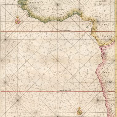
mapforumOctober 12, 2022 15th IssueCollation: Zee Atlas Ofte Water-Wereldt, ca.1654-1658 Library of Congress G1059. C64 1669 vault; Phillips 480 Collated by David Parry The example described is in…
mapforumOctober 12, 2022 15th IssueCollation: The New Fierie Sea-Colomne, 1640 [Koeman: J. Col 24 ]Library of Congress G1793 .C6 1640b; Phillips 3332 by Jason Hubbard As in the…
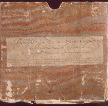
mapforumOctober 12, 2022 15th IssueEphemera: Jefferys Advert Among the more ephemeral items produced by mapsellers and publishers were engraved advertisement labels. Those that survive generally…
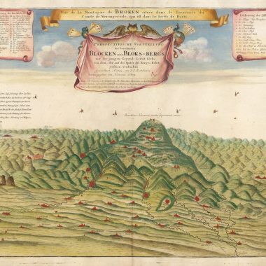
mapforumOctober 10, 2022 14th IssueCuriosities: The Blockenberg Witches HOMANN’S HEIRSPerspectivische Vorstellung Des… Blocken Oder Bloks-Bergs… Nürnberg, 1749-51. A view of Brocken in the Harz mountains of…
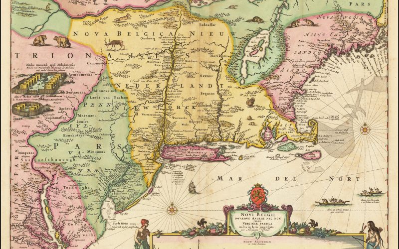
13th Issue Printed Maps of New England: 1630-1660 1630 [1630]: GERRITSZ., HesselNOVA ANGLIA, / NOVVM BELGIVM / ET VIRGINIA. [1b][Inset] ‘Bermuda majori mole expressa’ 82 x… mapforumOctober 4, 2022
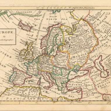
mapforumSeptember 30, 2022 13th IssueHerman Moll’s “Maps Of The Several Parts Of Europe…” While Moll’s county atlases and large maps – most particularly those prepared for “The World Described” – are…
mapforumSeptember 22, 2022 MapForum ArticlesMaps in Colom’s Atlases: De Vyerighe Colom, 1654 [Engraved Title page:]De Vyerighe Colom / waer door de Zeen en Custen van de Noordsche, / Oostersche, en…
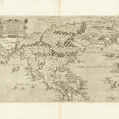
mapforumAugust 29, 2022 MapForum ArticlesBiography: Paolo Forlani (fl. 1560 – 1571/4?) The ‘Lafreri School’ of mapmakers is the umbrella term frequently applied – for want…
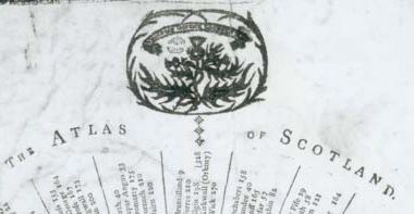
mapforumAugust 25, 2022 MapForum ArticlesThe Atlas of Scotland Edinburgh, May 18. 1797. -Designed by J.Halliday, Caledonian Mercury Office. -Entered in Stationers Hall.Broadsheet, 420 x 235mm. the…
10th Issue MapForum Articles California on the East Coast Mallet: Novveav Continent. From the German edition, ‘Beschreibung Des Gantzen Welt-Kriesses’ (‘Description de l’Univers’), published by Johann David… mapforumAugust 22, 2022